


Get to know Tuquan County
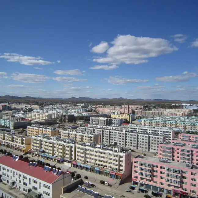
Photo adjustments
EXIF orientation normalized; resized without changing aspect ratio; converted to WebP. No subject edits.
- Administrative area
- County · 县
- Part of
- Hinggan League
- Chinese name
- 突泉县
- Local areas
- County guide
Area & population
- Area in the source
- 4,800.00 km²
- Population · 2020
- 220,668
- Administrative seat
- Tuquan Town
Source: cited geographic source, as of the dates shown.
Setting and landscape
The county government divides Tuquan into three zones: mountains in the northwest, shallow hills in the centre and a plain in the south. Heights range from 1,392.1 metres down to 185.5 metres. The climate is a temperate continental monsoon type with 110 to 140 frost-free days and an average yearly temperature of 6.1°C.
History
In 1636, at the start of the Qing, the Jiaoliu River (蛟流河) became the dividing line here: land to the south went to the Tushiye Tu prince's banner (图什业图亲王旗) and land to the north to the Jasagtu prince's banner (札萨克图郡王旗). A town called Liquan (醴泉镇) was set up in 1907 and became a county under Taonan prefecture in 1909. Because Shaanxi already had a Liquan County, the name was changed to Tuquan in 1914. The county was merged into Horqin Right Middle Banner in 1959 and moved to Jilin's Baicheng area in 1969.
What to see
Baoshi Lake scenic area (宝石湖旅游风景区), at Baocheng village in Baoshi town (宝石镇), takes the county's historic city of Chunzhou (春州古城) as its model and Liao–Jin culture as its theme, and houses the Tuquan County history and culture museum. On the east shore of Shuangcheng Lake (双城湖) in the same town, a national 2A ski area has three runs for different levels. Mingxing Lake resort (明星湖旅游度假区) at Mingxing village in Dong Du'erji town (东杜尔基镇) is a national 3A area built around fishing and farming, using the village's rice paddies and melon fields. Around Taiping township (太平乡), the Shuguang and Saiyinhua farm parks offer greenhouse fruit and vegetable picking.
Food and local products
Wang Xiao'er flatbread (王小二大饼) has been made in the county town for about a century and was listed as regional intangible heritage in 2014. Zuan tangzi (攥汤子) are noodles of cornmeal pressed by hand through a homemade sleeve worn on the fingers, then boiled. Liuhu dried tofu (六户干豆腐) is pressed so thin that sunlight shows through a sheet; locals roll it around spring onion and dip it in home-made soybean paste, and it joined the region's seventh intangible-heritage list in May 2023. Liuhu Han smoked chicken (六户韩烧鸡) uses barred farmyard hens, simmered for three hours in an old stock and then smoked in an iron wok. Taihe (太和) in the hill country is known for sweet melons and millet, and Xiliu (溪柳) for purple-skinned garlic.
Highlights
- Baoshi Lake scenic area 宝石湖旅游风景区: Liao–Jin themed area modelled on the old city of Chunzhou, with the county history and culture museum.
- Mingxing Lake resort 明星湖旅游度假区: National 3A area themed on fishing and farming, among rice paddies and melon fields.
- Liuhu dried tofu 六户干豆腐: Paper-thin pressed tofu eaten rolled round spring onion; regional intangible heritage since 2023.
- Wang Xiao'er flatbread 王小二大饼: Century-old county-town flatbread, regional intangible heritage since 2014.
- Zuan tangzi 攥汤子: Cornmeal noodles squeezed by hand through a finger sleeve into boiling water.
Sources for this guide
突泉概况_突泉县人民政府 · Tuquan County People's Government
历史沿革_突泉县人民政府 · Tuquan County People's Government
地理环境_突泉县人民政府 · Tuquan County People's Government
特色食物_突泉县人民政府 · Tuquan County People's Government
风景名胜_突泉县人民政府 · Tuquan County People's Government
Original English written from the listed sources and checked sentence by sentence against quoted extracts by a separate reviewer. Updated 2026-09-26.
Explore Tuquan County
Core places to explore, with English and Chinese names.
Tuquan County 突泉县
Plan your visit
Getting there
Tuquan County is about 85 km in a straight line from central Hinggan League. Search for 突泉县 in a map app to find stations and your accommodation.
Where to stay →More in Hinggan League
Sources & geographic information
Administrative names and parent areas: Official geographic directory · Reference date 2026-09-06.
Map data © OpenStreetMap contributors. Pins mark approximate centres, not entrances or boundaries.