


Get to know Liyang
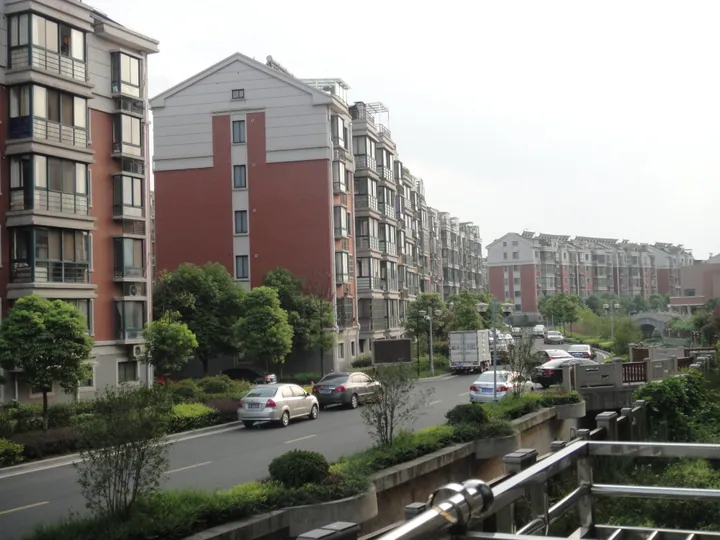
Photo adjustments
Full frame retained; proportionally resized and converted to WebP. No retouching or changes to the photographed subject. Card displays may crop the view.
- Administrative area
- County-level city · 县级市
- Part of
- Changzhou
- Chinese name
- 溧阳市
- Local areas
- County-level city guide
Area & population
- Area in the source
- 1,535.87 km²
- Population · 2024
- 806,900
Source: cited geographic source, as of the dates shown.
Setting and landscape
The southern hills are an extension of the Tianmu Mountains (天目山); Guodi Mountain (锅底山), 541 metres high on the Jiangsu–Anhui border, is the highest peak in Changzhou. The northwestern hills belong to the Mao Mountains (茅山), whose top, Yaji Mountain (丫髻山, 410 metres), stands where Jurong, Jintan and Liyang meet. Changdang Lake (长荡湖), shared with Jintan, is the third-largest lake in the Taihu basin. The Xu River (胥河), a canal dug in the Spring and Autumn period, links the Shuiyang River and Taihu basins; Ming-dynasty dams cut it off, and after the dams were removed and sluices built in 1991 the river reopened to shipping and the Nan River (南河) became part of the Wushen Canal (芜申运河).
History
The Liyang city government dates the county to 221 BC. In 620, under Emperor Gaozu of Tang, Liyang County was restored, and the name has been in continuous use since then; the county became a county-level city in August 1990. The city government lists Li Bai (李白), Zhu Xi (朱熹), Tang Xianzu (汤显祖) and Yuan Mei (袁枚) among visitors who left writing here, and local tradition tells of Shi Zhennü (史贞女), a young woman who helped Wu Zixu (伍子胥) in the Spring and Autumn period.
What to see
In 2013 the Tianmu Lake resort, the Nanshan Bamboo Sea (南山竹海) and the Yushui hot-spring area were combined into the national 5A-rated Tianmu Lake Scenic Area (天目湖景区). The lake itself began as Shahe Reservoir (沙河水库), built in 1958 over the village of Shanyaqiao. The Memorial Hall of the New Fourth Army's Jiangnan Command (新四军江南指挥部纪念馆) was rated 4A in 2015. The Liyang No. 1 Highway (溧阳1号公路), a scenic road, links sights across the city. At Shuimushan village in Shanghuang town, the Eosimias fossil site (中华曙猿化石地点) is a national key heritage site.
Food and local products
Local products include Tianmu Lake casserole fish head (天目湖砂锅鱼头), Liyang white tea (溧阳白茶), Liyang white celery (溧阳白芹), chestnuts and Tianmu Lake wind-dried goose (天目湖风鹅). The making of the casserole fish head, Guxian black rice (古县乌米饭) and Liyang zagan (溧阳扎肝) are all on Jiangsu's provincial intangible heritage list.
Getting oriented
Changzhou is a little over 60 kilometres away, and Nanjing and Suzhou are each about 100 kilometres. The Nanjing–Hangzhou high-speed railway, opened in 2013, has two stations in the city, Liyang and Wawushan, and Nanjing Lukou International Airport is 68 kilometres away.
Highlights
- Tianmu Lake Scenic Area 天目湖景区: National 5A scenic area formed in 2013 from the Tianmu Lake resort, the Nanshan Bamboo Sea and the Yushui hot springs.
- Nanshan Bamboo Sea 南山竹海: Part of the Tianmu Lake 5A scenic area since 2013.
- Memorial Hall of the New Fourth Army's Jiangnan Command 新四军江南指挥部纪念馆: Rated a national 4A scenic area in 2015.
- Eosimias fossil site 中华曙猿化石地点: National key heritage site at Shuimushan village, Shanghuang town.
- Tianmu Lake casserole fish head 天目湖砂锅鱼头: Its making is on Jiangsu's provincial intangible heritage list.
Sources for this guide
历史沿革 · Liyang Municipal People's Government
自然地理 · Liyang Municipal People's Government
人文荟萃 · Liyang Municipal People's Government
溧阳市 · Wikipedia (Chinese) · CC BY-SA 4.0
Original English written from the listed sources and checked sentence by sentence against quoted extracts by a separate reviewer. Updated 2026-09-25.
Explore Liyang
Core places to explore, with English and Chinese names.
Places to explore around Liyang
 Tianmu Lake (天目湖), Changzhou. Photograph: "Floating boat (Unsplash)".
Tianmu Lake天目湖
Tianmu Lake is the reservoir landscape south of Liyang, surrounded by hills and a tea-growing area. The broad water and cultivated slopes provide the principal setting for a lakeside visit.
Read the place guide → Jing Hu (the Quiet Lake) surrounded by bamboo-covered hills at Nanshan Bamboo Sea (South Mountain Bamboo Sea) in Liyang, Changzhou · 常州市溧阳市南山竹海静湖,周围竹林覆盖山峦 Source-recorded photograph date: 2009-05-25 08:44:18.
Nanshan Bamboo Sea南山竹海
Bamboo hills in south-east Liyang, part of the Tianmu Lake 5A area, with a giant longevity statue, raft lake, old stone road and panda house.
Read the place guide →Plan your visit
Getting there
Liyang is about 65 km in a straight line from central Changzhou. Search for 溧阳市 in a map app to find stations and your accommodation.
Where to stay →Build your route
Tianmu Lake and Nanshan Bamboo Sea are both listed here. The linked place guides have entrance and visit details.
Continue with Changzhou →More in Changzhou
Sources & geographic information
Administrative names and parent areas: Official geographic directory · Reference date 2026-09-06.
Some facts checked against 溧阳市 — Wikipedia contributors, CC BY-SA 4.0.
Photo: Tianmu Lake · Are R verdurousar · CC0. Full frame retained; EXIF orientation normalized, proportionally resized to at most 800 pixels and converted to WebP. No generated pixels or subject changes. Cards may crop the display.

Photo: Nanshan Bamboo Sea · 风之清扬 · CC BY-SA 4.0. Full frame retained; proportionally resized and converted to WebP. No retouching or changes to the photographed subject. Card displays may crop the view.

Map data © OpenStreetMap contributors. Pins mark approximate centres, not entrances or boundaries.