


Get to know Dantu District
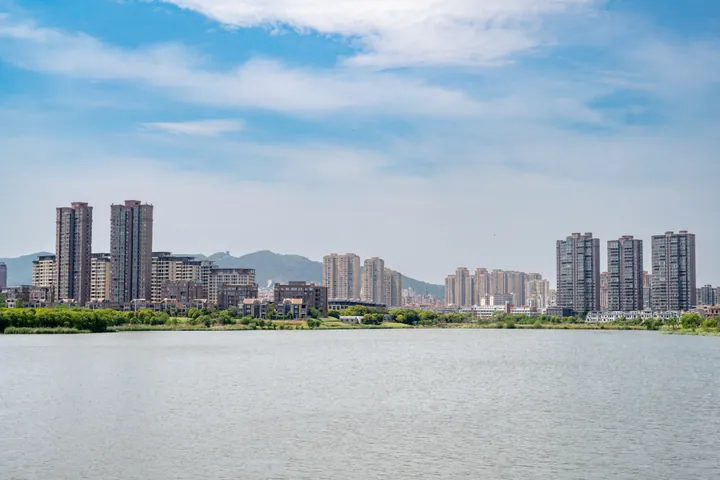
Photo adjustments
Full frame retained; proportionally resized and converted to WebP. No retouching or changes to the photographed subject. Card displays may crop the view.
- Administrative area
- District · 市辖区
- Part of
- Zhenjiang
- Chinese name
- 丹徒区
- Local areas
- District guide
Area & population
- Area in the source
- 611.00 km²
- Population · 2020 census
- 347,264
Source: cited geographic source, as of the dates shown.
Setting and landscape
The land is high in the southwest and low in the northeast: outliers of Mount Mao (茅山) in the south, the Ningzhen hills in the middle and river flats along the Yangtze in the north. The highest point is the main peak of Changshan (长山), at 349.7 metres. The Yangtze runs for 68.8 kilometres along the district's northern edge, and the Grand Canal crosses it for 11.8 kilometres. The Yangtze stretch here yields the prized tapertail anchovy (刀鱼) and pufferfish (河豚), and is home to the rare Chinese sucker (胭脂鱼) and finless porpoise (江豚).
History
The district government traces the area back more than 3,000 years to Yi (宜), a fief granted by King Kang of Zhou (周康王). It was Zhufang (朱方) under the state of Wu and Guyang (谷阳) under Chu, became a county in 221 BC and took the name Dantu in 210 BC. The county was renamed Zhenjiang County in 1928, restored as Dantu in 1949, and became a district of Zhenjiang in April 2002; that September the government moved to the new Dantu town at Guyang (谷阳镇).
What to see
The China Zhenjiang Vinegar Culture Museum (中国镇江醋文化博物馆) in the new town and the Mi Fu Calligraphy Park (中国米芾书法公园) on the Shili Changshan ridge (十里长山) are both listed as national 4A scenic areas. Guyang Lake (谷阳湖) has a water park themed on Qixing Island (七星岛). Huaiyin village (槐荫村) is held to be where the legend of Dong Yong and the Seventh Fairy (董永和七仙女) takes place, and has a Huaiyin temple (槐荫庙) and statues of the pair. Baoyan town (宝堰镇) keeps an old street and a memorial hall to the New Fourth Army's (新四军) four-county resistance association, on the site of the former Yihe wine shop (怡和酒行).
Food and local products
Chinese Wikipedia lists Dantu foods including Baoyan rice wine (宝堰米酒), Baoyan mutton terrine (羊糕) and mutton noodles, Gaozi "jumping" noodles (高资跳面), and Gaoqiao's (高桥) "three Yangtze delicacies" (江三鲜) of tapertail anchovy, pufferfish and crab. Stone carving at Gaozi (高资镇) dates back to the Tang dynasty and flourished under the Ming.
Highlights
- China Zhenjiang Vinegar Culture Museum 中国镇江醋文化博物馆: National 4A scenic area in the Dantu new town.
- Mi Fu Calligraphy Park 中国米芾书法公园: National 4A scenic area on the Shili Changshan ridge.
- Huaiyin Village 槐荫村: Setting of the Dong Yong and Seventh Fairy legend, with a Huaiyin temple.
- Baoyan Old Street 宝堰镇古街: Old street with a memorial hall to the New Fourth Army's four-county resistance association, on the site of a former wine shop.
Sources for this guide
地理地貌 | 丹徒区人民政府 · Dantu District People's Government, Zhenjiang
自然资源 | 丹徒区人民政府 · Dantu District People's Government, Zhenjiang
建置沿革 | 丹徒区人民政府 · Dantu District People's Government, Zhenjiang
丹徒区 - 维基百科,自由的百科全书 · Wikipedia (Chinese) · CC BY-SA 4.0
Original English written from the listed sources and checked sentence by sentence against quoted extracts by a separate reviewer. Updated 2026-09-25.
Explore Dantu District
Core places to explore, with English and Chinese names.
Dantu District 丹徒区
Plan your visit
Getting there
Dantu District is about 20 km in a straight line from central Zhenjiang. Search for 丹徒区 in a map app to find stations and your accommodation.
Where to stay →More in Zhenjiang
Sources & geographic information
Administrative names and parent areas: Official geographic directory · Reference date 2026-09-06.
Some facts checked against 丹徒区 — Wikipedia contributors, CC BY-SA 4.0.
Map data © OpenStreetMap contributors. Pins mark approximate centres, not entrances or boundaries.