


Get to know Jurong
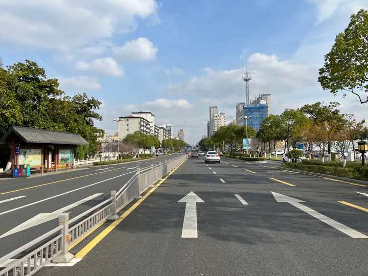
Photo adjustments
Full frame retained; proportionally resized and converted to WebP. No retouching or changes to the photographed subject. Card displays may crop the view.
- Administrative area
- County-level city · 县级市
- Part of
- Zhenjiang
- Chinese name
- 句容市
- Local areas
- County-level city guide
Area & population
- Area in the source
- 1,385.00 km²
- Population · 2020 census
- 639,266
Source: cited geographic source, as of the dates shown.
What to see
Mount Mao is a national 5A scenic area and a famous Taoist site; in 1938 the New Fourth Army (新四军) made it the centre of its anti-Japanese base in southern Jiangsu. Mount Baohua is a provincial nature reserve and national forest park, known among Buddhists as the foremost mountain of the Vinaya school (律宗). Chishan Lake (赤山湖) is a national wetland park, and Wawu Mountain (瓦屋山) is promoted as a Jiangsu "Jiuzhaigou" for its wild scenery. The Bixie stone carvings (辟邪石刻), locally called "stone lions", are ranked by the city government first among carvings of their kind in China. Gexian Lake Park (葛仙湖公园) is a national 3A scenic area.
Jurong has eight monuments on the provincial or national protection lists, four of them national. The city is working towards World Heritage nomination for the Mount Mao "grotto-heavens and blessed lands" (洞天福地) cultural landscape. Its rocks are well exposed and rich in fossils, and the city government describes it as one of the first areas in China to be studied by geologists.
History
Dang (党), a son of the Han prince of Changsha, was made Marquis of Jurong in 129 BC, and after his death the next year his fief became Jurong County. Under the Ming it belonged to Yingtian prefecture (应天府), and during the Taiping Rebellion it was governed directly from Tianjing (天京), the Taiping capital. It was placed back under the Zhenjiang prefecture in January 1950 and became a county-level city in 1995.
Food and local products
The city government says strawberries were grown in Jurong earlier than anywhere else in China, and in the 1980s it was already hailed as "China's foremost strawberry township". Maoshan old goose (茅山老鹅) takes its name from Mount Mao, and local people have long been known for raising and curing geese. Maoxi stinky tofu (茅西臭干) is steeped in aged brine, fried and dressed with a hot sauce, and Sancha pig's head meat (三岔猪头肉) is lean pig's-head meat braised in an aged master brine, reddish-brown in colour. Dazhuo honey peaches (大卓水蜜桃) come from Dazhuo town (大卓镇).
Highlights
- Mount Mao 茅山: National 5A scenic area and Taoist site; centre of the New Fourth Army base from 1938.
- Mount Baohua 宝华山: National forest park, called the foremost mountain of the Vinaya school.
- Chishan Lake 赤山湖: National wetland park.
- Bixie stone carvings 辟邪石刻: Stone beasts ranked first among carvings of their kind in China by the city government.
- Maoshan old goose 茅山老鹅: Named after Mount Mao; local people have long raised and cured geese.
Sources for this guide
句容简介 · Jurong Municipal People's Government
历史变迁 · Jurong Municipal People's Government
文化事业 · Jurong Municipal People's Government
Original English written from the listed sources and checked sentence by sentence against quoted extracts by a separate reviewer. Updated 2026-09-25.
Explore Jurong
Core places to explore, with English and Chinese names.
Places to explore around Jurong
 Maoshan Scenic Area on the Jurong Side · 茅山句容侧景区
Maoshan Scenic Area on the Jurong Side茅山句容侧景区
Jurong's Maoshan scenic area combines Daoist palaces with springs, caves and mountain valleys.
Read the place guide → Baohua Mountain Longchang Temple · 宝华山隆昌寺
Baohua Mountain Longchang Temple宝华山隆昌寺
Longchang Temple occupies a hollow among Jurong's Baohua Mountain hills and is known for its Buddhist ordination tradition and Ming-period beamless halls.
Read the place guide →Plan your visit
Getting there
Jurong is about 35 km in a straight line from central Zhenjiang. Search for 句容市 in a map app to find stations and your accommodation.
Where to stay →Build your route
Maoshan Scenic Area on the Jurong Side and Baohua Mountain Longchang Temple are both listed here. The linked place guides have entrance and visit details.
Continue with Zhenjiang →More in Zhenjiang
Sources & geographic information
Administrative names and parent areas: Official geographic directory · Reference date 2026-09-06.
Photo: Maoshan Scenic Area on the Jurong Side · Source photographer · License not provided. EXIF orientation normalized; resized without changing aspect ratio; converted to WebP. No subject edits.
Photo: Baohua Mountain Longchang Temple · No machine-readable author provided. Px820~commonswiki assumed (based on copyright claims). · CC BY-SA 3.0. EXIF orientation normalized; resized without changing aspect ratio; converted to WebP. No subject edits.

Map data © OpenStreetMap contributors. Pins mark approximate centres, not entrances or boundaries.