


Get to know Dongxiang District
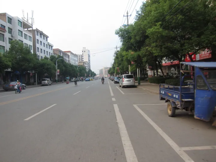
Photo adjustments
Full frame retained; proportionally resized and converted to WebP. No retouching or changes to the photographed subject. Card displays may crop the view.
- Administrative area
- District · 市辖区
- Part of
- Fuzhou
- Chinese name
- 东乡区
- Local areas
- District guide
Area & population
- Area in the source
- 1,196.00 km²
- Population · 2019
- 452,000
Source: cited geographic source, as of the dates shown.
Setting and history
The land is mostly flat, with gentle hills. The district borders Yujiang (余江) to the east, Jinxian (进贤) and Linchuan (临川) to the west, Yugan (余干) to the north and Jinxi (金溪) to the south, and its seat is Xiaogang (孝岗).
Dongxiang was created as a county in 1512, in the Ming dynasty, from the eastern part of Linchuan County. It became a district of Fuzhou in 2016, and the district government was formally inaugurated in March 2017.
What to see
Shangchi Village (上池村), south of Liwu town (黎圩镇), dates from the Northern Song and is described by the district government as the home village of Wang Anshi; its houses are mostly in Ming and Qing style. Nearby Wuxi Village (浯溪村) was founded in 1195 by descendants of Wang Anshi's brother Wang Anguo (王安国) who moved here from Linchuan, and keeps Ming and Qing official residences, merchants' houses, a chastity arch and old lanes.
Foling Park (佛岭国际公园), 2 km south-east of the town, combines calligraphy and Chan Buddhist themes; the Jihe Pagoda (吉和塔), Xiyin Temple (西隐寺) and a calligraphy arts centre have been built there. The district also has a museum to the calligrapher Shu Tong (舒同), who came from Dongxiang and created the Shu-style script. Qinghu Scenic Area (清湖景区), 2.8 km west of Wangqiao town (王桥镇), is a national 3A-rated scenic area.
Food, products and festivals
The district government praises the green-shelled eggs of Dongxiang black chickens as a "pearl of China" (华夏明珠). Dongxiang sugar cane, Dongxiang radish, Dongxiang kudzu (葛) and Wangqiao taro (王桥花果芋) are registered as national geographical-indication farm products. Other local specialities listed by the district include Dongxiang ham, mugua jelly (木瓜凉粉) and loofah sponges.
Dongxiang is a provincial home of lantern arts. Its Luohan lanterns (罗汉灯) entered Jiangxi's provincial intangible-heritage list in 2008 and the horse-and-cart lanterns (车马灯) of Lintang village (林塘村) in 2010.
Getting oriented
The district government puts Dongxiang 96 km from Nanchang (南昌) and calls it the "gateway to eastern Jiangxi". The Shanghai–Kunming railway stops at Dongxiang Station, and Fuzhou East Station (抚州东站) on the Shanghai–Kunming high-speed line serves the district; the Shanghai–Kunming Expressway and National Highway 320 also cross it.
Highlights
- Shangchi Village 上池村: Northern Song village named by the district government as Wang Anshi's home village.
- Wuxi Village 浯溪村: Village founded in 1195 by descendants of Wang Anguo, with Ming and Qing buildings.
- Foling Park 佛岭国际公园: Calligraphy and Chan Buddhist park 2 km south-east of town, with Jihe Pagoda and Xiyin Temple.
- Qinghu Scenic Area 清湖景区: National 3A scenic area west of Wangqiao town.
- Luohan lanterns 罗汉灯: Provincial intangible heritage since 2008.
Sources for this guide
东乡区 - 维基百科,自由的百科全书 · Wikipedia (Chinese) · CC BY-SA 4.0
东乡区人民政府 旅游东乡 东乡区旅游资源简介 · Dongxiang District People's Government (Culture, Radio, Television and Tourism Bureau)
东乡区人民政府 纵览历史 东乡区区情简介 · Dongxiang District People's Government
东乡区人民政府 旅游东乡 民俗特产——非遗众多、特产丰富 · Dongxiang District People's Government
Original English written from the listed sources and checked sentence by sentence against quoted extracts by a separate reviewer. Updated 2026-09-25.
Explore Dongxiang District
Core places to explore, with English and Chinese names.
Dongxiang District 东乡区
Plan your visit
Getting there
Dongxiang District is about 40 km in a straight line from central Fuzhou. Search for 东乡区 in a map app to find stations and your accommodation.
Where to stay →More in Fuzhou
Sources & geographic information
Administrative names and parent areas: Official geographic directory · Reference date 2026-09-06.
Some facts checked against 东乡区 — Wikipedia contributors, CC BY-SA 4.0.
Map data © OpenStreetMap contributors. Pins mark approximate centres, not entrances or boundaries.