


Get to know Yifeng County
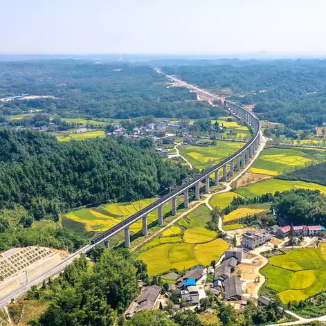
Photo adjustments
EXIF orientation normalized; resized without changing aspect ratio; converted to WebP. No subject edits.
- Administrative area
- County · 县
- Part of
- Yichun
- Chinese name
- 宜丰县
- Local areas
- County guide
Area & population
- Area in the source
- 1,935.00 km²
- Population · 2018
- 301,000
Source: cited geographic source, as of the dates shown.
Setting and landscape
The land slopes from the Jiuling range in the northwest towards the southeast, where the Jin River (锦江) crosses the south of the county, with Gao'an (高安) to the east, Shanggao (上高) to the south, Wanzai (万载) to the west and Tonggu (铜鼓) to the northwest. Guanshan (官山), a national nature reserve closed off for more than 400 years, now serves as a site for releasing giant pandas to the wild. Yifeng was among the first ten counties named a home of bamboo in China, and groves of golden-thread nanmu (金丝楠木) grow in several townships.
History
Yifeng became a county under the Wu state between 222 and 229. From 981 it was called Xinchang (新昌), and in 1914 it took back the name Yifeng because Zhejiang already had a Xinchang. The Northern Song poet-monk Huihong (惠洪) wrote "Lengzhai Yehua" (冷斋夜话), a collection of notes that is the source of many Chinese idioms. The former home of Xiong Xiong (熊雄), head of the political department at the Whampoa Military Academy, stands at Fangxi (芳溪) and is a provincial protected site.
What to see
At Dongshan (洞山), the monk Liangjie (良价) founded Guangfu Temple (广福寺), later renamed Puli Temple (普利寺), between 847 and 859; the name Caodong joins Dongshan with Caoshan, where his disciple taught. Fengqu Bridge (逢渠桥) marks where Liangjie is said to have reached enlightenment on seeing his reflection while wading a stream; it is a Song bridge, one of three left in Jiangxi, and a national key cultural relic.
Huangbo Mountain (黄檗山) is where the Tang master Xiyun (希运, died 850) taught; his pupil Linji Yixuan (临济义玄) later founded the Linji school at Zhengding in Hebei. Tianbao (天宝), a provincial historic and cultural village, has over a hundred clan halls and 17 stone archways; a Shang-dynasty bronze nao bell found at Xinhui village (辛会村) in 1985 was the first large Shang bronze discovered in Jiangxi. Jingjue Temple (净觉寺) on Wufeng Mountain (五峰山) dates from the Liu Song period of the Southern Dynasties.
Food and local products
Yifeng's bamboo shoots are a national geographical-indication product, and the county is listed as a Chinese home of honey. Root carving, bamboo work and wool embroidery (绒绣) are its three signature crafts.
Highlights
- Dongshan Puli Temple 洞山普利寺: Founded by Liangjie in 847–859; founding temple of the Caodong school.
- Fengqu Bridge 逢渠桥: Song-dynasty bridge at Dongshan; national key cultural relic.
- Huangbo Mountain 黄檗山: Where Xiyun, teacher of the Linji school's founder, taught.
- Tianbao village 天宝: Provincial historic village with over a hundred clan halls and 17 stone archways.
- Guanshan Nature Reserve 官山: Forest closed off for over 400 years; a giant panda release site.
Sources for this guide
宜丰县 - 维基百科,自由的百科全书 · Chinese Wikipedia · CC BY-SA 4.0
朱虹:宜丰——禅风竹韵 康养福地_央广网 · China National Radio (CNR) Jiangxi channel
黄蘗希运 - 维基百科,自由的百科全书 · Chinese Wikipedia · CC BY-SA 4.0
禅宗宗派 - 维基百科,自由的百科全书 · Chinese Wikipedia · CC BY-SA 4.0
Original English written from the listed sources and checked sentence by sentence against quoted extracts by a separate reviewer. Updated 2026-09-25.
Explore Yifeng County
Core places to explore, with English and Chinese names.
Yifeng County 宜丰县
Plan your visit
Getting there
Yifeng County is about 75 km in a straight line from central Yichun. Search for 宜丰县 in a map app to find stations and your accommodation.
Where to stay →More in Yichun
Sources & geographic information
Administrative names and parent areas: Official geographic directory · Reference date 2026-09-06.
Some facts checked against 宜丰县 — Wikipedia contributors, CC BY-SA 4.0.
Some facts checked against 黄蘗希运 — Wikipedia contributors, CC BY-SA 4.0.
Some facts checked against 禅宗宗派 — Wikipedia contributors, CC BY-SA 4.0.
Map data © OpenStreetMap contributors. Pins mark approximate centres, not entrances or boundaries.