


Get to know Yuanzhou District
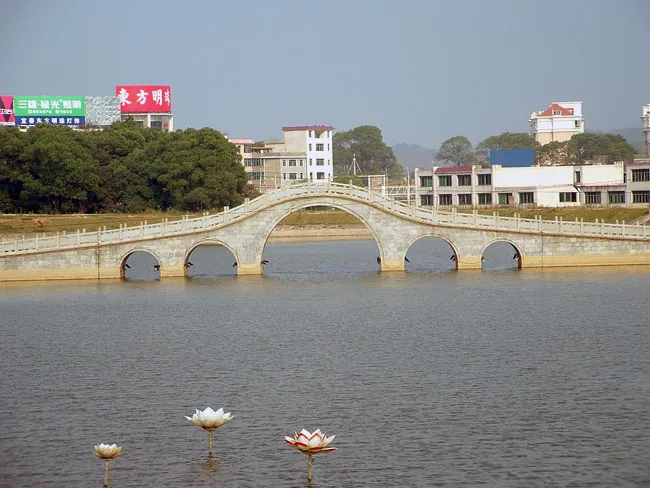
Photo adjustments
Full frame retained; proportionally resized and converted to WebP. No retouching or changes to the photographed subject. Card displays may crop the view.
- Administrative area
- District · 市辖区
- Part of
- Yichun
- Chinese name
- 袁州区
- Local areas
- District guide
Area & population
- Area in the source
- 2,532.36 km²
- Population · 2019
- 1,081,300
Source: cited geographic source, as of the dates shown.
History
A walled town was built here in 201 BC and named Yichun after a spring west of the town that was cool in summer and warm in winter. In 280 the Jin renamed it Yiyang to avoid the personal name of the empress dowager Zhang Chunhua (张春华); in 598 the Sui restored Yichun and made it the seat of the new Yuanzhou prefecture, which became Yuanzhou fu under the Ming in 1369. The Tang writer Han Yu (韩愈) served as prefect and left the line "do not think Yichun too remote; its hills and rivers offer many outings" (莫以宜春远,江山多胜游).
What to see
In the city, Chinese Wikipedia lists the Yichun Drum Tower (宜春鼓楼), which it describes as the oldest surviving local observatory in China. Huacheng Rock (化成岩) is linked to Han Yu's line; Zhuangyuan Islet (状元洲) is where the Tang top examination graduate Lu Zhao (卢肇) studied; and Chuntai Park (春台公园) keeps a stone tablet of the characters "Yichun" written by the Empress Dowager Cixi.
Mingyue Mountain (明月山) National Forest Park covers about 136 square kilometres of the northeastern end of the Wugong Mountains (武功山); People's Daily lists Mingyue Mountain as a national 5A scenic area. Wentang town (温汤镇) is home to the Mingyue Mountain Wentang hot springs, which People's Daily describes as high in selenium and metasilicic acid. At Yangshan (仰山) in Hongjiang town (洪江镇), the Guiyang school (沩仰宗) of Chan Buddhism took final shape.
Getting oriented and local products
Yichun Station, in the district, serves both the Shanghai–Kunming railway and the Shanghai–Kunming high-speed line. Yichun University (宜春学院) is based here. Yuanzhou ramie cloth (袁州夏布) has long been one of the area's known crafts, and the local speech is the Yichun dialect of Gan Chinese.
Highlights
- Mingyue Mountain 明月山: National forest park on the northeastern end of the Wugong Mountains; listed as a 5A scenic area.
- Wentang 温汤古镇: Hot-spring town; its springs are high in selenium and metasilicic acid.
- Yichun Drum Tower 宜春鼓楼: Described by Chinese Wikipedia as the oldest surviving local observatory in China.
- Huacheng Rock 化成岩: Linked to Han Yu's line on Yichun's hills and rivers.
- Yuanzhou ramie cloth 袁州夏布: Long-established local woven ramie fabric.
Sources for this guide
袁州区 - 维基百科,自由的百科全书 · Chinese Wikipedia · CC BY-SA 4.0
宜春市 - 维基百科,自由的百科全书 · Chinese Wikipedia · CC BY-SA 4.0
武功山 - 维基百科,自由的百科全书 · Chinese Wikipedia · CC BY-SA 4.0
宜春提炼城市精神 坚定发展信念 · People's Daily
Original English written from the listed sources and checked sentence by sentence against quoted extracts by a separate reviewer. Updated 2026-09-25.
Explore Yuanzhou District
Core places to explore, with English and Chinese names.
Places to explore around Yuanzhou District
 Mount Mingyue · 明月山
Mount Mingyue明月山
Mingyue Mountain rises above the Wentang area with forested slopes, waterfalls and a high-level lake landscape. Yungu Waterfall is a distinctive lower-mountain feature, while Moon Lake and the Qingyun cliff walkway introduce the…
Read the place guide → AI illustration · AI 示意图(仅供参考,非该地点实拍)
Wentang Ancient Town温汤古镇
Wentang (温汤) is a hot-spring town in Yuanzhou District, Yichun, Jiangxi, sitting below the Mingyueshan range and taking its name and its life from a selenium-rich spring that runs hot all year.
Read the place guide →Plan your visit
Getting there
Yuanzhou District covers the centre of Yichun. Search for 袁州区 in a map app to find stations and your accommodation.
Where to stay →Build your route
Mount Mingyue and Wentang Ancient Town are both listed here. The linked place guides have entrance and visit details.
Continue with Yichun →More in Yichun
Sources & geographic information
Administrative names and parent areas: Official geographic directory · Reference date 2026-09-06.
Some facts checked against 袁州区 — Wikipedia contributors, CC BY-SA 4.0.
Some facts checked against 宜春市 — Wikipedia contributors, CC BY-SA 4.0.
Some facts checked against 武功山 — Wikipedia contributors, CC BY-SA 4.0.
Photo: Mount Mingyue · Harald Groven from Tromsø, Norway · CC BY-SA 2.0. EXIF orientation normalized; resized without changing aspect ratio; converted to WebP. No subject edits.

Map data © OpenStreetMap contributors. Pins mark approximate centres, not entrances or boundaries.