

Explore the region
Tap any red Chinese text to hear it in Mandarin.
Mao’er Mountain National Forest Park is a southern Yanji landscape rather than a stand-alone peak detached from the city. Yanji’s municipal tourism page describes it as a place where mountain, water, forest, fields and city meet, and as a natural viewing platform toward the Buerhatong and Hailan rivers. That relationship is the reason to come: the walk moves from wooded slopes to an open view over the Yanji area, while the city remains close enough for a same-day return.
The Chinese name means “Little Hat Mountain”; the provincial tourism page links it to the mountain’s pointed, hat-like outline. It also describes protected woodland with mushrooms, wild fruit, squirrels, hares and pheasants, so the forest itself—not just the summit photograph—is part of the visit. The same source mentions a Korean ethnic-culture garden at the foot with traditional food and long swings. Treat that as a separate cultural stop, not as proof that every facility belongs to the forest park.
What to see and how to walk
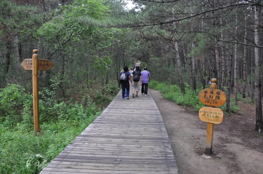
Use the full Chinese name 延吉帽儿山国家森林公园 when searching, since 帽儿山 alone can refer to other mountains. The park’s marked climbing paths include a wooden route toward the summit. Start at the signed public entrance and decide how far to climb after checking footing, weather and daylight. The summit view is the main payoff, but the lower forest is still a worthwhile visit if the upper climb is unsuitable.
The open landscape is clearest on a dry day. In rain, snow or ice, treat the ascent as a mountain walk rather than a paved city park outing; confirm trail access and any seasonal shuttle before leaving. Do not enter an unmarked or closed slope, and arrange your return before you climb.
Getting there and getting back
The current visitor listing places the park on 延龙路 (Yanlong Road). For a taxi or ride-hailing car, show the Chinese destination 帽儿山国家森林公园 Màoérshān Guójiā Sēnlín Gōngyuán and ask for the marked park entrance or main parking area, not simply a central mountain pin. The listing gives the address as Yanlong Road and labels the site as open all day, but it is not an operator notice; check the day’s entry arrangement before setting out.
An official Jilin transport information page published in 2024 lists the 龙井至延吉线 (Longjing–Yanji line), running between 龙井客运站 and 延吉客运北站, with a stop called 帽儿山 Màoérshān. That stop is not proof of a particular trailhead or today’s departure time, so confirm the current vehicle, alighting point and last return before boarding.
A July 3, 2026 tourism-service notice published through a government-affiliated channel described a free shuttle between 景区南部停车场 (the scenic area’s south parking lot) and the 帽儿山国家森林公园 Màoérshān Guójiā Sēnlín Gōngyuán terminal. In that notice, the south-parking departure was 08:30–17:30 and the park-terminal return was 08:50–17:50; the route passed 中国朝鲜族民俗园(延龙路), 帽儿山山泉路 Màoérshān Shānquán Lù and 延边山参研究所 Yánbiān Shānshēn Yánjiūsuǒ. The notice does not state an end date, so verify same-day operation, especially outside the summer travel period. If you use the shuttle, note the terminal on the way in and return before the final listed departure; otherwise pre-arrange a taxi or ride-hailing pickup.
For ticketing and winter operation, check the park’s same-day channel. The visitor listing’s all-day label is useful as a lead but does not replace an operator notice.
Combine your visit
Suggested order within this visit:
-
Tiger-statue entrance and boardwalk
Begin with the forest at a gentler level.
-
Summit lookout
Continue up the stairs only if the climb and visibility suit the group, returning by the confirmed open path.
This sequence is an editorial suggestion based on the features described in the sources. Access to individual buildings or areas should be checked locally; no travel time or shared admission is implied.
Find Mao’er Mountain National Forest Park
延吉帽儿山 · 延边朝鲜族自治州
The pin marks the area, not the entrance.
More places nearby
Approximate straight-line distances between map pins, not travel distances.
Yanji Dinosaur Museum 延吉恐龙博物馆
2 km awayYanji's dinosaur museum grew from fossil discoveries made at Longshan on Mao'er Mountain's southern slope. Its six Korean-style buildings divide the visit between a broad Dinosaur Planet introduction and the Dragon Rising in…
View guide →Korean Folk Customs Park of China 中国朝鲜族民俗园
3 km awayThe Korean Folk Customs Park in southern Yanji is a purpose-built cultural landscape arranged around traditional-style homes, food and performance spaces. It presents the appearance of a village while accommodating restaurants…
View guide →Yanbian Museum 延边博物馆
6 km awayYanbian Museum connects local archaeology with the history and cultural life of ethnic Korean communities in China. The excavated-relics galleries introduce the region's earlier societies, while the folk-customs displays bring…
View guide →Sources & visit information
Sources checked on 1 November 2026. Hours, tickets, reservations and transport can change; confirm with the operator before you go.
Image credits & notes (1)
- A boarded trail through the forest of Mao'er Mountain National Forest Park in Yanji, photographed on 21 July 2012. Photo: Yoshi CanopusPhoto: CC BY-SA 4.0