


Get to know Yanbian Korean Autonomous Prefecture

Photo adjustments
Proportionally resized and converted to WebP without cropping, retouching or changing the photographed subject.
- Administrative area
- Autonomous prefecture · 自治州
- Part of
- Jilin
- Chinese name
- 延边朝鲜族自治州
- Local areas
- 8 local areas
Area & population
- Area in the source
- 43,329.30 km²
- Population · 2022
- 2,015,500
- Administrative seat
- Yanji
Source: cited geographic source, as of the dates shown.
The prefectural capital is Yanji and the total area is 42,700 square kilometres (16,500 sq mi). The prefecture has an important Balhae archaeological site – the Ancient Tombs at Longtou Mountain – which includes the Mausoleum of Princess Jeonghyo.
Transportation
Railways include: Chang-Tu Line (长图线) Mu-Tu Line (牡图线) Chao-Kai Line (朝开线) Yangchuan-Shantun Line (阳川山屯线) Jilin–Hunchun intercity railway (吉珲客运专线)
There are 1480 km of public roads altogether. There are four airports.
Culture
The Yanbian Museum was planned in 1960, and constructed in 1982. It contains over 10,000 exhibits, including 11 first-level artifacts. The exhibits' labels and explanations are bilingual in Korean and Chinese and tour guides are also available in both languages.
Explore Yanbian Korean Autonomous Prefecture
Core places to explore, with English and Chinese names.
Yanji 延吉
Erdaobaihe 二道白河
Changbai Mountain Tianchi 长白山天池
Liuding Mountain 六鼎山
Fangchuan 防川
Yanbian Museum 延边博物馆
Changbai Waterfall 长白山瀑布
Korean Folk Customs Park of China 中国朝鲜族民俗园
Yanji Dinosaur Museum 延吉恐龙博物馆
Head Mountain 延吉帽儿山
Mengdumei Ski Resort 梦都美滑雪场
Xianjingtai 仙景台
Guangdong Village in Helong 光东村
Tumen River Port Riverfront 图们江口岸江畔
Changbai Mountain North Slope 长白山北坡
Erdaobaihe Town 二道白河镇
Mao'er Mountain 帽儿山
Yanji West Market and Yanbian University Area 西市场与延边大学周边街区
Piyan Mountain 琵岩山
Yanji 延吉市
Tumen 图们市
Dunhua 敦化市
Hunchun 珲春市
Longjing 龙井市
Helong 和龙市
Wangqing County 汪清县
Antu County 安图县
Places to explore around Yanbian Korean Autonomous Prefecture
 A street beside China Korean Folk Park in Yanji · 延吉 Photograph date recorded by the source: 23 June 2023.
Yanji延吉
Yanji introduces the Korean cultural life of China's Yanbian region alongside a surprisingly rich dinosaur story. Yanbian Museum provides the historical and folk-customs background, while the Korean Folk Customs Park presents a…
Read the place guide →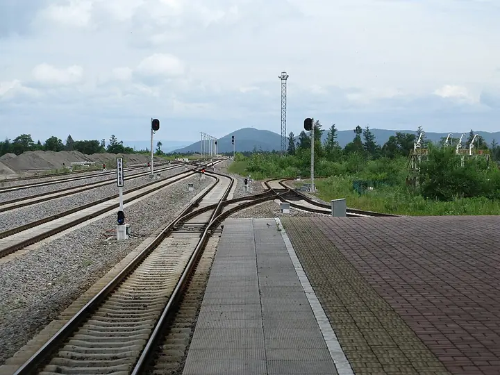 Baihe railway station in Erdaobaihe, photographed in 2012 · 二道白河白河站 Photograph date recorded by the source: 3 August 2012, 11:24.
Erdaobaihe二道白河
Erdaobaihe is the town base for Changbai Mountain's northern approach, but its pine parks and riverside spaces also support a visit without ascending the mountain. The Meirensong International Sculpture Park combines outdoor…
Read the place guide → Changbai Mountain · 长白山
Changbai Mountain Tianchi长白山天池
Changbai Mountain Tianchi fills a volcanic crater on the China–North Korea border, framed by steep, sparsely vegetated peaks. The contrast between the enclosed blue water and the broken volcanic rim is the main visual…
Read the place guide →Tomb No. 5 and the tomb of Princess Zhenhui beyond it in the Liudingshan burial area near Dunhua.Liuding Mountain六鼎山
Liuding Mountain south of Dunhua combines a modern Buddhist landscape with the much older archaeology of the Balhae kingdom. Zhengjue Temple and the large hilltop Jinding Buddha dominate the visitor experience, while the royal…
Read the place guide →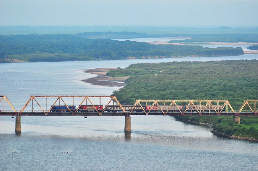 The Korea–Russia Friendship Bridge and Tumen River seen from the Fangchuan border area, July 2014.
Fangchuan防川
Fangchuan occupies a narrow corner of China beside the lower Tumen River, where the landscapes of Russia and North Korea meet across the borders. Longhu Pavilion provides a raised view of the river, railway crossing and…
Read the place guide → The main exterior and entrance steps of Yanbian Museum, Yanji. Photographed on 23 June 2023.
Yanbian Museum延边博物馆
Yanbian Museum connects local archaeology with the history and cultural life of ethnic Korean communities in China. The excavated-relics galleries introduce the region's earlier societies, while the folk-customs displays bring…
Read the place guide → Changbai Waterfall above its rocky northern valley and outflow stream. Photographed on 24 June 2023.
Changbai Waterfall长白山瀑布
Changbai Waterfall descends from the northern outlet of Tianchi through the mountain's volcanic landscape. Its narrow upper stream opens into a dramatic fall above the valley, while the Julong hot-spring area below adds evidence…
Read the place guide →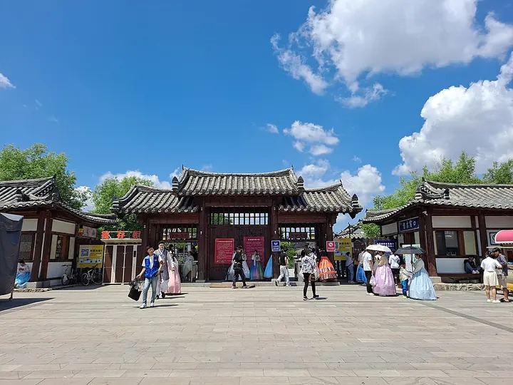 The entrance to the Korean Folk Customs Park of China · 中国朝鲜族民俗园 Photograph date recorded by the source: 23 June 2023.
Korean Folk Customs Park of China中国朝鲜族民俗园
The Korean Folk Customs Park in southern Yanji is a purpose-built cultural landscape arranged around traditional-style homes, food and performance spaces. It presents the appearance of a village while accommodating restaurants…
Read the place guide → Yanji Dinosaur Museum and its outdoor dinosaur model · 延吉恐龙博物馆 Photograph date recorded by the source: 23 June 2023.
Yanji Dinosaur Museum延吉恐龙博物馆
Yanji's dinosaur museum grew from fossil discoveries made at Longshan on Mao'er Mountain's southern slope. Its six Korean-style buildings divide the visit between a broad Dinosaur Planet introduction and the Dragon Rising in…
Read the place guide →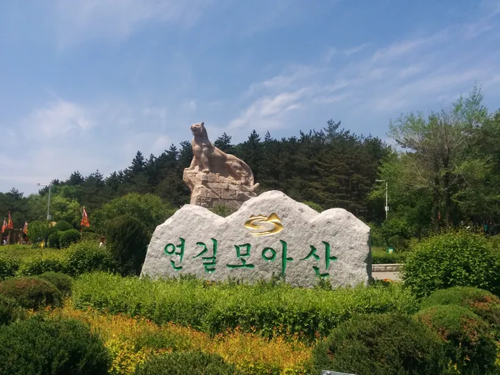 Entrance marker stone of Yanji Mao'ershan National Forest Park · 延吉帽儿山国家森林公园入口景观石 Source-recorded photograph date: 2016-05-29.
Head Mountain延吉帽儿山
Mao'er Mountain takes its name from a hat-like profile above Yanji's southern outskirts. The approach moves from a forest boardwalk to a long stair climb, ending at a lookout over the city, river valleys and surrounding rice…
Read the place guide → Mengdumei Ski Resort · 梦都美滑雪场
Mengdumei Ski Resort梦都美滑雪场
Mengdumei is a ski-and-holiday resort at Chunxing Village outside Yanji. Its ski terrain includes beginner, intermediate and more demanding slopes, while rental equipment and instruction help visitors organise a first session…
Read the place guide →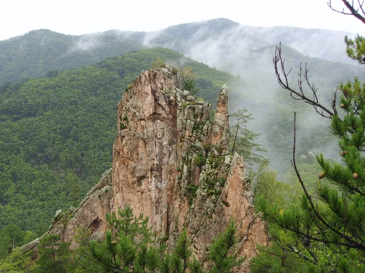 A granite rock peak at Xianjingtai scenic area, Helong, Yanbian Prefecture · 延边朝鲜族自治州和龙市仙景台奇峰 Source-recorded photograph date: Taken on 9 September 2007.
Xianjingtai仙景台
Xianjingtai is a mountain landscape in the Helong area of Yanbian, associated with distinctive granite peaks and exposed rock forms.
Read the place guide → AI illustration · AI 示意图(仅供参考,非该地点实拍)
Guangdong Village in Helong光东村
Guangdong Village, written 光东村, is a Korean ethnic village in Dongcheng Town, Helong, in the Yanbian region of Jilin.
Read the place guide → AI illustration · AI 示意图(仅供参考,非该地点实拍)
Tumen River Port Riverfront图们江口岸江畔
Tumen River Port Riverfront (图们江口岸江畔) is Tumen's port-side waterfront, where the Tumen River separates the Chinese city from Namyang in North Korea.
Read the place guide →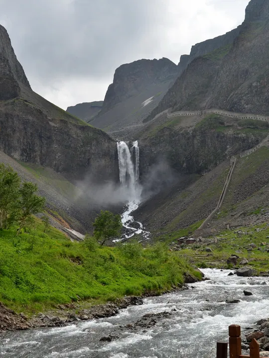 The twin cascades of Changbai Waterfall on the north slope of Changbai Mountain, Antu County · 长白山北坡长白瀑布,吉林省安图县 Source-recorded photograph date: 2013-07-15 14:48:23.
Changbai Mountain North Slope长白山北坡
Changbai Mountain's northern scenic area combines the Tianchi crater lake with hot springs, waterfalls and forest scenery.
Read the place guide →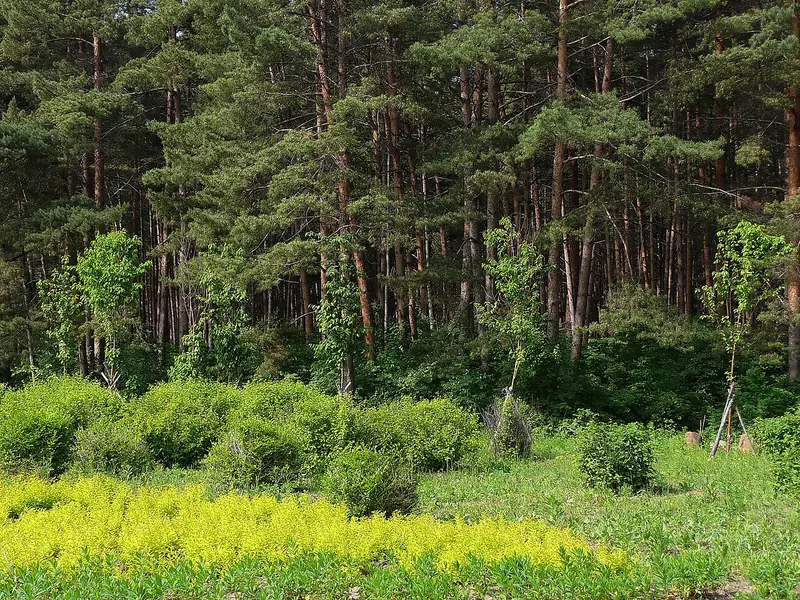 Erdaobaihe Town (二道白河镇), Yanbian Korean Autonomous Prefecture. Photograph: "赤松林 Red Pine Grove - panoramio".
Erdaobaihe Town二道白河镇
Erdaobaihe is a mountain gateway town on the northern side of Changbai Mountain.
Read the place guide →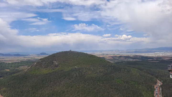 View of Mao'er Shan's forested peak from Hailan Mingzhu Tower, Yanji, Yanbian · 延边州延吉市海兰明珠塔上远眺帽儿山 Source-recorded photograph date: 2026-05-04 09:41:35.
Mao'er Mountain帽儿山
Mao'er Mountain (帽儿山) is a 517.2-metre mountain on Yanji's southern edge, named for a profile resembling a straw hat.
Read the place guide →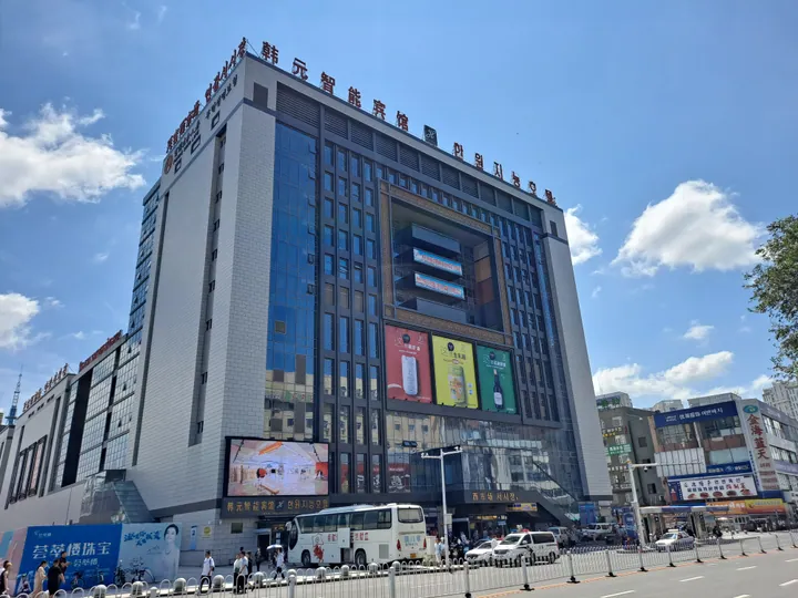 A tall multi-storey market building of white stone and dark glazing seen across its forecourt, carrying the roof sign 韩元智能宾馆 and the vertical signs 서시장 / 西市场 with a large LED screen and advertising panels on its flank; buses, cars and pedestrians along the road in front, other commercial blocks at the right, under a blue sky with cumulus.
Yanji West Market and Yanbian University Area西市场与延边大学周边街区
Yanji West Market and Yanbian University Area (西市场与延边大学周边街区) pairs Yanji's West Market with the streets around Yanbian University, highlighting local food culture and the city's bilingual streetscape.
Read the place guide → A brightly painted Korean-style pavilion of red columns and green-and-gold bracket sets with a tiled roof and a gourd finial, standing on a stone-flagged terrace with a timber deck and railing at the left; a white lamp post, a pine and several visitors on the terrace, with a hazy wooded plain below and a clear blue sky.
Piyan Mountain琵岩山
Piyan Mountain (琵岩山) is a low mountain in Longjing, wrapped on three sides by the Hailan River.
Read the place guide →Local life & food
Yanbian Korean Autonomous Prefecture local specialties
延边朝鲜族自治州特色美食 · 20 specialties to discover
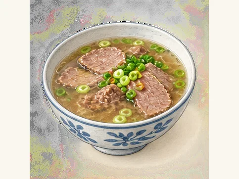 Beef soup 牛肉汤AI dish illustration · AI 菜品示意图
A well-made bowl emphasizes warm beef flavor and tender meat rather than a thick gravy. The intensity and clarity of the broth depend on the shop.
Source ↗Read the dish guide →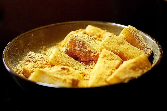 Pounded rice cake 打糕
The cake is dense, stretchy and gently grain-sweet; the coating adds a dry, nutty contrast. It firms as it cools and ages.
Source ↗Read the dish guide →_(rice_cake).jpg)
Photo adjustments
EXIF orientation applied where present; resized proportionally to at most 640 px on the long edge and encoded as WebP. No crop, retouching, recoloring or subject changes.
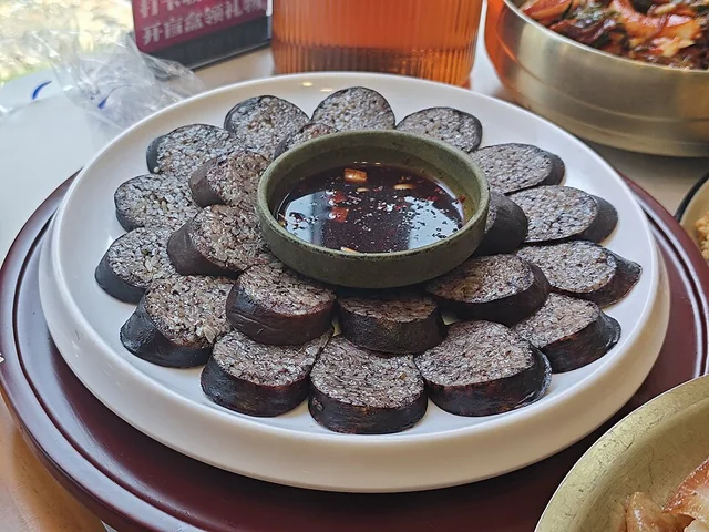 Rice sausage 米肠
The rice gives a soft, compact chew, while the casing holds each slice together. Seasoning and fillings determine whether the flavor is mild or pronounced.
Source ↗Read the dish guide →
Photo adjustments
EXIF orientation applied where present; resized proportionally to at most 640 px on the long edge and encoded as WebP. No crop, retouching, recoloring or subject changes.
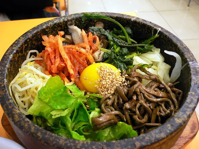 Stone-pot rice 石锅饭
Soft rice and tender toppings contrast with the browned, chewy crust. Chili paste may bring sweetness and heat, depending on what is added.
Source ↗Read the dish guide →
Photo adjustments
EXIF orientation applied where present; resized proportionally to at most 640 px on the long edge and encoded as WebP. No crop, retouching, recoloring or subject changes.
 Yanbian apple pear 延边苹果梨AI dish illustration · AI 菜品示意图
The flesh is crisp, very juicy and gently sweet, with a clean finish that contrasts with rich cooked food.
Source ↗Read the dish guide →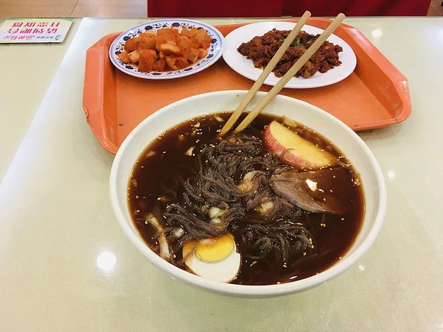 Yanbian cold noodles 延边冷面
The noodles are unusually resilient, while the cold liquid is refreshing, tangy and sometimes noticeably sweet.
Source ↗Read the dish guide →
Photo adjustments
EXIF orientation applied where present; resized proportionally to at most 640 px on the long edge and encoded as WebP. No crop, retouching, recoloring or subject changes.
 Yanbian spicy fermented cabbage 延边辣白菜AI dish illustration / AI 菜品示意图
Expect crisp leaves, juicy stems and a combination of chilli heat and acidity. Some versions lean sweeter or more garlicky, while longer fermentation makes the sourness more pronounced. The colour alone does not reliably predict the heat.
Source ↗Read the dish guide →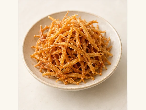 Yanbian seasoned pollock strips 延边明太鱼丝AI dish illustration / AI 菜品示意图
The flavour is savoury and concentrated, often with a sweet-spicy coating. The strands can be quite chewy. A little goes a long way when used as a side beside rice, instead of as the sole main dish.
Source ↗Read the dish guide →All dish names · 全部菜名 (20)
- Beef soup · 牛肉汤
- Pounded rice cake · 打糕
- Rice sausage · 米肠
- Stone-pot rice · 石锅饭
- Yanbian apple pear · 延边苹果梨
- Yanbian cold noodles · 延边冷面
- Yanbian spicy fermented cabbage · 延边辣白菜
- Yanbian seasoned pollock strips · 延边明太鱼丝
- Yanji Cold Noodles · 延吉冷面
- Yanbian Barbecue · 延边烧烤
- Spicy Pickled Cabbage · 辣白菜
- Dog Meat Soup · 狗肉汤
- Ginseng Chicken Soup · 参鸡汤
- Stone Pot Bibimbap · 石锅拌饭
- Alaska Pollock · 明太鱼
- Rice Wraps · 包饭
- Soybean Paste Soup · 酱汤
- Rice Wine · 米酒
- Warm Noodle Soup · 温面
- Beef Soup with Rice · 牛肉汤饭
More dishes from across Jilin are in the Jilin food guide.
Counties & districts in Yanbian Korean Autonomous Prefecture
8 areas belong directly to Yanbian Korean Autonomous Prefecture.
8 areas
Yanji 延吉市
Yanji is a county-level city in the east of China's Jilin Province, and is the seat of the Yanbian Korean Autonomous Prefecture. Yanji City is located in the eastern part of Jilin Province.
Explore the area →County-level cityTumen 图们市
Tumen (simplified Chinese: 图们; traditional Chinese: 圖們; pinyin: Túmén; Chosŏn'gŭl: 도문; Hangul: 투먼) is a county-level city in Yanbian Korean Autonomous Prefecture, eastern Jilin province, Northeast China.
Explore the area →County-level cityDunhua 敦化市
Dunhua is a county-level city of the Yanbian Korean Autonomous Prefecture in southeastern Jilin province, China. It has more than 480,000 inhabitants (as of 2002) and was the capital of Balhae between 742 and…
Explore the area →County-level cityHunchun 珲春市
Hunchun is a county-level city in the Yanbian Korean Autonomous Prefecture within Jilin province to the far east. It borders North Hamgyong Province in North Korea and Primorsky Krai in Russia, has over…
Explore the area →Show fewer areas
Longjing 龙井市
Longjing (simplified Chinese: 龙井; traditional Chinese: 龍井; pinyin: Lóngjǐng; Chosŏn'gŭl: 룡정; Hangul: 룽징) is a county-level city in the Yanbian Korean Autonomous Prefecture, south-eastern Jilin province, China.
Explore the area →County-level cityHelong 和龙市
Helong (simplified Chinese: 和龙; traditional Chinese: 和龍; pinyin: Hélóng; Chosŏn'gŭl: 화룡; Hangul: 허룽) is a county-level city in southeastern Jilin province, Northeast China.
Explore the area →CountyWangqing County 汪清县
Wangqing County (simplified Chinese: 汪清县; traditional Chinese: 汪清縣; pinyin: Wāngqīng Xiàn; Korean: 왕칭현) is a county of southeastern Jilin province, China.
Explore the area →CountyAntu County 安图县
Antu County (simplified Chinese: 安图县; traditional Chinese: 安圖縣; pinyin: Āntú Xiàn; Chosŏn'gŭl: 안도현; Hangul: 안투현) is a county of southeastern Jilin province, Northeast China.
Explore the area →No areas match this name.
Plan your visit
Getting there
Search for 延边朝鲜族自治州 in a map app to find stations and your accommodation.
Where to stay →Build your route
Yanji and Erdaobaihe are about 125 km apart in a straight line. The linked place guides have entrance and visit details.
Continue with Jilin →More in Jilin
Sources & geographic information
Administrative names and parent areas: Official geographic directory · Reference date 2026-09-06.
Background text adapted from Yanbian Korean Autonomous Prefecture — Wikipedia contributors, under CC BY-SA 4.0. Text has been shortened and reorganized; source revision 1369219358.
Photo: Yanji · EditQ · CC BY-SA 4.0. Full frame retained; proportionally resized and converted to WebP. No retouching or changes to the photographed subject. Card displays may crop the view.

Photo: Erdaobaihe · Caitriana Nicholson from 北京 ~ Beijing, 中国 ~ China · CC BY-SA 2.0. Full frame retained; proportionally resized and converted to WebP. No retouching or changes to the photographed subject. Card displays may crop the view.
.jpg)
Photo: Changbai Mountain Tianchi · Antigng · CC BY-SA 4.0. Wikimedia thumbnail; fitted to the ranking-card frame.

Photo: Liuding Mountain · Senkaku Islands · CC BY-SA 4.0. Proportionally resized and converted to WebP without cropping, retouching or changing the photographed subject.

Photo: Fangchuan · TowerCard · CC BY-SA 3.0. Proportionally resized and converted to WebP without cropping, retouching or changing the photographed subject.

Photo: Yanbian Museum · EditQ · CC BY-SA 4.0. Proportionally resized and converted to WebP without cropping, retouching or changing the photographed subject.

Photo: Changbai Waterfall · EditQ · CC BY-SA 4.0. Proportionally resized and converted to WebP without cropping, retouching or changing the photographed subject.

Photo: Korean Folk Customs Park of China · EditQ · CC BY-SA 4.0. Full frame retained; proportionally resized and converted to WebP. No retouching or changes to the photographed subject. Card displays may crop the view.

Photo: Yanji Dinosaur Museum · EditQ · CC BY-SA 4.0. Full frame retained; proportionally resized and converted to WebP. No retouching or changes to the photographed subject. Card displays may crop the view.

Photo: Head Mountain · 沧海夜风 · CC BY-SA 4.0. Full frame retained; proportionally resized and converted to WebP. No retouching or changes to the photographed subject. Card displays may crop the view.

Photo: Mengdumei Ski Resort · Source photographer · License not provided. EXIF orientation normalized; resized without changing aspect ratio; converted to WebP. No subject edits.
Photo: Xianjingtai · 冥想 · CC BY 3.0. Full frame retained; proportionally resized and converted to WebP. No retouching or changes to the photographed subject. Card displays may crop the view.

Photo: Changbai Mountain North Slope · 颐园新居 · CC BY-SA 3.0. Full frame retained; proportionally resized and converted to WebP. No retouching or changes to the photographed subject. Card displays may crop the view.

Photo: Erdaobaihe Town · lienyuan lee · CC BY 3.0. Full frame retained; EXIF orientation normalized, proportionally resized to at most 800 pixels and converted to WebP. No generated pixels or subject changes. Cards may crop the display.

Photo: Mao'er Mountain · H2v5o68z · CC0. Full frame retained; proportionally resized and converted to WebP. No retouching or changes to the photographed subject. Card displays may crop the view.

Photo: Yanji West Market and Yanbian University Area · EditQ · CC BY-SA 4.0. Full frame retained; proportionally resized and converted to WebP. No retouching or changes to the photographed subject. Card displays may crop the view.

Photo: Piyan Mountain · EditQ · CC BY-SA 4.0. Full frame retained; proportionally resized and converted to WebP. No retouching or changes to the photographed subject. Card displays may crop the view.

Map data © OpenStreetMap contributors. Pins mark approximate centres, not entrances or boundaries.