


Get to know Benxi Manchu Autonomous County
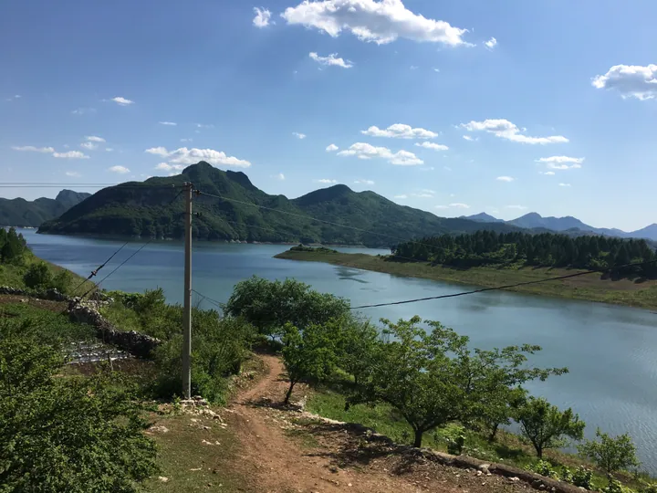
Photo adjustments
Full frame retained; proportionally resized and converted to WebP. No retouching or changes to the photographed subject. Card displays may crop the view.
- Administrative area
- Autonomous county · 自治县
- Part of
- Benxi
- Chinese name
- 本溪满族自治县
- Local areas
- Autonomous county guide
Area & population
- Area in the source
- 3,362.00 km²
- Population · 2020 census
- 230,850
- Administrative seat
- Xiaoshi
Source: cited geographic source, as of the dates shown.
Setting and landscape
The county sits on a southeastern spur of the Changbai Mountains (长白山脉), with more than 240 hills and ridges. The land is highest in the southeast, where the Qianshan range (千山山脉) crosses from east to west, and lowest in the northwest. Through the middle runs the great fault zone of the Taizi River (太子河), whose valley holds a small sedimentary plain averaging under 300 metres. The highest summit, Chubulaigou Ding (出不来沟顶), reaches 1,310 metres; the lowest point, 120 metres, is where the Taizi River leaves the county. Its rivers drain partly to the Yellow Sea and partly to the Bohai, and they freeze for about five months a year.
History
In 1467 the Ming built the ten forts of Liaodong, three of them here: Qinghe (清河堡), Jianchang (碱厂堡) and Caohe (草河堡). A year later a border wall linked the forts, running for more than 100 li through the county. The Qing court created Benxi County in October 1906 from border land of Liaoyang (辽阳), Xingjing (兴京) and Fenghuang (凤凰厅), and many Manchu people moved in. The county was merged into Benxi city in 1952, restored in 1956 and made a Manchu autonomous county in September 1989.
What to see
Guanmenshan National Forest Park (关门山国家森林公园), 53 kilometres southeast of Benxi city, covers 3,517 hectares between 310 and 1,234 metres. Its four scenic areas hold 108 named spots, among them a lion-shaped cliff and the three-step Jinglian waterfall (晶帘瀑布). The county government calls it a nationally known place to see autumn maples; it also has Siebold's magnolia, Benxi's city flower, and mandarin ducks on its waters.
Benxi Water Cave (本溪水洞) lies on the Taizi River 26 kilometres from Benxi city and opened to visitors in 1983. Boats follow an underground river past more than 100 sights, in air that stays at 12°C. Neolithic stone tools and bones about 10,000 years old have been found at its mouth.
Laobiangou (老边沟) forms part of the Dashihu scenic area (大石湖) in Dongyingfang township (东营坊乡). Its Jushichuan valley (巨石川) is choked with boulders and holds sites of the Northeast Anti-Japanese United Army, while Wanxiang Valley (万象谷) takes in the Laomaiduo area (老麦垛), whose peak marks the boundary with Kuandian (宽甸).
Food
Xiaoshi mutton soup (小市羊汤) is made from local cashmere goats. The whole butchered goat goes into a wood-fired pot and simmers for several hours over alternating high and low heat, a method adapted from Manchu mutton soup.
Highlights
- Guanmenshan National Forest Park 关门山国家森林公园: Forest park of 3,517 hectares known for its autumn maples, 53 kilometres southeast of Benxi city.
- Benxi Water Cave 本溪水洞: Karst cave toured by boat on an underground river, first opened to visitors in 1983.
- Laobiangou 老边沟: Boulder-filled valleys in the Dashihu scenic area, with sites of the Northeast Anti-Japanese United Army.
- Xiaoshi mutton soup 小市羊汤: Goat simmered whole for hours in a wood-fired pot.
Sources for this guide
地理位置_本县概况_走进满乡_本溪满族自治县人民政府 · Benxi Manchu Autonomous County People's Government
地质地貌_本县概况_走进满乡_本溪满族自治县人民政府 · Benxi Manchu Autonomous County People's Government
历史变迁_历史文化_走进满乡_本溪满族自治县人民政府 · Benxi Manchu Autonomous County People's Government
小市羊汤_美食美购_枫乡旅游_本溪满族自治县人民政府 · Benxi Manchu Autonomous County People's Government
本溪满族自治县 - 维基百科,自由的百科全书 · Wikipedia (Chinese) · CC BY-SA 4.0
本溪水洞_景区景点_枫乡旅游_本溪满族自治县人民政府 · Benxi Manchu Autonomous County People's Government
关门山国家森林公园_景区景点_枫乡旅游_本溪满族自治县人民政府 · Benxi Manchu Autonomous County People's Government
大石湖(老边沟)景区_景区景点_枫乡旅游_本溪满族自治县人民政府 · Benxi Manchu Autonomous County People's Government
Original English written from the listed sources and checked sentence by sentence against quoted extracts by a separate reviewer. Updated 2026-09-25.
Explore Benxi Manchu Autonomous County
Core places to explore, with English and Chinese names.
Places to explore around Benxi Manchu Autonomous County
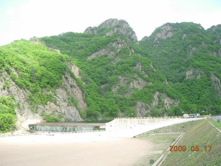 Forested mountain peaks above the reservoir at the entrance to Guanmenshan, Benxi · 本溪关门山水库及山峰景观 Source-recorded photograph date: 2009-05-17.
Guanmen Mountain关门山
Guanmenshan takes its name from two opposing peaks shaped like a gateway, in the forested mountains of Benxi Manchu Autonomous County.
Read the place guide →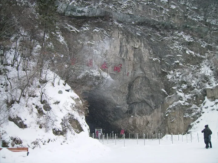 Entrance to Benxi Water Cave in winter, Benxi · 本溪水洞洞口(冬景),本溪市 Source-recorded photograph date: 2009-02-24.
Benxi Water Cave本溪水洞
Benxi Water Cave is a limestone cave system with contrasting dry and water-filled sections. The entrance chamber opens towards passages where stalactites, stalagmites and columns cluster along natural fractures. The underground…
Read the place guide →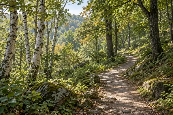 AI illustration · AI 示意图(仅供参考,非该地点实拍)
Laobiangou Valley老边沟
Laobiangou is a wooded mountain-valley attraction in Benxi Manchu Autonomous County, centred on the boulder-filled Yongluo River.
Read the place guide →Plan your visit
Getting there
Benxi Manchu Autonomous County is about 30 km in a straight line from central Benxi. Search for 本溪满族自治县 in a map app to find stations and your accommodation.
Where to stay →Build your route
Guanmen Mountain and Benxi Water Cave are both listed here. The linked place guides have entrance and visit details.
Continue with Benxi →More in Benxi
Sources & geographic information
Administrative names and parent areas: Official geographic directory · Reference date 2026-09-06.
Some facts checked against 本溪满族自治县 — Wikipedia contributors, CC BY-SA 4.0.
Photo: Guanmen Mountain · Wang65 · CC BY-SA 3.0. Full frame retained; proportionally resized and converted to WebP. No retouching or changes to the photographed subject. Card displays may crop the view.

Photo: Benxi Water Cave · Unsonique · CC BY-SA 3.0. Full frame retained; proportionally resized and converted to WebP. No retouching or changes to the photographed subject. Card displays may crop the view.

Map data © OpenStreetMap contributors. Pins mark approximate centres, not entrances or boundaries.