


Get to know Benxi
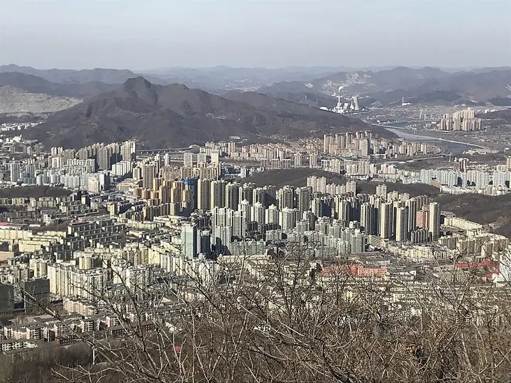
Photo adjustments
Full frame retained; proportionally resized and converted to WebP. No retouching or changes to the photographed subject. Card displays may crop the view.
- Administrative area
- Prefecture-level city · 地级市
- Part of
- Liaoning
- Chinese name
- 本溪市
- Local areas
- 6 local areas
Area & population
- Area in the source
- 8,429.00 km²
- Population · 2020 census
- 1,326,018
- Administrative seat
- Xihu District
Source: cited geographic source, as of the dates shown.
Tourist activities
The eastern side of Benxi has mountains, caves and lakes with low population, making the various parks in that area popular.
The Benxi Lake, located at the urban area of Xihu district in Benxi, after which the city was named in Qing dynasty, has been described as the smallest lake in the world. With an area less than 15 sq. meters and a daily rate of flow at approximately 20,000 tons, the lake acts as a tourist attraction.
Explore Benxi
Core places to explore, with English and Chinese names.
Places to explore around Benxi
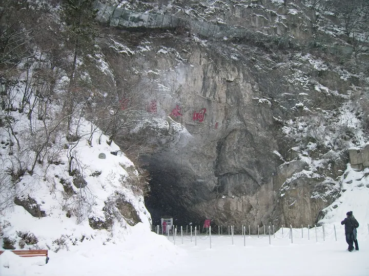 Entrance to Benxi Water Cave in winter, Benxi · 本溪水洞洞口(冬景),本溪市 Source-recorded photograph date: 2009-02-24.
Benxi Water Cave本溪水洞
Benxi Water Cave is a limestone cave system with contrasting dry and water-filled sections. The entrance chamber opens towards passages where stalactites, stalagmites and columns cluster along natural fractures. The underground…
Read the place guide →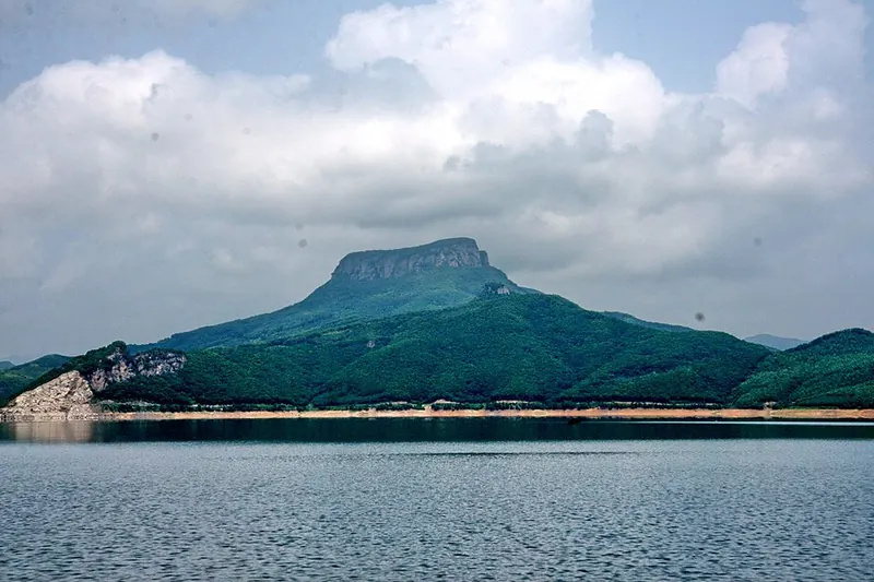 Wunu Mountain viewed across Huanlong Lake · 五女山 Photograph date recorded by the source: 22 July 2007 (according to Exif data).
Wunü Mountain五女山
Wunü Mountain's plateau preserves the remains of an early Goguryeo mountain city above Huanren. Steep cliffs supplied much of the defence, with built walls closing the more accessible gaps. On the summit, building foundations…
Read the place guide →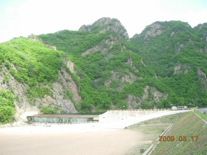 Forested mountain peaks above the reservoir at the entrance to Guanmenshan, Benxi · 本溪关门山水库及山峰景观 Source-recorded photograph date: 2009-05-17.
Guanmen Mountain关门山
Guanmenshan takes its name from two opposing peaks shaped like a gateway, in the forested mountains of Benxi Manchu Autonomous County.
Read the place guide →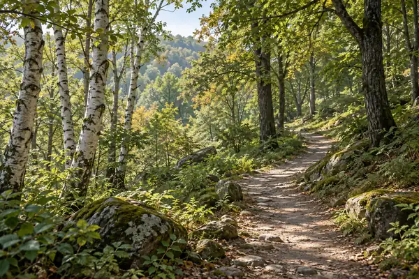 AI illustration · AI 示意图(仅供参考,非该地点实拍)
Laobiangou Valley老边沟
Laobiangou is a wooded mountain-valley attraction in Benxi Manchu Autonomous County, centred on the boulder-filled Yongluo River.
Read the place guide → Fenglin Valley · 枫林谷
Fenglin Valley枫林谷
Fenglingu is a forest park in Huanren Manchu Autonomous County, where maple woods, old trees and mountain streams meet at a transition between the Changbai and North China plant regions.
Read the place guide →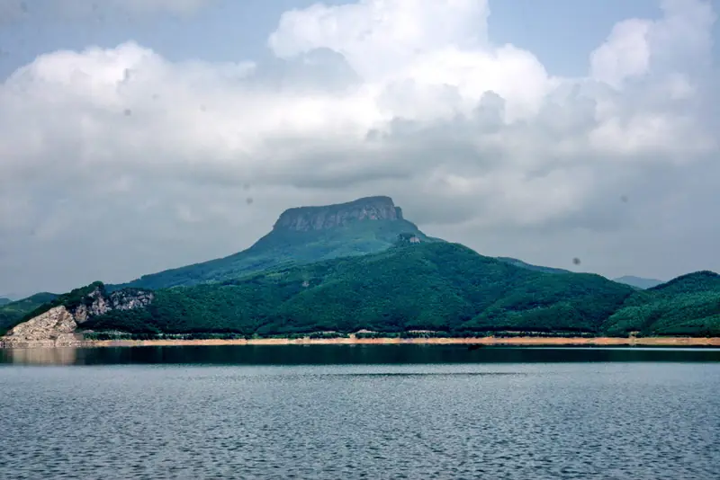 Huanlong Lake (桓龙湖), Huanren Manchu Autonomous County. Photograph: "五女山远景".
Huanlong Lake桓龙湖
Huanlong Lake is a mountain reservoir in Huanren Manchu Autonomous County, with an indented shoreline and islands including Wanle Island.
Read the place guide →Local life & food
Benxi local specialties
本溪市特色美食 · 9 specialties to discover
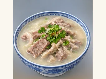 Benxi lamb soup 本溪羊汤AI illustration · AI 示意图
The bowl has a pronounced lamb aroma, tender meat and chewier offal, with a warming, savory finish.
Source ↗Read the dish guide →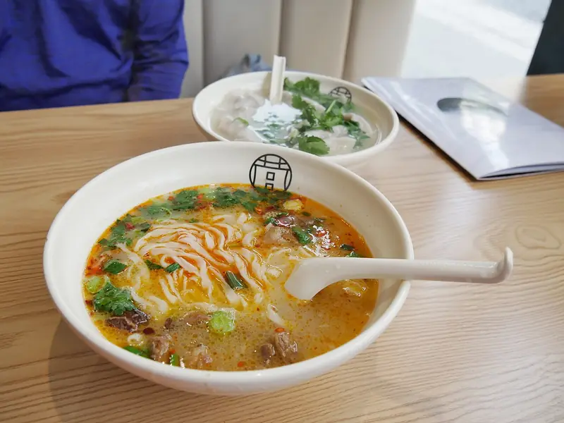 Xiaoshi Goat Soup 小市羊汤Reference photo of a similar dish · 同类菜品参考照片
Xiaoshi Goat Soup (小市羊汤) is a local cashmere-goat soup associated with Benxi (本溪). Its thick, white broth and soft meat are characteristic features described by the Benxi Manchu Autonomous County (本溪满族自治县) government.
Read the dish guide →
Photo adjustments
Full frame retained; EXIF orientation normalized, proportionally resized to at most 800 pixels and converted to WebP. No generated pixels or subject changes. Cards may crop the display.
 Changkuan Pig Trotters 长宽猪蹄AI illustration · AI 示意图(仅供参考,非实拍)
Changkuan Pig Trotters (长宽猪蹄) are pig trotters from Benxi (本溪), Liaoning, made by sauce-braising (酱卤, jianglu).
Read the dish guide →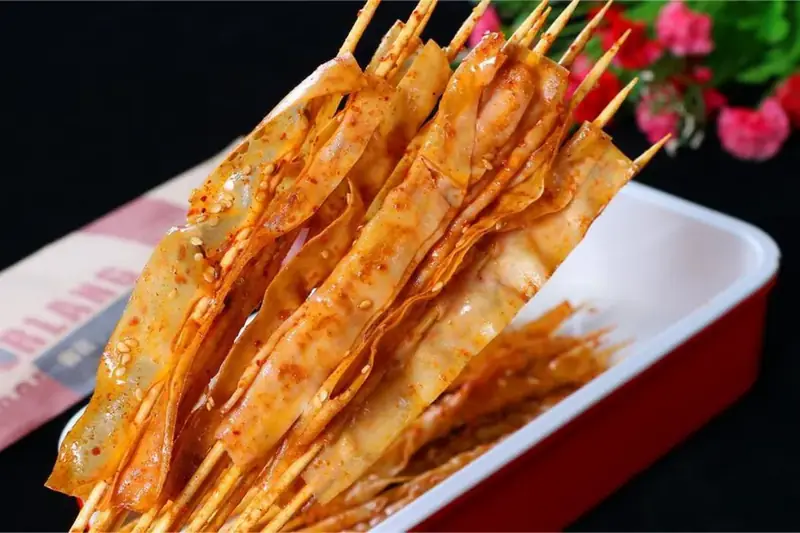 Benxi Tofu Skin 本溪豆皮
Benxi Tofu Skin (本溪豆皮) is a soybean sheet eaten in the city of Benxi (本溪), Liaoning.
Read the dish guide →Photo adjustments
EXIF orientation normalized; resized without changing aspect ratio; converted to WebP. No subject edits.
 Huanren Grilled Fish 桓仁烤鱼AI illustration · AI 示意图(仅供参考,非实拍)
Huanren Grilled Fish (桓仁烤鱼) is listed among the local specialties of Benxi, Liaoning. The name includes 鱼 (fish). 烤 describes roasting or grilling.
Read the dish guide →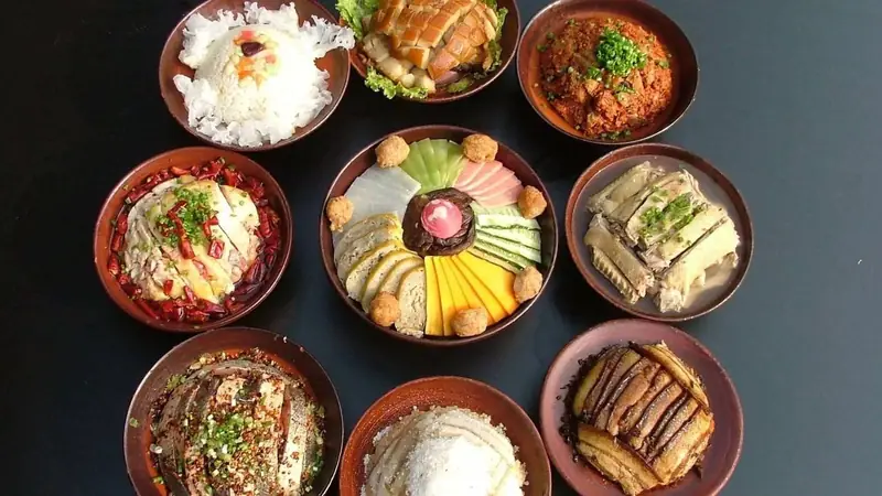 Manchu Eight-Bowl Banquet 满族八大碗
Manchu Eight-Bowl Banquet (满族八大碗) is a named set of dishes from Manchu home cooking, served in Benxi (本溪), Liaoning.
Read the dish guide →Photo adjustments
EXIF orientation normalized; resized without changing aspect ratio; converted to WebP. No subject edits.
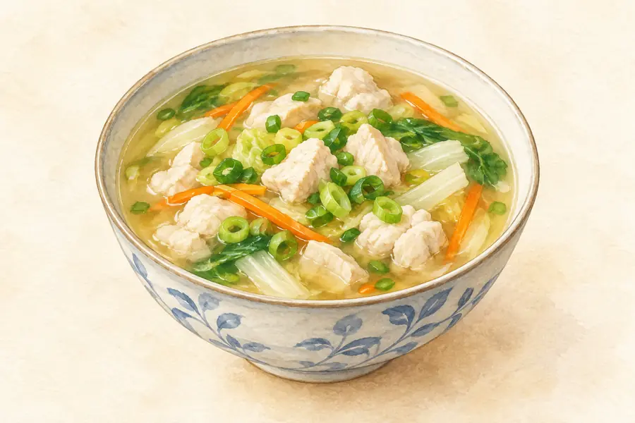 Sour Fermented Grain Noodles 酸汤子AI illustration · AI 示意图(仅供参考,非实拍)
Sour Fermented Grain Noodles (酸汤子) are thick fermented corn noodles eaten in Xinbin (新宾), Fushun (抚顺). Golden in colour, they have a gently sour flavour and a smooth texture.
Source ↗Read the dish guide →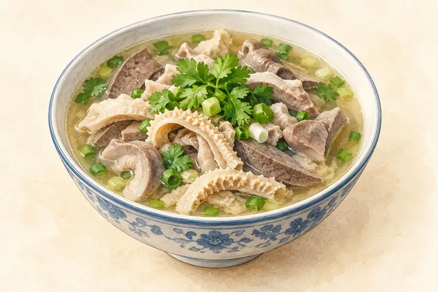 Benxi Sheep Offal 本溪羊杂AI illustration · AI 示意图(仅供参考,非实拍)
Benxi Sheep Offal (本溪羊杂) is listed among the local specialties of Benxi, Liaoning. The name includes 羊杂 (sheep offal).
Read the dish guide →More dishes from across Liaoning are in the Liaoning food guide.
Counties & districts in Benxi
6 areas belong directly to Benxi.
6 areas
Pingshan District 平山区
Pingshan District (simplified Chinese: 平山区; traditional Chinese: 平山區; pinyin: Píngshān Qū; lit. 'flat or peaceful mountain') is a district under the administration of the city of Benxi, Liaoning province…
Explore the area →DistrictXihu District 溪湖区
Xihu District (simplified Chinese: 溪湖区; traditional Chinese: 溪湖區; pinyin: Xīhú Qū) is a District under the administration of the city of Benxi, Liaoning province, People's Republic of China.
Explore the area →DistrictMingshan District 明山区
Mingshan District (simplified Chinese: 明山区; traditional Chinese: 明山區; pinyin: Míngshān Qū) is a district under the administration of the city of Benxi, Liaoning Province, China.
Explore the area →DistrictNanfen District 南芬区
Nanfen District (simplified Chinese: 南芬区; traditional Chinese: 南芬區; pinyin: Nánfēn Qū) is a district under the administration of the city of Benxi, Liaoning province, People's Republic of China.
Explore the area →Show fewer areas
Benxi Manchu Autonomous County 本溪满族自治县
Benxi Manchu Autonomous County (simplified Chinese: 本溪满族自治县; traditional Chinese: 本溪滿族自治縣; pinyin: Běnxī Mǎnzú Zìzhìxiàn; Manchu: ᠪᡝᠨᠰᡳ ᠮᠠᠨᠵᡠ ᠪᡝᠶᡝ ᡩᠠᠰᠠᠩᡤᠠ ᠰᡳᠶᠠᠨ; Möllendorff: bensi manju beye dasangga siyan)…
Explore the area →Autonomous countyHuanren Manchu Autonomous County 桓仁满族自治县
Huanren Manchu Autonomous County (simplified Chinese: 桓仁满族自治县; traditional Chinese: 桓仁滿族自治縣; pinyin: Huánrén Mǎnzú Zìzhì Xìan, Manchu: ᡥᡠᠸᠠᠨᡵᡝᠨ ᠮᠠᠨᠵᡠ ᠪᡝᠶᡝ ᡩᠠᠰᠠᠩᡤᠠ ᡥᡳᠶᠠᠨ; Möllendorff: huwanren manju beye…
Explore the area →No areas match this name.
Plan your visit
Getting there
Search for 本溪市 in a map app to find stations and your accommodation.
Where to stay →Build your route
Benxi Water Cave and Wunü Mountain are about 110 km apart in a straight line. The linked place guides have entrance and visit details.
Continue with Liaoning →More in Liaoning
Sources & geographic information
Administrative names and parent areas: Official geographic directory · Reference date 2026-09-06.
Background text adapted from Benxi — Wikipedia contributors, under CC BY-SA 4.0. Text has been shortened and reorganized; source revision 1371999615.
Photo: Benxi Water Cave · Unsonique · CC BY-SA 3.0. Full frame retained; proportionally resized and converted to WebP. No retouching or changes to the photographed subject. Card displays may crop the view.

Photo: Wunü Mountain · User:Ndpy007 · CC BY-SA 3.0. Full frame retained; proportionally resized and converted to WebP. No retouching or changes to the photographed subject. Card displays may crop the view.

Photo: Guanmen Mountain · Wang65 · CC BY-SA 3.0. Full frame retained; proportionally resized and converted to WebP. No retouching or changes to the photographed subject. Card displays may crop the view.

Photo: Fenglin Valley · Source photographer · License not provided. EXIF orientation normalized; resized without changing aspect ratio; converted to WebP. No subject edits.
Photo: Huanlong Lake · User:Ndpy007 · CC BY-SA 3.0. Full frame retained; EXIF orientation normalized, proportionally resized to at most 800 pixels and converted to WebP. No generated pixels or subject changes. Cards may crop the display.

Map data © OpenStreetMap contributors. Pins mark approximate centres, not entrances or boundaries.