


Get to know Gongchangling District
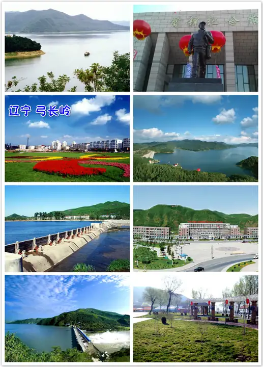
Photo adjustments
EXIF orientation normalized; resized without changing aspect ratio; converted to WebP. No subject edits.
- Administrative area
- District · 市辖区
- Part of
- Liaoyang
- Chinese name
- 弓长岭区
- Local areas
- District guide
Area & population
- Area in the source
- 340.20 km²
- Population · 2020
- 80,870
Source: cited geographic source, as of the dates shown.
Setting and landscape
The ground is higher in the south than the north, with ridges running in bands across the district. The Tang River (汤河) flows north through its length. Two large reservoirs sit at either end: the Tanghe Reservoir (汤河水库), which the district government calls the only unpolluted reservoir in Liaoning, and the Shenwo Reservoir (参窝水库), which it describes as the largest reinforced-concrete gravity-dam reservoir in Liaoning.
Beneath the hills lie iron ore, barite, silica, marble and limestone, and the Gongchangling iron ore is one of the main supplies for Ansteel (鞍钢). Cold and hot springs rise 300 m apart; the hot water reaches 72°C. The China Mineral Water Association named the district a "home of Chinese mineral water" in 2006, Gongchangling mineral water is a national geographical-indication product, and in 2011 the Ministry of Land and Resources named it a "hot-spring city".
History and sights
Anping (安平) is the former ground of Yifeng county (宜丰) under the Western Han and of Anping county under the Jin; the site of the old town survives, and the area remained the centre of the hill country south-east of Liaoyang through later dynasties. The district government counts more than 200 historic spots, among them Huabiao Mountain (华表山) and the Huabiao pillar (华表柱), the old pines of Sifangtai (四方台), the Buddhist temples of Longfeng (龙峰寺) and Chaoyang (朝阳寺), and Gusao City (姑嫂城), the subject of a local legend. The soldier Lei Feng (雷锋) joined the army from Gongchangling.
Food and local products
Tanghe "nourishing fish head" (滋补鱼头) was named one of Liaoning's ten flavour foods by the Liaoning Tourism Association, and Sanxing mutton soup (三星羊汤) is listed by the provincial tourism system as a noted Liaoning snack. Pieces of local Songhua stone (松花石) are shown as natural pictures, and carved ornamental stones have become popular souvenirs.
Getting oriented
The Liaoyang–Benxi railway (辽溪铁路) runs through the urban area. The district lies 25 km south-east of Liaoyang city, 34 km south-west of Benxi (本溪) and 35 km north-east of Anshan (鞍山).
Highlights
- Shenwo Reservoir 参窝水库: Holds 791 million cubic metres behind a reinforced-concrete gravity dam.
- Tanghe Reservoir 汤河水库: Holds 723 million cubic metres; described by the district government as Liaoning's only unpolluted reservoir.
- Tanghe fish head 汤河滋补鱼头: Rated one of Liaoning's ten flavour foods by the Liaoning Tourism Association.
- Sanxing mutton soup 三星羊汤: Listed as a noted Liaoning snack.
Sources for this guide
弓长岭区概况-弓长岭区网站欢迎您! · Gongchangling District People's Government
弓长岭区 - 维基百科 · Wikipedia (Chinese) · CC BY-SA 4.0
Original English written from the listed sources and checked sentence by sentence against quoted extracts by a separate reviewer. Updated 2026-09-25.
Explore Gongchangling District
Core places to explore, with English and Chinese names.
Places to explore around Gongchangling District
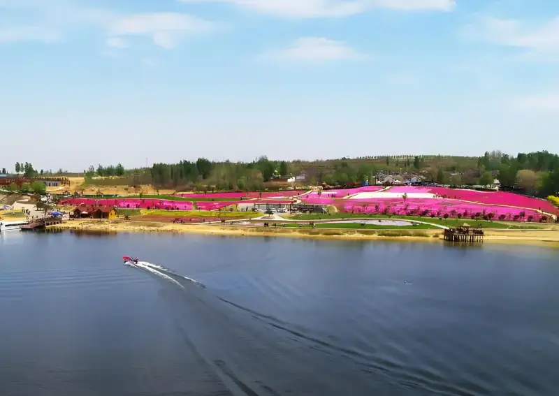 Tanghe Scenic Area ·
 Plan your visit
Getting there
Gongchangling District is about 25 km in a straight line from central Liaoyang. Search for 弓长岭区 in a map app to find stations and your accommodation.
Where to stay →Build your route
Start with Tanghe Scenic Area. The linked place guides have entrance and visit details.
Continue with Liaoyang →More in Liaoyang
Sources & geographic information
Administrative names and parent areas: Official geographic directory · Reference date 2026-09-06.
Some facts checked against 弓长岭区 — Wikipedia contributors, CC BY-SA 4.0.
Photo: Tanghe Scenic Area · Source photographer · License not provided. EXIF orientation normalized; resized without changing aspect ratio; converted to WebP. No subject edits.
Map data © OpenStreetMap contributors. Pins mark approximate centres, not entrances or boundaries.