

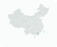
Get to know Novos Aterros do Porto Exterior e Aterros da Baía da Praia Grande
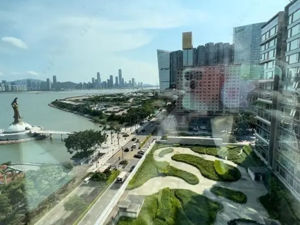
Photo adjustments
EXIF orientation normalized; resized without changing aspect ratio; converted to WebP. No subject edits.
- Administrative area
- Statistical area · 統計分區
- Part of
- Macau
- Chinese name
- 外港及南灣湖新填海區
- Local areas
- Statistical area guide
How the land was made
The older Outer Harbour reclamation was first meant to become a deep-water port, but the channel narrowed and the plan stalled. As the city ran short of land, further reclamation followed, and the newly filled tract became NAPE. Dynasty Plaza (皇朝廣場) was the first building completed there, which is why locals call the whole district Wong Chiu, 'Dynasty'.
The Nam Van scheme began in July 1992 with a dyke drawn between Praça de Ferreira do Amaral (銅馬廣場) and Meia Laranja (半邊橙). The dykes south of Nam Van and Sai Van were finished in 1997, leaving a larger lake, Nam Van Lake, and a smaller one, Sai Van Lake. Four tidal flats were built in Nam Van Lake, and one carries a planted island for birds. The Legislative Assembly and the court building, which overlook Nam Van Lake, opened in 1999, the Macau Tower followed on 19 December 2001, and the Nam Van Lake Nautical Centre opened in 2005. The western part of NAPE, with Wynn Macau and MGM Macau, also belongs to the Nam Van scheme.
What to see
NAPE is laid out around Alameda Dr. Carlos d'Assumpção (宋玉生廣場). To keep the view of Guia Lighthouse (松山燈塔), buildings were held to a height limit, producing rows of similar block towers; many pair an office tower in front with a residential block behind. Bars opened along Avenida Dr. Sun Yat-sen (孫逸仙大馬路) as the district took shape, and after gaming was liberalised in 2002 casino hotels followed, including Wynn Macau, StarWorld, L'Arc and MGM. The district also holds the Macao Cultural Centre (澳門文化中心), the Kun Iam Ecumenical Centre (觀音蓮花苑) and the Macao Science Center (澳門科學館). The Science Center was designed by Pei Partnership Architects with I. M. Pei and completed in 2009; its asymmetrical conical main building has a spiral walkway and interactive galleries, and there is a planetarium.
On the lakes side, the Macau Tower rises 338 metres, with an observation deck, and the square in front of it on Sai Van Lake was laid out in 1998. Nam Van Lake is used for sprint kayaking, rowing and dragon boat racing.
Highlights
- Macao Science Center 澳門科學館: Conical building by Pei Partnership Architects with I. M. Pei, completed in 2009, with a planetarium.
- Macau Tower 澳門旅遊塔: 338-metre tower opened on 19 December 2001, built as part of the Nam Van reclamation project.
- Nam Van Lake 南灣湖: Artificial lake formed by dykes completed in 1997; used for kayaking, rowing and dragon boat racing.
Sources for this guide
新口岸新填海区 - 维基百科,自由的百科全书 · Wikipedia (Chinese) · CC BY-SA 4.0
南湾湖 (澳门) - 维基百科,自由的百科全书 · Wikipedia (Chinese) · CC BY-SA 4.0
Nam Van Lake - Wikipedia · Wikipedia (English) · CC BY-SA 4.0
Macao Science Center - Wikipedia · Wikipedia (English) · CC BY-SA 4.0
Macau Tower - Wikipedia · Wikipedia (English) · CC BY-SA 4.0
Original English written from the listed sources and checked sentence by sentence against quoted extracts by a separate reviewer. Updated 2026-09-23.
Find Novos Aterros do Porto Exterior e Aterros da Baía da Praia Grande
A reliable area-level map point is not available in the current sources.
Plan your visit
Getting there
Search for 外港及南灣湖新填海區 in a map app to find stations and your accommodation.
Where to stay →More in Macau
Sources & geographic information
Administrative names and parent areas: Official geographic directory · Reference date 2026-09-06.
DSEC statistical-zone directory
Cultural Affairs Bureau via MGTO: Kun Iam Ecumenical Centre
Some facts checked against 新口岸新填海区 — Wikipedia contributors, CC BY-SA 4.0.
Some facts checked against 南湾湖 (澳门) — Wikipedia contributors, CC BY-SA 4.0.
Some facts checked against Nam Van Lake — Wikipedia contributors, CC BY-SA 4.0.
Some facts checked against Macao Science Center — Wikipedia contributors, CC BY-SA 4.0.
Some facts checked against Macau Tower — Wikipedia contributors, CC BY-SA 4.0.
Map data © OpenStreetMap contributors. Pins mark approximate centres, not entrances or boundaries.