


Get to know Lanling County
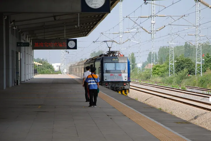
Photo adjustments
Full frame retained; proportionally resized and converted to WebP. No retouching or changes to the photographed subject. Card displays may crop the view.
- Administrative area
- County · 县
- Part of
- Linyi
- Chinese name
- 兰陵县
- Local areas
- County guide
Area & population
- Area in the source
- 1,724.00 km²
- Population · 2019
- 1,201,000
Source: cited geographic source, as of the dates shown.
Setting and landscape
Plains laid down by the East and West Jia rivers (泇河), the Wen River (汶河) and the Yi River (沂河) cover most of the county, and its streams belong to the Zhongyun River (中运河) system of the Huai basin. Lanling lies 42 kilometres from Linyi.
History
The state of Chu took Lanling in 261 BC and made it a county. The philosopher Xunzi (荀子) served twice as magistrate of Lanling for nearly twenty years, stayed on to write and teach, and was buried here. Lanling was also the ancestral seat of the Xiao (萧) clan, whose descendants founded the Southern Qi and Liang dynasties and produced eleven emperors.
Between 1594 and 1604 the Ming government dug the Jia River canal (泇河运道) through the lower West Jia valley, more than 260 li long, so that shipping could avoid 330 li of dangerous Yellow River channel. In 1947 a new county was set up at Bianzhuang (卞庄) and named Cangshan after the Cangshan uprising (苍山暴动) of July 1933; the State Council approved the change of name to Lanling on 27 December 2013.
What to see
In Lanling Town (兰陵镇), the Xunzi Culture Park (荀子文化园) takes in Xunzi's tomb precinct, and the Xiao Clan Culture Park (兰陵萧氏文化园) at Xiaozhong village (小仲村) holds an ancestral hall and the tomb of Xiao Wangzhi (萧望之). Langgong Temple (朗公寺) on Dazong Mountain (大宗山), east of Dazhongcun Town (大仲村镇), was founded in AD 339. Wenfeng Mountain (文峰山) west of the county town takes its name from Ji Wenzi (季文子), a chief minister of Lu buried there; its main peak is 238 metres high. The Lanling National Agricultural Park (兰陵国家农业公园) at Daicun (代村) is a 4A area, and the Cangshan Uprising Memorial (苍山暴动纪念馆) stands at Dayuzi village (大圩子村) in Jinling Town (金岭镇).
Food and local products
Lanling wine (兰陵美酒) opens Li Bai's quatrain "Lanling meijiu yujinxiang" (兰陵美酒郁金香, "Lanling's fine wine, fragrant as turmeric"), and it won a gold medal at the Panama-Pacific Exposition in San Francisco in 1915. The Lucheng whole-sheep banquet (鲁城宫廷全羊宴), a provincial intangible heritage item from Lucheng Town (鲁城镇), goes back to the Qianlong reign and serves many dishes from one sheep, none of them named after the animal. Hengshan shaobing (横山烧饼) are round, yellow sesame-covered flatbreads, and Changcheng facing-heaven chillies (长城朝天椒) are a national geographical-indication product.
Highlights
- Xunzi Culture Park 荀子文化园: 3A park in Lanling Town built around the tomb of the philosopher Xunzi, once magistrate of Lanling.
- Langgong Temple 朗公寺: Temple on Dazong Mountain founded in AD 339 in the Eastern Jin.
- Wenfeng Mountain 文峰山: Hill west of the county town named after Ji Wenzi of Lu, buried there.
- Lanling wine 兰陵美酒: Wine praised by Li Bai; gold medal at the 1915 Panama-Pacific Exposition.
- Lucheng whole-sheep banquet 鲁城宫廷全羊宴: Provincial intangible heritage banquet from Lucheng Town dating to the Qianlong reign.
Sources for this guide
自然环境-兰陵县人民政府 · Lanling County People's Government
兰陵县 - 维基百科,自由的百科全书 · Wikipedia (Chinese) · CC BY-SA 4.0
历史沿革-兰陵县人民政府 · Lanling County People's Government
人文历史-兰陵县人民政府 · Lanling County People's Government
游在兰陵-兰陵县人民政府 · Lanling County People's Government
吃在兰陵-兰陵县人民政府 · Lanling County People's Government
Original English written from the listed sources and checked sentence by sentence against quoted extracts by a separate reviewer. Updated 2026-09-23.
Explore Lanling County
Core places to explore, with English and Chinese names.
Lanling County 兰陵县
Plan your visit
Getting there
Lanling County is about 40 km in a straight line from central Linyi. Search for 兰陵县 in a map app to find stations and your accommodation.
Where to stay →More in Linyi
Sources & geographic information
Administrative names and parent areas: Official geographic directory · Reference date 2026-09-06.
Some facts checked against 兰陵县 — Wikipedia contributors, CC BY-SA 4.0.
Map data © OpenStreetMap contributors. Pins mark approximate centres, not entrances or boundaries.