


Get to know Luozhuang District
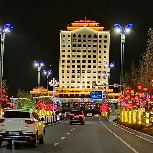
Photo adjustments
EXIF orientation normalized; resized without changing aspect ratio; converted to WebP. No subject edits.
- Administrative area
- District · 市辖区
- Part of
- Linyi
- Chinese name
- 罗庄区
- Local areas
- District guide
Area & population
- Area in the source
- 642.00 km²
- Population · 2019
- 568,000
Source: cited geographic source, as of the dates shown.
Setting and landscape
All of the district's 87 hills and ridges branch off from Mount Meng (蒙山); the highest, Zhaishan (寨山), reaches 272.4 metres. Five rivers cross the district, the Yi, the Wu (武河), the Nansu (南涑河), the Xianni (陷泥河) and the Yanzi (燕子河), all belonging to the Huai River (淮河) system. The Wu River, also called the Pi–Cang flood diversion channel (邳苍分洪道), was dug in the Kangxi reign of the Qing to carry Yi water to the canal, and was dug out again in 1957 to take flood water from the Yi.
History
The district was created in 1994, but pottery here goes back to the Longshan culture: an eggshell-pottery stem cup was unearthed at Huxiya village (湖西崖村) in April 1980. The Zhuchen kiln site (朱陈古瓷窑址), first fired in the Northern Dynasties and used into the Qing, was listed as a provincial heritage site in 2006. Baoquan Temple (宝泉寺), founded in the Song and rebuilt in 1318 under the Yuan, grew into one of the four famous temples of Yizhou (沂州).
The Eastern Han tomb at Wubaizhuang (吴白庄画像石墓) yielded 49 carved stones in high relief and openwork showing foreigners, tigers, monkeys, bears and coiled dragons; it became a provincial heritage site in 2006. The Yitang memorial archway (沂堂牌坊), a stone arch of four pillars and five tiers built in 1815 to honour the wife of a military licentiate, was listed by the province in 2003.
What to see
The Baoquan Shengjing scenic area (宝泉胜境景区), rated 3A, takes in the Zhuchen kiln site. The Wuhe Wetland Park (武河湿地公园) in Huangshan Town (黄山镇) runs 15 kilometres along the Wu River, from the Jiangfengkou flood gate to the Liaojiatun control gate, and is described by the district as the largest man-made river wetland in China. Yinfeng Lake Park (银凤湖公园) was built on a former industrial waste dump and keeps the old pits.
Local products and crafts
Luozhuang is one of China's eight main ceramic-producing areas, and cage-kiln firing by the Zhou family (周氏笼窑陶瓷烧制技艺) is among the crafts the district presents. In Huangshan Town, villagers have planted osier willow on the river flats of the Yi and the Wu for more than a thousand years, according to historical records, and weave it into baskets (黄山柳编).
Getting oriented
The district lies about 10 kilometres from Linyi airport and 25 kilometres from the Linyi high-speed rail station. National Highway 206 passes through it.
Highlights
- Zhuchen kiln site 朱陈古瓷窑址: Kiln site first fired in the Northern Dynasties; provincial heritage site since 2006.
- Wubaizhuang pictorial stone tomb 吴白庄画像石墓: Eastern Han tomb with 49 carved relief stones; provincial heritage site since 2006.
- Yitang memorial archway 沂堂牌坊: Stone arch built in 1815; provincial heritage site since 2003.
- Wuhe Wetland Park 武河湿地公园: 15-kilometre wetland along the Wu River in Huangshan Town.
- Yinfeng Lake Park 银凤湖公园: Park built on a former industrial waste dump, keeping the old pits.
- Huangshan willow weaving 黄山柳编: Basketry from osier willow grown on the river flats of Huangshan Town.
Sources for this guide
罗庄区 - 维基百科,自由的百科全书 · Chinese Wikipedia · CC BY-SA 4.0
罗庄概况-罗庄区人民政府 · Luozhuang District People's Government
自然环境-罗庄区人民政府 · Luozhuang District People's Government
景点打卡-罗庄区人民政府 · Luozhuang District People's Government
罗庄文化-罗庄区人民政府 · Luozhuang District People's Government
Original English written from the listed sources and checked sentence by sentence against quoted extracts by a separate reviewer. Updated 2026-09-23.
Explore Luozhuang District
Core places to explore, with English and Chinese names.
Luozhuang District 罗庄区
Plan your visit
Getting there
Luozhuang District is about 15 km in a straight line from central Linyi. Search for 罗庄区 in a map app to find stations and your accommodation.
Where to stay →More in Linyi
Sources & geographic information
Administrative names and parent areas: Official geographic directory · Reference date 2026-09-06.
Some facts checked against 罗庄区 — Wikipedia contributors, CC BY-SA 4.0.
Map data © OpenStreetMap contributors. Pins mark approximate centres, not entrances or boundaries.