


Get to know Yishui County
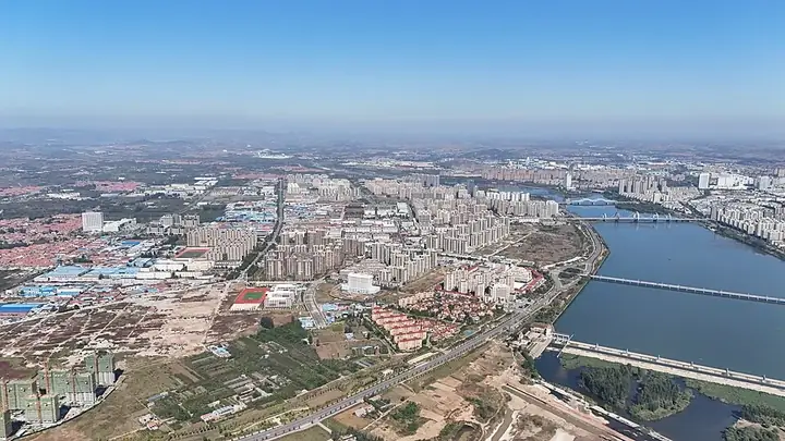
Photo adjustments
Full frame retained; resized proportionally to a maximum dimension of 960 pixels and converted to WebP quality 88. No crop, retouch, generated elements, or subject alteration. Final website rendition: full frame retained, proportionally resized to at most 720 pixels and converted to WebP. No additional retouching or subject alteration. Card displays may crop the view.
- Administrative area
- County · 县
- Part of
- Linyi
- Chinese name
- 沂水县
- Local areas
- County guide
Area & population
- Area in the source
- 2,414.00 km²
- Population · 2019
- 1,007,100
Source: cited geographic source, as of the dates shown.
Setting and landscape
The west and north of the county are low mountains, the east and north-east are hills, and the centre and south are plains; the land as a whole slopes from north-west to south-east. The highest point, Taibo Peak (泰薄顶) on the south side of Mount Yi (沂山), reaches 916.1 m and is also where the Shu River rises. The Yi River, which the county government calls Shandong's largest river, flows through the county for 56 km, passing through the Bashan Reservoir (跋山水库).
History
Muling Pass (穆陵关), a pass on the Qi Great Wall (齐长城), stands in Guanding village (关顶村) of Mazhan (马站镇); Liu Bin (刘斌), a Linzi (临淄) specialist in Qi history, dates it to no later than 821 BC. The Qi Great Wall remains are a national key protected site. In December 1938 the Communist Party's Shandong Bureau and the Eighth Route Army's Shandong Column headquarters were set up at Wangzhuang (王庄) in Xiawei (夏蔚镇). Dazhong Daily (《大众日报》) was founded in the same town, at Yuntouyu village (云头峪村), on 1 January 1939, and the county became known as a "little Yan'an" of East China.
What to see
The Jiwang Gu tombs (纪王崮墓群), about 40 km north-west of the county town in Quanzhuang (泉庄镇), lie inside the Tianshang Wangcheng (天上王城) scenic area on a mesa-top 577.2 m high. Building work there in 2012 uncovered a Spring and Autumn tomb whose chamber and chariot pit were cut into one rock hollow; it was named one of China's ten major archaeological discoveries for 2014. Its finds are shown in a dedicated hall of the Yishui County Museum (沂水县博物馆), which opened in 2001 and holds about 51,000 objects.
The Underground Grand Canyon (地下大峡谷), a national 4A scenic area, has waterfalls, rock formations and rafting on an underground river. Lingquan Mountain (灵泉山) has the old Lingquan Temple (灵泉古寺), an ancient ginkgo, a pagoda forest and a Song-dynasty Nine Dragon stele (九龙碑).
Food and local products
Wood-fired chicken (木柴炒鸡) uses free-range local chickens and spices cooked over a wood fire; the county government points to Xiqiangyu village (西墙峪) in Yuandongtou (院东头镇), where the restaurants sit on the hillsides, as the place to eat it. Yishui jianbing (沂水煎饼) is batter spread thin on an iron griddle; dried and folded, it keeps for up to a month, and a leek-and-egg filling cooked on the griddle between two sheets makes a jianbing hezi (煎饼合子). Gaoqiao hand embroidery (高桥手绣) is on Linyi's intangible-heritage list.
Highlights
- Jiwang Gu Tombs at Tianshang Wangcheng 纪王崮墓群: Spring and Autumn tomb found in 2012 with its chariot pit cut into one rock hollow.
- Muling Pass 穆陵关: Pass on the Qi Great Wall dated to no later than 821 BC.
- Underground Grand Canyon 地下大峡谷: 4A scenic area with rafting on an underground river.
- Wood-fired chicken 木柴炒鸡: Free-range chicken cooked over wood; the county names Xiqiangyu village as the most authentic place to eat it.
- Yishui jianbing 沂水煎饼: Thin griddle pancake that keeps for up to a month when dried.
Sources for this guide
地理环境-欢迎您来到沂水县人民政府 · Yishui County People's Government
历史文化-欢迎您来到沂水县人民政府 · Yishui County People's Government
精品线路推荐——全景沂水,山水之旅二日游-欢迎您来到沂水县人民政府 · Yishui County People's Government
木柴炒鸡-欢迎您来到沂水县人民政府 · Yishui County People's Government
沂水煎饼-欢迎您来到沂水县人民政府 · Yishui County People's Government
Original English written from the listed sources and checked sentence by sentence against quoted extracts by a separate reviewer. Updated 2026-09-25.
Explore Yishui County
Core places to explore, with English and Chinese names.
Places to explore around Yishui County
 Yishui Firefly Water Cave · 萤火虫水洞
Yishui Firefly Water Cave萤火虫水洞
Yishui Firefly Water Cave is a karst-cave and underground-lake attraction in Simendong Village, Yuandongtou Town. It is one component of the combined Firefly Water Cave and Underground Grand Canyon destination, with its own visitor experience and entrance.
Read the place guide →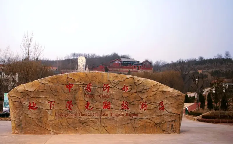 Underground Grand Canyon · 地下大峡谷
Underground Grand Canyon地下大峡谷
The Underground Grand Canyon (地下大峡谷) is a karst cave at Yongfuzhuang village in Yuandongtou Town, Yishui County, Linyi, Shandong, whose main passage runs as a deep, narrow gorge with a river along its floor.
Read the place guide →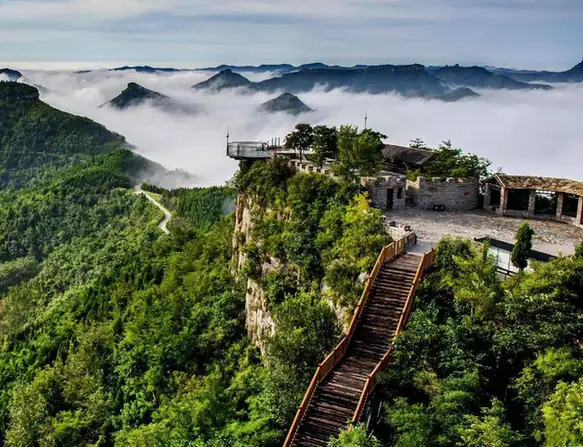 Tianshang Wangcheng Scenic Area · 天上王城
Tianshang Wangcheng Scenic Area天上王城
Tianshang Wangcheng (天上王城) is a scenic area on the flat summit of Jiwanggu, a rock mesa in Quanzhuang Town about 40 kilometres north-west of the Yishui county seat in Linyi, Shandong, and it is the place where a Spring and Autumn period princely tomb was excavated.
Read the place guide →Plan your visit
Getting there
Yishui County is about 80 km in a straight line from central Linyi. Search for 沂水县 in a map app to find stations and your accommodation.
Where to stay →Build your route
Yishui Firefly Water Cave and Underground Grand Canyon are both listed here. The linked place guides have entrance and visit details.
Continue with Linyi →More in Linyi
Sources & geographic information
Administrative names and parent areas: Official geographic directory · Reference date 2026-09-06.
Photo: Yishui Firefly Water Cave · Source photographer · License not provided. EXIF orientation normalized; resized without changing aspect ratio; converted to WebP. No subject edits.
Photo: Underground Grand Canyon · WeelStone · CC BY-SA 3.0. EXIF orientation normalized; resized without changing aspect ratio; converted to WebP. No subject edits.

Photo: Tianshang Wangcheng Scenic Area · Source photographer · License not provided. EXIF orientation normalized; resized without changing aspect ratio; converted to WebP. No subject edits.
Map data © OpenStreetMap contributors. Pins mark approximate centres, not entrances or boundaries.