


Get to know Licang District
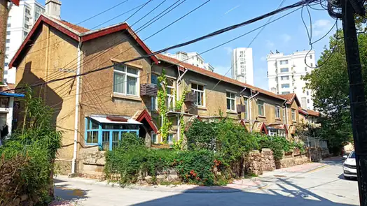
Photo adjustments
EXIF orientation normalized; resized without changing aspect ratio; converted to WebP. No subject edits.
- Administrative area
- District · 市辖区
- Part of
- Qingdao
- Chinese name
- 李沧区
- Local areas
- District guide
Area & population
- Area in the source
- 95.20 km²
- Population · 2019
- 589,200
Source: cited geographic source, as of the dates shown.
Setting and landscape
The district government describes Licang as set between hills, rivers and the bay, with 14 rivers, 13 km of coast and 11 hills. The Licun River (李村河), 17 km long, rises at the foot of Shimen Mountain (石门山), runs east to west through the district and enters Jiaozhou Bay (胶州湾) near Shengli Bridge (胜利桥).
History
In the late Qing the area was Renhua township (仁化乡) of Jimo County (即墨县). After the Beiyang government took over Jiaozhou Bay in 1922, it was split between the Sicang (四沧) and Licun rural districts. In May 1994 the part of Cangkou District north of the Licun River and the part of Licun town north of the Zhangcun River (张村河) were merged to create Licang.
The district government calls Licang the cradle of Qingdao's modern industry. Steel, petrochemical and textile works once clustered here, and it names the district as the birthplace of the Hao Jianxiu work method (郝建秀工作法).
What to see
Licang hosted the 2014 Qingdao World Horticultural Exposition. Its main exhibition area was sited around Baiguoshan Reservoir (百果山水库) in Jiushuilu Subdistrict (九水路街道), with hills and woodland as a backdrop.
For everyday street life the district points to the Licun Market (李村大集), which it describes as a century old, and the Licun night-market pedestrian street (李村夜市步行街). It also bills the Licun commercial district (李村商圈) as the leading shopping area of the Shandong Peninsula.
Getting oriented
Qingdao North Station (青岛北站), a first-class hub of the national rail network, stands in Licang, and the Qingdao end of the Jiaozhou Bay Bridge (胶州湾大桥) comes ashore here. Seven metro lines cross the district, and all the main roads into urban Qingdao pass through it.
Sources for this guide
基本情况-李沧政务网 · Licang District People's Government, Qingdao
李沧区 - 维基百科,自由的百科全书 · Wikipedia (Chinese) · CC BY-SA 4.0
2014年世界园艺博览会 - 维基百科,自由的百科全书 · Wikipedia (Chinese) · CC BY-SA 4.0
李村河 - 维基百科,自由的百科全书 · Wikipedia (Chinese) · CC BY-SA 4.0
Original English written from the listed sources and checked sentence by sentence against quoted extracts by a separate reviewer. Updated 2026-09-23.
Explore Licang District
Core places to explore, with English and Chinese names.
Licang District 李沧区
Plan your visit
Getting there
Licang District is about 10 km in a straight line from central Qingdao. Search for 李沧区 in a map app to find stations and your accommodation.
Where to stay →More in Qingdao
Sources & geographic information
Administrative names and parent areas: Official geographic directory · Reference date 2026-09-06.
Some facts checked against 李沧区 — Wikipedia contributors, CC BY-SA 4.0.
Some facts checked against 2014年世界园艺博览会 — Wikipedia contributors, CC BY-SA 4.0.
Some facts checked against 李村河 — Wikipedia contributors, CC BY-SA 4.0.
Map data © OpenStreetMap contributors. Pins mark approximate centres, not entrances or boundaries.