


Get to know Wulian County
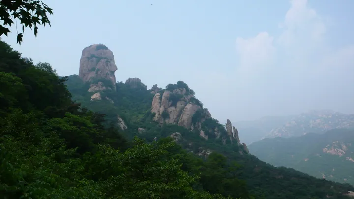
Photo adjustments
Full frame retained; proportionally resized and converted to WebP. No retouching or changes to the photographed subject. Card displays may crop the view.
- Administrative area
- County · 县
- Part of
- Rizhao
- Chinese name
- 五莲县
- Local areas
- County guide
Area & population
- Area in the source
- 1,497.00 km²
- Population · 2019
- 500,000
Source: cited geographic source, as of the dates shown.
Setting and landscape
Wulian borders Huangdao District (黄岛区) of Qingdao (青岛) to the east, Donggang District (东港区) to the south, Ju County (莒县) to the west and Zhucheng (诸城) to the north. Small plains lie in the north and west. Three river systems have their sources here: the Wei (潍河), the Shu (沭河) and the coastal rivers. The county has proven granite reserves of 5 billion cubic metres and styles itself China's "home of granite"; four hot springs have also been found.
History
In the Zhou period the area belonged to the state of Ju (莒国). Wulian County was formed in May 1947 from four districts of Zangma County (藏马县) and three of Zhucheng. From February 1948 to March 1949 the East China Bureau of the Communist Party used it as a pilot county for completing land reform and party rectification. It moved from Weifang (潍坊) to Rizhao in December 1992.
What to see
Four of the county's rated scenic areas hold 4A status: Mount Wulian, Daqing Shan (大青山), Heihu Shan (黑虎山) and Bailu Bay (白鹭湾). The Mount Wulian resort is a national forest park; the poet Su Shi (苏轼) praised its scenery as "no less remarkable than Yandang" (奇秀不减雁荡). The county also lists Guangming Temple (光明寺) as one of the four imperial temples of the Ming. Daqing Shan is one of the important centres for passing on Chen-style taijiquan (陈氏太极拳). The Bailu Bay art museum town (白鹭湾美术馆小镇) was among Shandong's first designated characteristic towns.
Food and local products
The county grows tea, apples, chestnuts, cherries and yellow peaches. Wulian green tea is described as having thick leaves that stand up to repeated infusions, a chestnut aroma and a yellow-green liquor. The small Guoguang apple (小国光) has long been the main variety grown here, valued for good colour, firm flesh, good keeping and a balance of sweet and sour.
Highlights
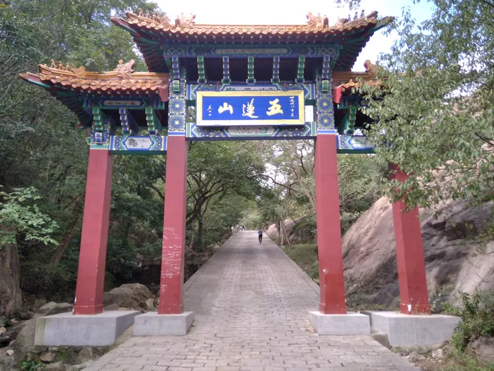
- Mount Wulian 五莲山: Namesake mountain; its resort is a national forest park and 4A scenic area praised by Su Shi.
- Guangming Temple 光明寺: Described by the county as one of the four imperial temples of the Ming.
- Daqing Shan 大青山: 4A scenic area and a centre for Chen-style taijiquan.
- Wulian green tea 五莲绿茶: Thick-leaved tea with a chestnut aroma and a yellow-green liquor.
Sources for this guide
五莲县 - 维基百科,自由的百科全书 · Wikipedia (Chinese) · CC BY-SA 4.0
五莲概况 (Wulian overview) · Wulian County People's Government
历史沿革 (Wulian history) · Wulian County People's Government
小国光苹果 (Small Guoguang apple) · Wulian County People's Government
Original English written from the listed sources and checked sentence by sentence against quoted extracts by a separate reviewer. Updated 2026-09-23.
Explore Wulian County
Core places to explore, with English and Chinese names.
Places to explore around Wulian County
 The
The Plan your visit
Getting there
Wulian County is about 50 km in a straight line from central Rizhao. Search for 五莲县 in a map app to find stations and your accommodation.
Where to stay →Build your route
Start with Wulian Mountain and Jiuxian Mountain. The linked place guides have entrance and visit details.
Continue with Rizhao →More in Rizhao
Sources & geographic information
Administrative names and parent areas: Official geographic directory · Reference date 2026-09-06.
Some facts checked against 五莲县 — Wikipedia contributors, CC BY-SA 4.0.
Photo: Wulian Mountain and Jiuxian Mountain · Sprt98 · CC BY-SA 4.0. Full frame retained; proportionally resized and converted to WebP. No retouching or changes to the photographed subject. Card displays may crop the view.

Map data © OpenStreetMap contributors. Pins mark approximate centres, not entrances or boundaries.