


Get to know Ju County
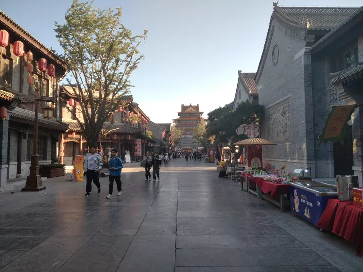
Photo adjustments
Full frame retained; proportionally resized and converted to WebP. No retouching or changes to the photographed subject. Card displays may crop the view.
- Administrative area
- County · 县
- Part of
- Rizhao
- Chinese name
- 莒县
- Local areas
- County guide
Area & population
- Population · 2019
- 997,000
Source: cited geographic source, as of the dates shown.
Setting and landscape
Hills ring the county, its centre is a patchwork of low hills, plain and low-lying ground, and the land as a whole falls from north to south; the Yi–Shu fault zone (沂沭断裂带) runs through the middle. The main heights are Qiaozi Shan (峤子山) in the east, Fulai Shan (浮来山) in the west, Laoyingding (老营顶) in the south and Qi Shan (碁山) in the north. The Shu River flows 76.5 km through the county, and Shuhe Park (沭河公园) along it is a national wetland park. The county government lists Qingfengling Reservoir (青峰岭水库) as the fourth largest in Shandong and calls Ju one of China's main ginkgo-growing areas.
History
Ju was a state of the Shang and Zhou periods and, in the Spring and Autumn period, one of three powers in Shandong with Qi (齐) and Lu (鲁). The saying "Do not forget Ju" (毋忘在莒) comes from events here. The Qin made Ju a county, and in 178 BC the Han founded the Chengyang kingdom (城阳国) for Liu Zhang (刘章) with its capital at Ju. Ju Prefecture (莒州) became Ju County in 1913; the county came under Linyi (临沂) in 1953 and passed to Rizhao in 1993. The 1668 Tancheng earthquake (郯城大地震) killed more than 20,000 people in Ju.
What to see
Fulai Shan, 8 km west of the county town where Ju meets Yinan (沂南) and Yishui (沂水), is a national 4A scenic area and provincial geopark with three peaks. On it stands Dinglin Temple (定林寺), where Liu Xie (刘勰), author of the literary treatise The Literary Mind and the Carving of Dragons (文心雕龙), became a monk. A ginkgo in the temple, nearly 4,000 years old by the county's reckoning, is known as the "First Ginkgo under Heaven" (天下银杏第一树). Trilobites and other marine fossils have been found on the mountain.
The county government says the pottery marks from the Lingyanghe site (陵阳河遗址) are more than 1,500 years older than oracle-bone script, and ranks the Juzhou Museum (莒州博物馆) among the three major county-level museums of Shandong.
Local crafts
Ju County door-lintel paper cuts (莒县过门笺) are on the national intangible heritage list.
Highlights
- Fulai Shan 浮来山: Three-peaked 4A scenic area and provincial geopark 8 km west of the county town.
- Dinglin Temple 定林寺: Temple where Liu Xie became a monk, home of a ginkgo nearly 4,000 years old.
- Juzhou Museum 莒州博物馆: Ranked by the county among the three major county-level museums of Shandong.
- Ju County door-lintel paper cuts 莒县过门笺: National intangible heritage paper cuts.
Sources for this guide
莒县 - 维基百科,自由的百科全书 · Wikipedia (Chinese) · CC BY-SA 4.0
县情概况 (Ju County overview) · Ju County People's Government
自然地理 (Ju County physical geography) · Ju County People's Government
浮来山 - 维基百科,自由的百科全书 · Wikipedia (Chinese) · CC BY-SA 4.0
历史沿革 (Ju County history) · Ju County People's Government
Original English written from the listed sources and checked sentence by sentence against quoted extracts by a separate reviewer. Updated 2026-09-23.
Explore Ju County
Core places to explore, with English and Chinese names.
Places to explore around Ju County
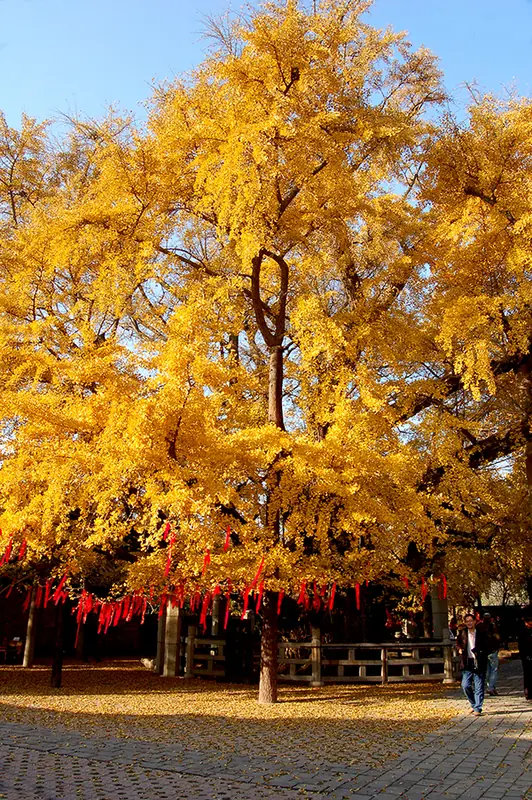 FuLaiShan scenic spot (
Plan your visit
Getting there
Ju County is about 65 km in a straight line from central Rizhao. Search for 莒县 in a map app to find stations and your accommodation.
Where to stay →Build your route
Start with FuLaiShan scenic spot. The linked place guides have entrance and visit details.
Continue with Rizhao →More in Rizhao
Sources & geographic information
Administrative names and parent areas: Official geographic directory · Reference date 2026-09-06.
Some facts checked against 莒县 — Wikipedia contributors, CC BY-SA 4.0.
Some facts checked against 浮来山 — Wikipedia contributors, CC BY-SA 4.0.
Photo: FuLaiShan scenic spot · Smainali3 · CC BY-SA 3.0. Full frame retained; EXIF orientation normalized, proportionally resized to at most 800 pixels and converted to WebP. No generated pixels or subject changes. Cards may crop the display.

Map data © OpenStreetMap contributors. Pins mark approximate centres, not entrances or boundaries.