


Get to know Dongping County
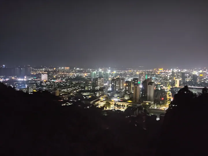
Photo adjustments
Full frame retained; proportionally resized and converted to WebP. No retouching or changes to the photographed subject. Card displays may crop the view.
- Administrative area
- County · 县
- Part of
- Tai'an
- Chinese name
- 东平县
- Local areas
- County guide
Area & population
- Area in the source
- 1,339.00 km²
- Population · 2019
- 761,500
Source: cited geographic source, as of the dates shown.
Setting and landscape
The land falls from northeast to southwest. The northern hills are an outlying spur of Mount Tai with 218 summits; the highest, Wailaopo Peak (歪老婆顶) in Timen (梯门镇), reaches 451 metres. Along and south of the Daqing River (大清河) lies farmland on the alluvial plain of the Dawen River, while the west is low lake basin on the Yellow River plain, broken by isolated hills such as Mount La (腊山) and Mount Kun (昆山).
The county government lists Dongping Lake as the second-largest freshwater lake in Shandong. It is the only remaining water of the old "eight hundred li" Liangshan marsh (八百里梁山水泊), and today it serves as a flood-detention basin on the Yellow River and a hub of the eastern route of the South-North Water Transfer Project (南水北调).
History
The old name Dongyuan (东原), "eastern plain", is generally traced to a line in the Tribute of Yu (禹贡) chapter of the Book of Documents (尚书); the county name Dongping dates from the Tang dynasty, when Sucheng County (宿城县) was renamed. In the year 1000 a Yellow River breach drowned the town of Xuchang (须昌城), and a new town, today's Zhoucheng (州城), replaced it. Song Jiang's (宋江) rebels were active here at the end of the Northern Song.
Once the Grand Canal opened under the Yuan, Dongping stood where the canal met the Ji River (济水) and grew into a water-transport hub that Marco Polo called a grand and splendid city; it declined after the Ming as the canal silted up. In 2007 builders preparing a shopping-mall site found a Western Han tomb whose wall paintings include an early scene of Confucius meeting Laozi.
What to see
The county has four national key protected cultural sites and three national 4A scenic areas. Daicun Dam (戴村坝), known as the "heart of the canal" (运河之心), is part of the Grand Canal World Heritage listing. Dongping Lake is itself a 4A scenic area. Baifo Mountain (白佛山), "White Buddha Mountain", holds a temple fair on the second day of the second lunar month that has run since the Tang, when tens of thousands of people climb it to pray.
Two local traditions are on the national intangible cultural heritage list: Duangu singing (端鼓腔) and the Taoist music of Mount La (腊山道教音乐).
Highlights
- Daicun Dam 戴村坝: The "heart of the canal", part of the Grand Canal World Heritage listing.
- Dongping Lake 东平湖: Where the Yellow River, Grand Canal and Dawen River converge; a national 4A scenic area.
- Baifo Mountain 白佛山: Scene of a temple fair on the second day of the second lunar month, held since the Tang.
- Taoist music of Mount La 腊山道教音乐: On the national intangible cultural heritage list.
Sources for this guide
东平县人民政府 东平概况 · Dongping County People's Government
东平县 - 维基百科,自由的百科全书 · Wikipedia (Chinese) · CC BY-SA 4.0
Dongping County - Wikipedia · Wikipedia (English) · CC BY-SA 4.0
Original English written from the listed sources and checked sentence by sentence against quoted extracts by a separate reviewer. Updated 2026-09-23.
Explore Dongping County
Core places to explore, with English and Chinese names.
Places to explore around Dongping County
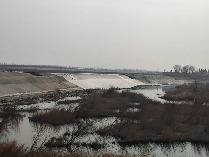 The stone spillway of Daicun Dam on the Grand Canal, with the riverbed and wetland reeds in the foreground, Dongping County, Tai'an. · 泰安市东平县戴村坝溢流坝体及河滩芦苇。 Source-recorded photograph date: 2022-02-11 13:08:17.
Daicun Dam戴村坝
Ming weir of 1411 on the Dawen River in Dongping that fed the Grand Canal's summit, rebuilt in stone and part of the canal World Heritage site.
Read the place guide →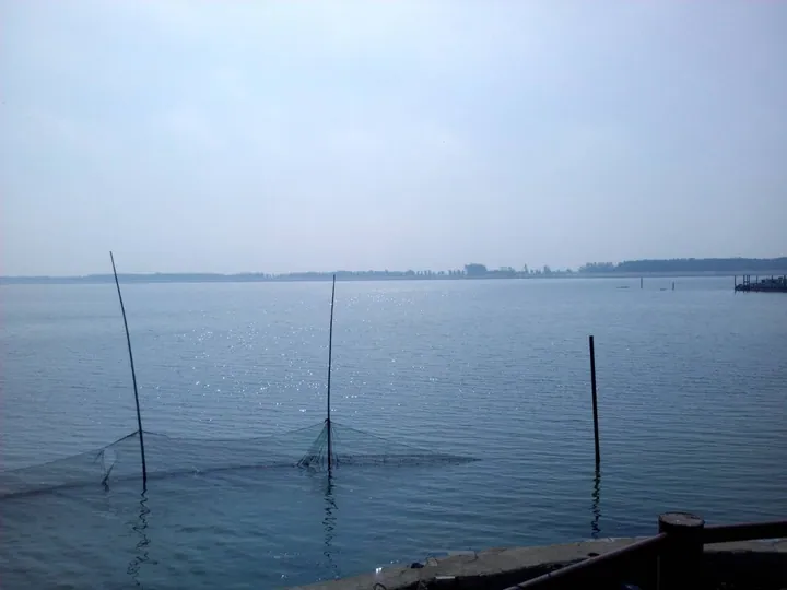 Fishing nets on Dong Ping Hu (Dongping Lake) in Dongping County, Tai'an · 泰安市东平县东平湖渔网 Source-recorded photograph date: 2017-07-11 08:37:11.
Dongping Lake东平湖
Shandong's second-largest freshwater lake, a Yellow River flood basin and the last surviving part of Water Margin's Liangshan Marsh.
Read the place guide →Plan your visit
Getting there
Dongping County is about 65 km in a straight line from central Tai'an. Search for 东平县 in a map app to find stations and your accommodation.
Where to stay →Build your route
Daicun Dam and Dongping Lake are both listed here. The linked place guides have entrance and visit details.
Continue with Tai'an →More in Tai'an
Sources & geographic information
Administrative names and parent areas: Official geographic directory · Reference date 2026-09-06.
Some facts checked against 东平县 — Wikipedia contributors, CC BY-SA 4.0.
Some facts checked against Dongping County — Wikipedia contributors, CC BY-SA 4.0.
Photo: Daicun Dam · Ngguls · CC BY-SA 4.0. Full frame retained; proportionally resized and converted to WebP. No retouching or changes to the photographed subject. Card displays may crop the view.

Photo: Dongping Lake · 陈静 · CC BY-SA 4.0. Full frame retained; proportionally resized and converted to WebP. No retouching or changes to the photographed subject. Card displays may crop the view.
.jpg)
Map data © OpenStreetMap contributors. Pins mark approximate centres, not entrances or boundaries.