


Get to know Feicheng
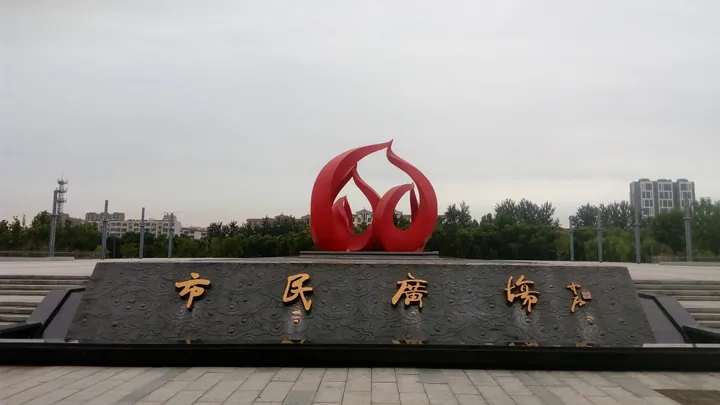
Photo adjustments
Full frame retained; proportionally resized and converted to WebP. No retouching or changes to the photographed subject. Card displays may crop the view.
- Administrative area
- County-level city · 县级市
- Part of
- Tai'an
- Chinese name
- 肥城市
- Local areas
- County-level city guide
Area & population
- Area in the source
- 1,277.00 km²
- Population · 2019
- 968,100
Source: cited geographic source, as of the dates shown.
Setting and landscape
Feicheng lies where the central Shandong hills meet the southwestern plains, and from north to south the ground alternates hill, plain, hill, plain. The hills, mostly in the north and centre, are outliers of the Taishan range; Jianyun Mountain (翦云山), 607.7 metres high on the boundary with Changqing (长清区) and Daiyue (岱岳区), is the highest point.
A central ridge splits the plain into northern and southern parts. To the north the Hui (汇河) and Kangwang (康王河) rivers built the Kanghui Plain (康汇平原) in the Feicheng basin. To the south the Wenyang Plain (汶阳平原) spreads along the north bank of the Dawen River (大汶河); these are the "Wenyang fields" (汶阳田) that the states of Qi and Lu fought over in the Spring and Autumn period. Across the Dawen lie Ningyang County (宁阳县) and Wenshang County (汶上县).
What to see
The Great Wall of Qi (齐长城) follows Feicheng's northern boundary with Changqing in two lines, a main wall of 6,708 metres and a second line of 11,384 metres; the site entered the fifth batch of national key protected cultural sites in 2001. The Jiazi Mountain (夹子山) stretch is the best-preserved section in Feicheng.
Chaoyang Cave (朝阳洞), a natural karst cave in the cliff northwest of the main peak of Mount Tao (陶山) in Hutun (湖屯镇), is named for its south-facing mouth. More than 80 carved figures, inscriptions and stelae from the Song to the Republican era survive in and around it, including the Song "Kuaizai Cave" (快哉洞) cliff inscription; the cave became a national key protected site in 2019. Mount Tao is also one of three scenic areas of Niushan National Forest Park (牛山国家森林公园), and the Peach Blossom Garden (桃花园景区) in the central hills is the city's main peach-culture scenic area.
Food and local products
The Feicheng peach, also called the Buddha peach (佛桃) or longevity peach (寿桃), has been grown here for more than 1,100 years and was sent as tribute to the imperial court. It now covers more than 30 varieties; the city government rates Baili (白里) as the finest and Hongli (红里) as the most common. The fruit ripens at the end of August and in early September, turns creamy yellow, and usually weighs 250 to 300 grams. In 2000 Guinness certified the orchard area as the largest peach garden, and in 2011 Feicheng was also named a home of peach-wood carving (桃木雕刻).
Highlights
- Great Wall of Qi (Feicheng section) 齐长城遗址(肥城段): Two lines along the northern boundary; Jiazi Mountain has the best-preserved stretch.
- Chaoyang Cave carvings, Mount Tao 陶山朝阳洞石刻造像: Karst cave with more than 80 carvings and inscriptions from the Song onward; national protected site since 2019.
- Niushan National Forest Park 牛山国家森林公园: Northern hills park with the Niushan, Mugezhai and Taoshan scenic areas.
- Feicheng peach 肥城桃: Grown for more than 1,100 years; ripens late August to early September.
Sources for this guide
肥城市人民政府 名优特产 肥城桃 · Feicheng Municipal People's Government
肥城市人民政府 名胜古迹 齐长城遗址(肥城段) · Feicheng Municipal People's Government
肥城市人民政府 名胜古迹 陶山朝阳洞石刻造像 · Feicheng Municipal People's Government
肥城市 - 维基百科,自由的百科全书 · Wikipedia (Chinese) · CC BY-SA 4.0
Original English written from the listed sources and checked sentence by sentence against quoted extracts by a separate reviewer. Updated 2026-09-23.
Explore Feicheng
Core places to explore, with English and Chinese names.
Plan your visit
Getting there
Feicheng is about 30 km in a straight line from central Tai'an. Search for 肥城市 in a map app to find stations and your accommodation.
Where to stay →More in Tai'an
Sources & geographic information
Administrative names and parent areas: Official geographic directory · Reference date 2026-09-06.
Some facts checked against 肥城市 — Wikipedia contributors, CC BY-SA 4.0.
Map data © OpenStreetMap contributors. Pins mark approximate centres, not entrances or boundaries.