


Get to know Chengqu
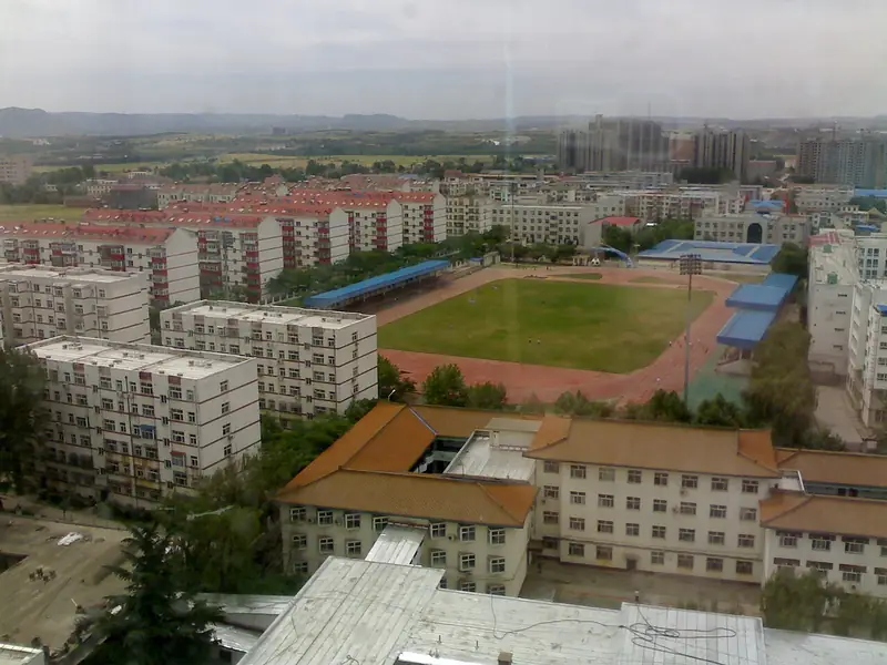
Photo adjustments
Full frame retained; EXIF orientation normalized, proportionally resized to at most 800 pixels and converted to WebP. No generated pixels or subject changes. Cards may crop the display.
- Administrative area
- District · 市辖区
- Part of
- Jincheng
- Chinese name
- 城区
- Local areas
- District guide
Area & population
- Area in the source
- 141.00 km²
- Population · 2020
- 574,665
Source: cited geographic source, as of the dates shown.
Setting and landscape
The district sits in the middle of the Zezhou Basin (泽州盆地), with ground that falls from northwest to southeast across low mountains, hills and river valleys. Its highest point is the main peak of Mount Yihou (伊侯山), at 1,122.5 metres. The two main streams, the Baishui River (白水河) and the Beishidian River (北石店河), both flow southeast into the Dan River (丹河), and the whole district drains to the Yellow River.
History
From 627 the area belonged to Jincheng County and was the seat of Zezhou (泽州); in 1728, when Zezhou was raised to a prefecture, the new Fengtai County (凤台县) was created here as the prefectural seat. The district government credits the Northern Song philosopher Cheng Hao (程颢), who served as magistrate of Jincheng county, with teaching at the local academy himself and founding 72 village schools. Chengqu was created in 1985, when the county-level city of Jincheng was divided into Chengqu and a suburban district that is today Zezhou County.
What to see
Jingde Bridge (景德桥), begun in 1189 under the Jin dynasty, is described by the district government as the oldest surviving stone arch bridge in Shanxi and one of the oldest open-spandrel arch bridges. Huaiqin Guild Hall (怀覃会馆), built from 1792, has painted beams, glazed roof ornaments, murals and an intact stone tablet recording the rules of a merchant guild; Chinese Wikipedia lists it as a major national heritage site. Baima Temple (白马禅寺), 4 kilometres north of the city, is tied to the legend of the white horse trailing its reins (白马拖缰) and was counted among the four famous sights of old Zezhou. The former party school of the Central Plains Bureau (中原局) and the residence of Li Xiannian (李先念) also survive.
The district government lists Shangdang bangzi opera (上党梆子), bayinhui ensemble music (八音会) and Shangdang erhuang opera (上党二簧) among its national intangible heritage. Among local foods it names millet pancakes (小米煎饼), also called tanmo (摊馍), which come off the griddle golden and smelling of millet.
Getting oriented
Jincheng railway station on the Taiyuan–Jiaozuo railway (太焦铁路) is in Chengqu, and National Highway 342 passes through. The district government puts the city 350 kilometres from Taiyuan (太原) and 700 kilometres from Beijing.
Highlights
- Jingde Bridge 景德桥: Stone arch bridge begun in 1189; called the oldest surviving stone arch bridge in Shanxi by the district government.
- Huaiqin Guild Hall 怀覃会馆: Guild hall built from 1792, with murals, glazed roof ornaments and a tablet of merchant-guild rules.
- Baima Temple 白马禅寺: Buddhist temple 4 km north of the city, one of the four famous sights of old Zezhou.
Sources for this guide
城区 (晋城市) · Chinese Wikipedia · CC BY-SA 4.0
城区概况 · Chengqu District People's Government, Jincheng
历史文化 · Chengqu District People's Government, Jincheng
自然地理 · Chengqu District People's Government, Jincheng
小米煎饼 · Chengqu District People's Government, Jincheng
Original English written from the listed sources and checked sentence by sentence against quoted extracts by a separate reviewer. Updated 2026-09-26.
Explore Chengqu
Core places to explore, with English and Chinese names.
Plan your visit
Getting there
Chengqu covers the centre of Jincheng. Search for 城区 in a map app to find stations and your accommodation.
Where to stay →More in Jincheng
Sources & geographic information
Administrative names and parent areas: Official geographic directory · Reference date 2026-09-06.
Some facts checked against 城区 (晋城市) — Wikipedia contributors, CC BY-SA 4.0.
Map data © OpenStreetMap contributors. Pins mark approximate centres, not entrances or boundaries.