


Get to know Nanjiang County
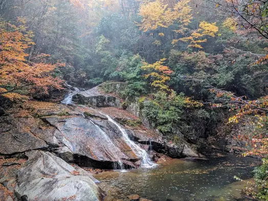
Photo adjustments
EXIF orientation normalized; resized without changing aspect ratio; converted to WebP. No subject edits.
- Administrative area
- County · 县
- Part of
- Bazhong
- Chinese name
- 南江县
- Local areas
- County guide
Area & population
- Area in the source
- 3,388.00 km²
- Population · 2020
- 467,609
Source: cited geographic source, as of the dates shown.
Stone pinnacles and a river bend
Yanyan Stone Forest (燕岩石林) contains tall rock columns with trees growing on their summits, many of them Bashan pines. At Taiji Tiankeng (太极天坑), the Jiaojia River (焦家河) cuts an S-shaped course through the karst hills. Despite its name, the formation is a curved river channel rather than a geological sinkhole.
Micang Mountain forests
Micang Mountain National Forest Park (米仓山国家森林公园) lies in the county’s north. Within its scenic area, the Natural Gallery (天然画廊) has a shaded boardwalk among Bashan beech trees. Black Bear Valley (黑熊沟), on the southern side of Xianglu Mountain (香炉山), contains a granite streambed, shallow streams and deep pools beneath dense vegetation.
Sources for this guide
光雾山_巴中市光雾山诺水河文旅融合发展示范区 · Bazhong Guangwushan-Nuoshuihe Culture and Tourism Development Demonstration Zone
米仓山_巴中市光雾山诺水河文旅融合发展示范区 · Bazhong Guangwushan-Nuoshuihe Culture and Tourism Development Demonstration Zone
Original English written from the listed sources and checked sentence by sentence against quoted extracts by a separate reviewer. Updated 2026-09-27.
Explore Nanjiang County
Core places to explore, with English and Chinese names.
Places to explore around Nanjiang County
 Autumn waterfall in the Guangwu Mountain scenic area, Nanjiang County, Bazhong · 光雾山景区秋季瀑布,巴中市南江县 Source-recorded photograph date: 31 October 2014, 05:19:21 (UTC).
Guangwu Mountain光雾山
Guangwu Mountain’s main scenic area, formerly called Taoyuan, is a landscape of karst peaks, wooded valleys and traces of the ancient Micang Road. Qinv Peaks and the Yanyan stone-forest area give the walking routes their…
Read the place guide →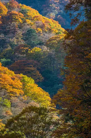 Micangshan National Forest Park · 米仓山国家森林公园
Micangshan National Forest Park米仓山国家森林公园
Forest park in the Micang Mountains of Nanjiang, Sichuan, known for autumn red leaves, beech forest, Xianglu Mountain and the old Micang Road.
Read the place guide →Plan your visit
Getting there
Nanjiang County is about 55 km in a straight line from central Bazhong. Search for 南江县 in a map app to find stations and your accommodation.
Where to stay →Build your route
Guangwu Mountain and Micangshan National Forest Park are both listed here. The linked place guides have entrance and visit details.
Continue with Bazhong →More in Bazhong
Sources & geographic information
Administrative names and parent areas: Official geographic directory · Reference date 2026-09-06.
Photo: Guangwu Mountain · 无相 · CC BY 3.0. Full frame retained; proportionally resized and converted to WebP. No retouching or changes to the photographed subject. Card displays may crop the view.
.jpeg)
Photo: Micangshan National Forest Park · Source photographer · License not provided. EXIF orientation normalized; resized without changing aspect ratio; converted to WebP. No subject edits.
Map data © OpenStreetMap contributors. Pins mark approximate centres, not entrances or boundaries.