


Get to know North District
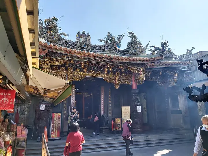
Photo adjustments
Full-frame source proportionally resized and converted to WebP for display. No subject alteration. Source-supplied marks and edits remain; cards may crop the view.
- Administrative area
- District · 區
- Part of
- Hsinchu City
- Chinese name
- 北區
- Local areas
- District guide
Area & population
- Area in the source
- 15.73 km²
Source: cited geographic source, as of the dates shown.
Stone carving from Fuzhou
An enlargement completed in 1924 used stone imported from Fuzhou (福州), with craftsmen from that city carving columns, stone lions and divine images. The rear hall contains seats for the City God’s wife, two sons and Zhusheng Niangniang (註生娘娘). Guanyin Hall (觀音佛祖殿), also called Falian Temple (法蓮寺), was added during an earlier renovation in 1803.
A divine administration
The temple explains the City God as an official overseeing moral conduct in both the living world and the afterlife. Its religious arrangement includes civil and military judges, six administrative departments and six generals. The principal image wears an ornate crown and looks downward with a solemn expression.
Sources for this guide
歷史沿革-新竹都城隍廟 · Hsinchu City God Temple
Original English written from the listed sources and checked sentence by sentence against quoted extracts by a separate reviewer. Updated 2026-09-27.
Explore North District
Core places to explore, with English and Chinese names.
Places to explore around North District
Plan your visit
Getting there
North District is about 4 km in a straight line from central Hsinchu City. Search for 北區 in a map app to find stations and your accommodation.
Where to stay →Build your route
Start with Hsinchu City God Temple and Old Town. The linked place guides have entrance and visit details.
Continue with Hsinchu City →More in Hsinchu City
Sources & geographic information
Administrative names and parent areas: Official geographic directory · Reference date 2026-09-06.
Photo: Hsinchu City God Temple and Old Town · 阿道 · CC BY-SA 4.0. Full-frame source proportionally resized and converted to WebP for display. No subject alteration. Source-supplied marks and edits remain; cards may crop the view.

Map data © OpenStreetMap contributors. Pins mark approximate centres, not entrances or boundaries.