


Get to know Mingjian Township
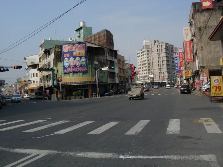
Photo adjustments
Full frame retained; proportionally resized and converted to WebP. No retouching or changes to the photographed subject. Card displays may crop the view.
- Administrative area
- Rural township · 鄉
- Part of
- Nantou County
- Chinese name
- 名間鄉
- Local areas
- Rural township guide
Area & population
- Area in the source
- 83.00 km²
Source: cited geographic source, as of the dates shown.
A temple and its tea street
Songboling Shoutian Temple (松柏嶺受天宮) anchors an old tea-shopping street. Many shops retain the appearance of the 1990s. Locally, the deity Xuantian Shangdi (玄天上帝) is affectionately called Diye Gong (帝爺公). Temple pilgrimage and tea buying have long been linked in local shopkeepers’ accounts.
Puzhong tea
Tea cultivation in Mingjian dates to the late Qing period. Puzhong tea (埔中茶) developed around Puzhong Village (埔中村), where oolong planting expanded in 1927. Tea merchant Wu Xiansan (吳憲三) describes the village’s spring Qingxin oolong (青心烏龍) as having caramel, rice and barley flavours. In 1975, Chiang Ching-kuo (蔣經國) gave local tea the name Songbo Changqing tea (松柏長青茶).
Sources for this guide
南投縣名間產業觀光發展協會 | 南投小旅行 | Taiwan, 南投 · Nantou County Mingjian Industry and Tourism Development Association
有神快BUY!受天宮茶街飄香百年的興盛與繁榮 · Nantou County Mingjian Industry and Tourism Development Association
名間誌Làm-á Magazine 為水走傱的名間「人」:螺溪、湳仔、八卦山-回望時光之流裡,名間的時代脈動與變遷>從埔中茶到松柏長青茶:八十歲以上耆老才知道的好滋味 · Nantou County Mingjian Industry and Tourism Development Association
Original English written from the listed sources and checked sentence by sentence against quoted extracts by a separate reviewer. Updated 2026-09-27.
Explore Mingjian Township
Core places to explore, with English and Chinese names.
Mingjian Township 名間鄉
Plan your visit
Getting there
Mingjian Township is about 6 km in a straight line from central Nantou County. Search for 名間鄉 in a map app to find stations and your accommodation.
Where to stay →More in Nantou County
Sources & geographic information
Administrative names and parent areas: Official geographic directory · Reference date 2026-09-06.
Map data © OpenStreetMap contributors. Pins mark approximate centres, not entrances or boundaries.