


Get to know Rutog County
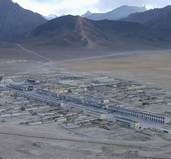
Photo adjustments
Full frame retained; resized proportionally to a maximum dimension of 960 pixels and converted to WebP quality 88. No crop, retouch, generated elements, or subject alteration. Final website rendition: full frame retained, proportionally resized to at most 720 pixels and converted to WebP. No additional retouching or subject alteration. Card displays may crop the view.
- Administrative area
- County · 县
- Part of
- Ngari Prefecture
- Chinese name
- 日土县
- Local areas
- County guide
Area & population
- Area in the source
- 81,046.00 km²
- Population · 2020
- 11,167
Source: cited geographic source, as of the dates shown.
A long lake with changing salinity
Pangong Lake (班公湖) lies in the northwest of Rutog, about fifteen kilometres from the county seat. The lake stretches roughly 110 kilometres from east to west but averages only about four kilometres across. Its eastern water is fresh and green in colour, while salinity increases westward. Islands include Moon Island (月亮岛), Swan Island (天鹅岛) and Bird Island (鸟岛).
Pastoral life on rock
Rutog’s rock art records animals and human activity in the pastoral landscape. At sites including Ruri Langka (鲁日朗卡), Takangba (塔康巴) and Renmudong (仁姆栋), subjects include tigers, yaks, hunters, the sun, blades and plants. Rock-art locations commonly occupy open valley margins, slopes, alluvial fans at ravine mouths and lakeside foothills close to water. National Highway 219 (219国道) passes through Rutog Town (日土镇).
Sources for this guide
震惊老司机!风光无限的G219最值得探索的一段在这里!_西藏自治区文化和旅游厅 · Xizang Department of Culture and Tourism
阿里旅游资源_西藏自治区自然资源厅 · Xizang Department of Natural Resources
Original English written from the listed sources and checked sentence by sentence against quoted extracts by a separate reviewer. Updated 2026-09-27.
Entry & permits for Tibet (Xizang)
Foreign tourists need Tibet entry approval, commonly called a Tibet Travel Permit, and an organised visit arranged through a specialist travel agency in China. Confirm your approved route before booking transport. Requirements differ for Taiwan residents and for travellers using mainland or Hong Kong/Macao Chinese resident documents; check the document guide before you book.
Check the travel-document requirements →Policy scope verified: 2026-09-06. UK FCDO: China regional travel advice ↗ State Council Taiwan Affairs Office: Tibet entry approval ↗ Xizang Department of Culture and Tourism: Medog border permit notice ↗
Explore Rutog County
Core places to explore, with English and Chinese names.
Places to explore around Rutog County
 Pangong Lake Visitor Area · 班公湖开放游览区
Pangong Lake Visitor Area班公湖开放游览区
Pangong Lake (班公湖) is a long, narrow lake in the north-west of Rutog County, in the Ngari Prefecture of the Tibet Autonomous Region, about 15 kilometres from the county town. The Ngari Culture and Tourism Bureau lists it as a 3A scenic area, describes it as a nationally famous wetland, fresh in the east and salty in the west, and places it within Wujiang village in Duoma Township.
Read the place guide → AI illustration · AI 示意图(仅供参考,非该地点实拍)
Rutog Rock Art Site日土岩画开放展示点
The Rutog rock art (日土岩画) is a body of carvings on rock in Rutog County, in the Ngari Prefecture of the Tibet Autonomous Region. The Tibet Department of Natural Resources says rock art on the Qinghai-Tibet Plateau is mainly found in northern Tibet, most of it in Ngari, and that Rutog County's is the best known of it.
Read the place guide →Plan your visit
Getting there
Rutog County is about 105 km in a straight line from central Ngari Prefecture. Search for 日土县 in a map app to find stations and your accommodation.
Where to stay →Build your route
Pangong Lake Visitor Area and Rutog Rock Art Site are both listed here. The linked place guides have entrance and visit details.
Continue with Ngari Prefecture →More in Ngari Prefecture
Sources & geographic information
Administrative names and parent areas: Official geographic directory · Reference date 2026-09-06.
Photo: Pangong Lake Visitor Area · Source photographer · License not provided. EXIF orientation normalized; resized without changing aspect ratio; converted to WebP. No subject edits.
Map data © OpenStreetMap contributors. Pins mark approximate centres, not entrances or boundaries.