


Get to know Xinshi District
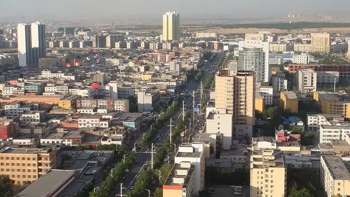
Photo adjustments
Full frame retained; proportionally resized and converted to WebP. No retouching or changes to the photographed subject. Card displays may crop the view.
- Administrative area
- District · 市辖区
- Part of
- Ürümqi
- Chinese name
- 新市区
- Local areas
- District guide
Area & population
- Area in the source
- 158.70 km²
- Population · 2020
- 1,011,440
- Administrative seat
- Gaoxin Street Subdistrict
Source: cited geographic source, as of the dates shown.
Specialist gardens and a former vineyard
The botanical garden stands on Beijing Middle Road (北京中路). Its grounds cover more than sixty hectares, with dedicated rose and perennial-flower areas. The collection includes more than four hundred plant species, including more than ten rare or endangered plants from Xinjiang (新疆). Its northern section began as a vineyard in 1964 and was formally renamed the botanical garden’s northern section on 23 June 2006. Improvements in 2011 added greenery and lighting.
A park focused on its landscape
Liyushan Park stands on Liyushan South Road (鲤鱼山南路). Of its roughly one hundred hectares, about eighty hectares are woodland, with green coverage recorded at seventy-six percent by Xinjiang Daily (新疆日报) in April 2024. The park emphasises natural scenery and has no amusement rides.
Sources for this guide
“公园20分钟效应”火了!快来乌鲁木齐这些公园实地体验 · Xinjiang Daily, republished by Altay News
乌鲁木齐植物园北区葡萄园将变“农博园”-中国植物园联盟 · China Union of Botanical Gardens, republishing Morning Post/Yaxinwang
Original English written from the listed sources and checked sentence by sentence against quoted extracts by a separate reviewer. Updated 2026-09-27.
Explore Xinshi District
Core places to explore, with English and Chinese names.
Xinshi District 新市区
Plan your visit
Getting there
Xinshi District is about 4 km in a straight line from central Ürümqi. Search for 新市区 in a map app to find stations and your accommodation.
Where to stay →More in Ürümqi
Sources & geographic information
Administrative names and parent areas: Official geographic directory · Reference date 2026-09-06.
Map data © OpenStreetMap contributors. Pins mark approximate centres, not entrances or boundaries.