


Get to know Gongshan Derung and Nu Autonomous County
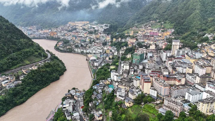
Photo adjustments
Full frame retained; proportionally resized and converted to WebP. No retouching or changes to the photographed subject. Card displays may crop the view.
- Administrative area
- Autonomous county · 自治县
- Part of
- Nujiang Lisu Autonomous Prefecture
- Chinese name
- 贡山独龙族怒族自治县
- Local areas
- Autonomous county guide
Area & population
- Area in the source
- 4,506.00 km²
- Population · 2020 census
- 38,471
- Administrative seat
- Cikai
Source: cited geographic source, as of the dates shown.
Setting and landscape
The Biluo Snow Mountains (碧罗雪山) stand in the east, the Gaoligong Mountains (高黎贡山) in the centre and west, and the Dandanglika Mountains (丹当力卡山) in the northwest. Gongshan forms part of the Three Parallel Rivers world natural heritage area (三江并流) and the Gaoligong Mountain nature reserve. The Dulong valley has marked differences in temperature between its riverbank, middle slopes and snow-covered heights.
Peoples and traditions
Derung (独龙族), Nu (怒族), Lisu (傈僳族) and Tibetan (藏族) communities live in Gongshan. The Derung Kaquewa festival (卡雀哇) and Nu Fairy Festival (仙女节) are listed as national intangible cultural heritage. Historically, Derung people kept records and transmitted messages with carved wood and knotted cords. The county’s named scenic destinations include Bingzhongluo (丙中洛) and the Dulong River tourism area.
Sources for this guide
贡山概况 - 贡山县人民政府 · Gongshan County Government
概况 · National Ethnic Affairs Commission
Original English written from the listed sources and checked sentence by sentence against quoted extracts by a separate reviewer. Updated 2026-09-30.
Explore Gongshan Derung and Nu Autonomous County
Core places to explore, with English and Chinese names.
Places to explore around Gongshan Derung and Nu Autonomous County
 Zhongding Church roof and a snow-capped peak above Bingzhongluo, Gongshan County, Nujiang Prefecture · 云南怒江州贡山县丙中洛重丁教堂屋顶与雪山 Source-recorded photograph date: 2011-05-18 12:13:35.
Bingzhongluo丙中洛
Bingzhongluo occupies an unusually open part of the Nujiang valley, where cultivated land and villages sit between steep mountains. South of town, the Nujiang First Bend turns around a projecting hillside; to the north, Shimen…
Read the place guide → Dulong River Valley Official Route · 独龙江谷正规开放线路
Dulong River Valley Official Route独龙江谷正规开放线路
Dulong River Valley Official Route names the officially designated visitor route through the Dulongjiang (Derung River) valley in Gongshan Derung and Nu Autonomous County, Yunnan -- the sole settlement area of the Derung ethnic minority, reached by a road tunnel under the Gaoligong mountains completed in 2014.
Read the place guide →Plan your visit
Getting there
Gongshan Derung and Nu Autonomous County is about 215 km in a straight line from central Nujiang Lisu Autonomous Prefecture. Search for 贡山独龙族怒族自治县 in a map app to find stations and your accommodation.
Where to stay →Build your route
Bingzhongluo and Dulong River Valley Official Route are both listed here. The linked place guides have entrance and visit details.
Continue with Nujiang Lisu Autonomous Prefecture →More in Nujiang Lisu Autonomous Prefecture
Sources & geographic information
Administrative names and parent areas: Official geographic directory · Reference date 2026-09-06.
Photo: Bingzhongluo · 蒋亦炯 · CC BY-SA 3.0. Full frame retained; proportionally resized and converted to WebP. No retouching or changes to the photographed subject. Card displays may crop the view.

Photo: Dulong River Valley Official Route · Source photographer · License not provided. EXIF orientation normalized; resized without changing aspect ratio; converted to WebP. No subject edits.
Map data © OpenStreetMap contributors. Pins mark approximate centres, not entrances or boundaries.