


Get to know Lushui
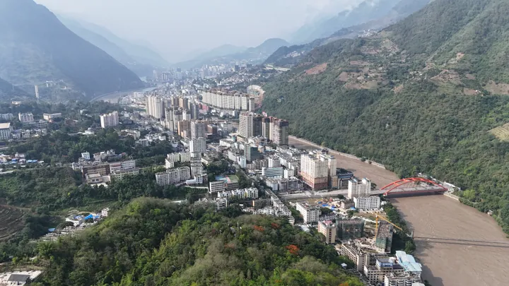
Photo adjustments
Full frame retained; proportionally resized and converted to WebP. No retouching or changes to the photographed subject. Card displays may crop the view.
- Administrative area
- County-level city · 县级市
- Part of
- Nujiang Lisu Autonomous Prefecture
- Chinese name
- 泸水市
- Local areas
- County-level city guide
Area & population
- Area in the source
- 2,938.00 km²
- Population · 2020 census
- 203,977
Source: cited geographic source, as of the dates shown.
Setting and history
Lushui occupies the southern end of the Hengduan Mountains (横断山) and adjoins Myanmar on its western side. The county seat moved from Luzhang (鲁掌) to Liuku (六库) in 2004; Lushui changed from county to city status in 2016. Coffee and tsaoko cardamom (草果) are important local crops.
Riverbank springs and Lisu music
Denggeng Hot Springs (登埂澡塘) lie beside Yuejin Bridge (跃进桥) on the Nu River’s west bank. The Ministry of Culture and Tourism describes eighteen spring outlets along roughly 200 metres of riverbank. Lisu (傈僳族) communities gather here for spring bathing, singing and dancing in a custom known as Zaotanghui (澡塘会). Baihualing Lisu Music Town (百花岭傈僳音乐小镇) centres on Lisu music, including unaccompanied four-part choral singing.
Sources for this guide
泸水概况 - 泸水市人民政府 · Lushui Municipal Government
云南·纵享峡谷乡愁 畅购怒江好物 · Ministry of Culture and Tourism
Original English written from the listed sources and checked sentence by sentence against quoted extracts by a separate reviewer. Updated 2026-09-30.
Explore Lushui
Core places to explore, with English and Chinese names.
Places to explore around Lushui
 AI illustration · AI
 Plan your visit
Getting there
Lushui covers the centre of Nujiang Lisu Autonomous Prefecture. Search for 泸水市 in a map app to find stations and your accommodation.
Where to stay →Build your route
Start with Denggeng Hot Spring Baths. The linked place guides have entrance and visit details.
Continue with Nujiang Lisu Autonomous Prefecture →More in Nujiang Lisu Autonomous Prefecture
Sources & geographic information
Administrative names and parent areas: Official geographic directory · Reference date 2026-09-06.
Map data © OpenStreetMap contributors. Pins mark approximate centres, not entrances or boundaries.