


Get to know Lanping Bai and Pumi Autonomous County
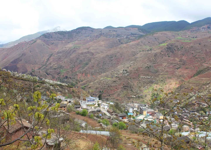
Photo adjustments
Full frame retained; proportionally resized and converted to WebP. No retouching or changes to the photographed subject. Card displays may crop the view.
- Administrative area
- Autonomous county · 自治县
- Part of
- Nujiang Lisu Autonomous Prefecture
- Chinese name
- 兰坪白族普米族自治县
- Local areas
- Autonomous county guide
Area & population
- Area in the source
- 4,455.00 km²
- Population · 2020 census
- 195,874
- Administrative seat
- Cuiping Subdistrict
Source: cited geographic source, as of the dates shown.
Setting and landscape
Lanping sits within the longitudinal valleys of the Hengduan Mountains (横断山). Its ranges include the Yunling Mountains (云岭), Biluo Snow Mountains (碧罗雪山) and Laojun Mountains (老君山). Xinshengqiao National Forest Park (新生桥国家森林公园), Qinghuadian National Wetland Park (箐花甸国家湿地公园) and Luoguqing (罗古箐) are named natural areas within the county.
Bai and Pumi culture
Lanping became an autonomous county in 1987. Its local festivals include the Bai (白族) Eryuehui festival (二月会) and the Pumi (普米族) Lovers’ Festival (情人节). The latter developed from Dragon Boat Festival (端午节) gatherings involving ancestor remembrance and courtship, and adopted its present name in 2013. Pumi Cuocuo dance (搓蹉) has a national intangible cultural heritage listing; Lama Bai (白族拉玛人) Kaiyi song and dance (开益) and Pumi four-string music and dance (四弦舞乐) have provincial listings.
Sources for this guide
兰坪概况 - 兰坪县人民政府 · Lanping County Government
相约兰坪罗古箐 共度“普米情人节” - 中国日报网 · China Daily
Original English written from the listed sources and checked sentence by sentence against quoted extracts by a separate reviewer. Updated 2026-09-30.
Explore Lanping Bai and Pumi Autonomous County
Core places to explore, with English and Chinese names.
Places to explore around Lanping Bai and Pumi Autonomous County
 Luoguqing Scenic Area ·
 Plan your visit
Getting there
Lanping Bai and Pumi Autonomous County is about 100 km in a straight line from central Nujiang Lisu Autonomous Prefecture. Search for 兰坪白族普米族自治县 in a map app to find stations and your accommodation.
Where to stay →Build your route
Start with Luoguqing Scenic Area. The linked place guides have entrance and visit details.
Continue with Nujiang Lisu Autonomous Prefecture →More in Nujiang Lisu Autonomous Prefecture
Sources & geographic information
Administrative names and parent areas: Official geographic directory · Reference date 2026-09-06.
Photo: Luoguqing Scenic Area · Source photographer · License not provided. EXIF orientation normalized; resized without changing aspect ratio; converted to WebP. No subject edits.
Map data © OpenStreetMap contributors. Pins mark approximate centres, not entrances or boundaries.