


Get to know Luyang District
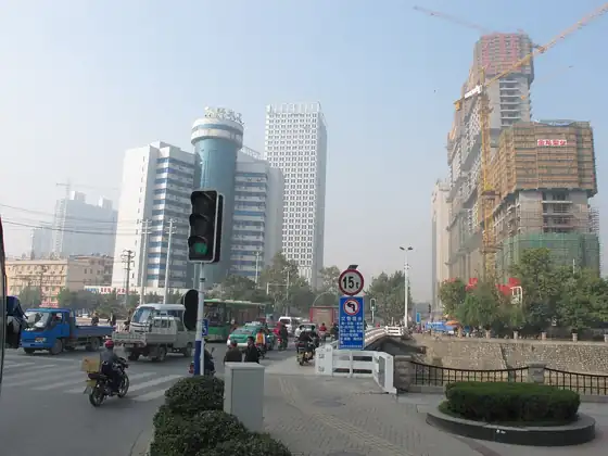
Photo adjustments
Resized and WebP compressed; subject not altered.
- Administrative area
- District · 市辖区
- Part of
- Hefei
- Chinese name
- 庐阳区
- Local areas
- District guide
Area & population
- Area in the source
- 139.32 km²
- Population · 2020
- 697,293
- Administrative seat
- Bozhoulu
Source: cited geographic source, as of the dates shown.
What to see
Xiaoyaojin (逍遥津), in the northeast corner of the old city, is a park of about 200,000 square metres on what was once a ford on the Fei River (淝水). It is known as a Three Kingdoms battlefield: here, by tradition, Zhang Liao (张辽), a general of Cao Cao (曹操), routed Sun Quan (孙权), a story retold in the Romance of the Three Kingdoms. A mound on one of the islands in the lake is said to be Zhang Liao's cenotaph. The ford was brought inside the city walls when Hefei grew in the Qiandao era of the Song.
Mingjiao Temple (明教寺) on Huaihe Road (淮河路) stands on a raised terrace, the Crossbow Training Platform (教弩台), where Cao Cao drilled troops against the Wu navy; locals still call it Cao Cao's Review Platform. Emperor Wu of Liang built an Iron Buddha Temple on it, it took the name Mingjiao under the Ming, and it was rebuilt in 1885. It is one of the national key Buddhist temples in Han Chinese areas.
Also on Huaihe Road, at No. 208, the former residence of Li Hongzhang (李鸿章故居) is part of the late-Qing statesman's family house, built in the Jianghuai style of the period. Its halls hold exhibitions on his life and calligraphy, and the "young ladies' building" is furnished with Qing furniture. It became a national key cultural relic site in 2013 under the name Li Family Old Residence.
The Luzhou Prefecture City God Temple (庐州府城隍庙) on Huoqiu Road (霍邱路) was founded in 1051, burned in the Taiping war in 1854 and rebuilt between 1871 and 1879. Its gate, opera stage and main hall line up along one axis; it now serves as the Hefei Culture Centre, with a market built around it since the 1980s.
History
The district grew out of the First and Second districts set up when the Hefei People's Government was founded in February 1949. It was later called Dongshi (东市区), then Nanshi (南市区) and Zhongshi (中市区), and took the name Luyang in February 2002, when Sanshigang (三十岗乡), Xinghuacun (杏花村镇) and Dayang (大杨镇) were moved in from the suburbs.
Getting oriented
Metro Line 5 runs through the district, stopping at Xinghua Park (杏花公园) and Sanxiaokou (三孝口); Line 3 stops at Xinghuacun (杏花村).
Highlights
- Xiaoyaojin Park 逍遥津: Old-city park on the site of the Three Kingdoms battle where Zhang Liao routed Sun Quan.
- Mingjiao Temple 明教寺: Temple on Cao Cao's Crossbow Training Platform, rebuilt in 1885.
- Former Residence of Li Hongzhang 李鸿章故居: Late-Qing family house on Huaihe Road; national key cultural relic site since 2013.
- Luzhou Prefecture City God Temple 庐州府城隍庙: Founded in 1051 and rebuilt in 1871–1879; now the Hefei Culture Centre.
Sources for this guide
庐阳区 - 维基百科,自由的百科全书 · Wikipedia (Chinese) · CC BY-SA 4.0
逍遥津 - 维基百科,自由的百科全书 · Wikipedia (Chinese) · CC BY-SA 4.0
李鸿章故居 - 维基百科,自由的百科全书 · Wikipedia (Chinese) · CC BY-SA 4.0
明教寺 (合肥) - 维基百科,自由的百科全书 · Wikipedia (Chinese) · CC BY-SA 4.0
庐州府城隍庙 - 维基百科,自由的百科全书 · Wikipedia (Chinese) · CC BY-SA 4.0
Original English written from the listed sources and checked sentence by sentence against quoted extracts by a separate reviewer. Updated 2026-09-23.
Explore Luyang District
Core places to explore, with English and Chinese names.
Luyang District 庐阳区
Plan your visit
Getting there
Luyang District is about 5 km in a straight line from central Hefei. Search for 庐阳区 in a map app to find stations and your accommodation.
Where to stay →More in Hefei
Sources & geographic information
Administrative names and parent areas: Official geographic directory · Reference date 2026-09-06.
Some facts checked against 庐阳区 — Wikipedia contributors, CC BY-SA 4.0.
Some facts checked against 逍遥津 — Wikipedia contributors, CC BY-SA 4.0.
Some facts checked against 李鸿章故居 — Wikipedia contributors, CC BY-SA 4.0.
Some facts checked against 明教寺 (合肥) — Wikipedia contributors, CC BY-SA 4.0.
Some facts checked against 庐州府城隍庙 — Wikipedia contributors, CC BY-SA 4.0.
Map data © OpenStreetMap contributors. Pins mark approximate centres, not entrances or boundaries.