


Get to know Feixi County
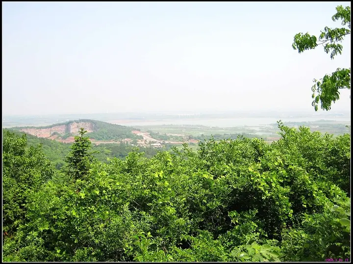
Photo adjustments
Full frame retained; proportionally resized and converted to WebP. No retouching or changes to the photographed subject. Card displays may crop the view.
- Administrative area
- County · 县
- Part of
- Hefei
- Chinese name
- 肥西县
- Local areas
- County guide
Area & population
- Area in the source
- 2,053.19 km²
- Population · 2020
- 967,508
Source: cited geographic source, as of the dates shown.
Setting and landscape
The county is wide in the west and narrow in the east, with Lu'an (六安) to the west, Chaohu city across the lake, and the Fengle River (丰乐河) along its southern edge facing Shucheng (舒城县) and Lujiang (庐江县). It straddles the Yangtze and Huai basins; a county tourism official says that on the Jianghuai watershed (江淮分水岭) rain runs half to the Huai and half to the Yangtze. A watershed monument stands in the centre of Guanting (官亭). Once barren upland, Guanting is now planted with nursery forest, the Guanting Forest (官亭林海), which became a national ecological park and 4A scenic area in 2017.
What to see
Sanhe, in the southeast of the county, sits on the Chaohu plain where Feixi, Shucheng and Lujiang meet; the Fengle and Xiaonan (小南河) rivers join the Hangbu River (杭埠河) here on their way to the lake, and the town is named for these three rivers. Under its old name, Que'an (鹊岸), it appears in the Zuo Zhuan (左传) as the site of a battle between Wu and Chu, and in the Taiping war the Taiping army routed the Xiang Army (湘军) here. It became a national historic and cultural town in 2007. On West Street, the Liu Tongxing shop (刘同兴隆庄) runs through five courtyards and thirty-two rooms; on South Street is the house where Chen-Ning Yang (杨振宁) lived after his family fled Beiping in 1937 to his mother's home town.
Liu Mingchuan (刘铭传), Huai Army general and the first governor of Taiwan, built his moated manor in 1868 about 2 kilometres north of Daqian Mountain (大潜山), in today's Mingchuan township (铭传乡). The compound covers about 70,000 square metres inside two moats, with five watchtowers, and has been a national key cultural relic site since 2006. Huai Army commanders built more than a hundred such manors around Zipeng (紫蓬山), Zhougong (周公山) and Daqian mountains.
Xiaojingzhuang (小井庄), a village in Shannan town (山南镇), has a memorial hall recalling 1978, when drought drove seven households to take on 50 mu of paddy themselves, an early step towards household farming contracts.
Food and local products
Sanhe rice dumplings (三河米饺) are sold in the old town with a shrimp in the filling, and Sanhe stir-fry (三河小炒) is made of shredded pork, celery, pressed tofu, wood-ear, onion and yellow garlic chives. Sanhe rice wine (三河米酒) is a national geographical-indication product.
Highlights
- Sanhe Ancient Town 三河古镇: Three-river water town; national historic and cultural town (2007) and 5A scenic area (2015).
- Liu Mingchuan's Former Residence 刘铭传旧居: Moated 1868 manor of Taiwan's first governor, a national key cultural relic site since 2006.
- Guanting Forest 官亭林海: Nursery forest on the Jianghuai watershed; national ecological park and 4A scenic area since 2017.
- Sanhe rice wine 三河米酒: National geographical-indication product.
Sources for this guide
肥西县 - 维基百科,自由的百科全书 · Wikipedia (Chinese) · CC BY-SA 4.0
三河镇 (肥西县) - 维基百科,自由的百科全书 · Wikipedia (Chinese) · CC BY-SA 4.0
安徽肥西:工业强县唱响旅游大戏 · Ministry of Culture and Tourism of China (from the Anhui Tourism Development Commission)
刘铭传旧居 - 维基百科,自由的百科全书 · Wikipedia (Chinese) · CC BY-SA 4.0
“圩堡”里走出刘铭传_中安在线 · Anhuinews (中安在线), Anhui Daily Group
Original English written from the listed sources and checked sentence by sentence against quoted extracts by a separate reviewer. Updated 2026-09-23.
Explore Feixi County
Core places to explore, with English and Chinese names.
Places to explore around Feixi County
 Chaoyang Tower in Sanhe Ancient Town, Feixi County, March 2011.
Sanhe, Feixi County三河古镇
Sanhe developed where the Fengle, Hangbu and Xiaonan rivers meet, and its old streets still reveal that water-borne trading layout. The lanes lead between bridges, shopfronts and former merchants’ premises. Liu Tong Xing Long…
Read the place guide →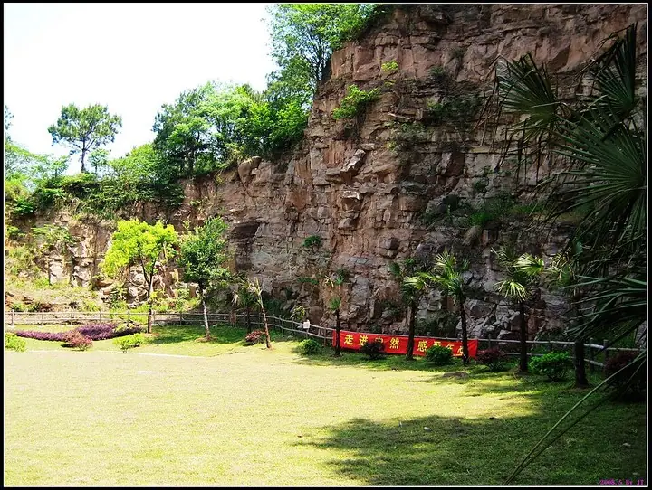 Rock face and garden at Zipeng Mountain · 紫蓬山岩壁与绿地 Capture date not established by the retained file page.
Zi Peng mountain紫蓬山
Zipeng’s forest paths link a lakeside setting with Buddhist sculpture and Xilu Temple above it. The Foyuan area places large Buddhist figures against the hillside, giving the climb a different scale from the trees and water…
Read the place guide →Plan your visit
Getting there
Feixi County is about 25 km in a straight line from central Hefei. Search for 肥西县 in a map app to find stations and your accommodation.
Where to stay →Build your route
Sanhe, Feixi County and Zi Peng mountain are about 30 km apart in a straight line. The linked place guides have entrance and visit details.
Continue with Hefei →More in Hefei
Sources & geographic information
Administrative names and parent areas: Official geographic directory · Reference date 2026-09-06.
Some facts checked against 肥西县 — Wikipedia contributors, CC BY-SA 4.0.
Some facts checked against 三河镇 (肥西县) — Wikipedia contributors, CC BY-SA 4.0.
Some facts checked against 刘铭传旧居 — Wikipedia contributors, CC BY-SA 4.0.
Photo: Sanhe, Feixi County · JtWang · CC BY-SA 3.0. Proportionally resized and converted to WebP without cropping, retouching or changing the photographed subject.

Photo: Zi Peng mountain · JtWang · CC BY-SA 3.0. The exact downloaded source bytes are separately retained and hashed. Prepared JPEG is proportionally reduced to a maximum 720-pixel long edge; full frame retained, no subject alteration. Final website rendition: full frame retained, proportionally resized to at most 720 pixels and converted to WebP. No additional retouching or subject alteration. Card displays may crop the view.

Map data © OpenStreetMap contributors. Pins mark approximate centres, not entrances or boundaries.