


Get to know Huashan District
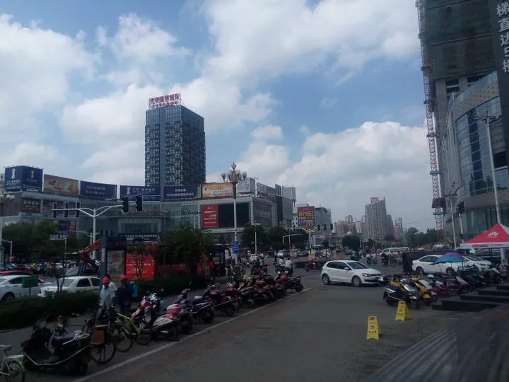
Photo adjustments
Full frame retained; proportionally resized and converted to WebP. No retouching or changes to the photographed subject. Card displays may crop the view.
- Administrative area
- District · 市辖区
- Part of
- Ma'anshan
- Chinese name
- 花山区
- Local areas
- District guide
Area & population
- Area in the source
- 179.00 km²
- Population · 2020
- 450,983
- Administrative seat
- Huoli
Source: cited geographic source, as of the dates shown.
History
The present district dates from September 2012, when the old Jinjiazhuang District (金家庄区) and Huashan District were abolished and merged into a new Huashan. Within it stands the hill called Ma'anshan, "saddle mountain", which legend says was formed from the saddle of Wuzhui (乌骓), the horse of Xiang Yu (项羽). The district also contains the site of the first Party branch in the Jiangdong area (江东), founded in 1938, the No. 9 blast furnace of the Masteel works (马钢) that Mao Zedong inspected, and the offices used when the city was first set up.
What to see
Xuejiawa Ecological Park (薛家洼生态园) lies on the east bank of the Yangtze, where the district cleaned up the riverside, and is now a riverside spot for viewing the Yangtze.
Putang (濮塘) is the district's only town. In the Putang hills of eastern Ma'anshan, the Putang Natural Scenic Area (濮塘自然风景区) covers about 20 square kilometres with 49 peaks, 53 valleys and 8 reservoirs under forest, bamboo and tea gardens. Among its old trees are a ginkgo more than 800 years old and an evergreen holly whose crown covers 200 square metres. The Putang holiday area is a national 4A scenic area and was in the first group of Anhui provincial tourist resorts; the district singles out its lotus ponds, old trees and bamboo.
For city life, the district names Jiefang Road (解放路) and Hudong Road (湖东路) among its shopping streets, alongside the Jinying (金鹰) and Weixing Xingyue Plaza (伟星星悦广场) shopping areas, the Tiyu Road night market (体育路夜市) and the Chuangke+ creative park (创客+文创园).
Getting oriented
The Nanjing–Anqing high-speed railway (宁安高铁), the Nanjing–Wuhu expressway (宁芜高速) and the Nanjing–Ma'anshan intercity line (宁马城际) run through the district, and Ma'anshan's high-speed East station, its main passenger transport hub and Ma'anshan port are all here. The Cihu High-tech Zone (慈湖高新区) takes up 39 square kilometres of the district.
Highlights
- Putang holiday area 濮塘: National 4A hill area in eastern Ma'anshan with bamboo, reservoirs and a ginkgo more than 800 years old.
- Xuejiawa Ecological Park 薛家洼生态园: Riverside park on the cleaned-up east bank of the Yangtze.
- Masteel No. 9 blast furnace 马钢9号高炉: Blast furnace inspected by Mao Zedong, listed by the district among its historic sites.
Sources for this guide
花山概况_马鞍山市花山区人民政府 · Huashan District People's Government, Ma'anshan
濮塘自然风景区_马鞍山市人民政府 · Ma'anshan Municipal People's Government
花山区 - 维基百科,自由的百科全书 · Wikipedia (Chinese) · CC BY-SA 4.0
Original English written from the listed sources and checked sentence by sentence against quoted extracts by a separate reviewer. Updated 2026-09-23.
Explore Huashan District
Core places to explore, with English and Chinese names.
Huashan District 花山区
Plan your visit
Getting there
Huashan District is about 4 km in a straight line from central Ma'anshan. Search for 花山区 in a map app to find stations and your accommodation.
Where to stay →More in Ma'anshan
Sources & geographic information
Administrative names and parent areas: Official geographic directory · Reference date 2026-09-06.
Some facts checked against 花山区 — Wikipedia contributors, CC BY-SA 4.0.
Map data © OpenStreetMap contributors. Pins mark approximate centres, not entrances or boundaries.