


Get to know Minle County
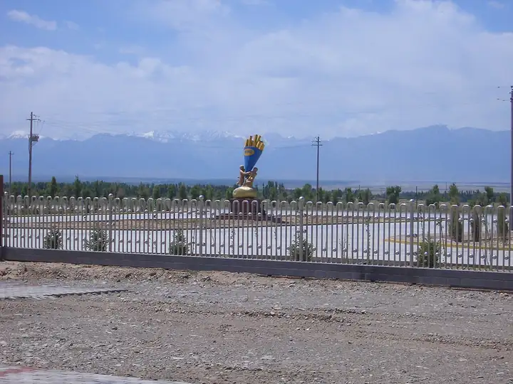
Photo adjustments
EXIF orientation normalized; resized without changing aspect ratio; converted to WebP. No subject edits.
- Administrative area
- County · 县
- Part of
- Zhangye
- Chinese name
- 民乐县
- Local areas
- County guide
Area & population
- Area in the source
- 3,678.00 km²
- Population · 2018
- 248,570
- Administrative seat
- Hongshui
Source: cited geographic source, as of the dates shown.
Setting and landscape
The land climbs from 1,589 metres in the north to 5,027 metres in the south, with mountains on the east, west and south and a tilted high plain between them. The climate is continental desert steppe, and the county lies in the Qilian water-conservation zone that feeds the Hei River (黑河). Within its borders the county government lists desert and gobi, farmland oasis, forest and grassland, canyons, snow peaks and glaciers.
History
The Donghuishan and Xihuishan culture sites (东西灰山文化遗址) show that people lived here more than 5,000 years ago. After Huo Qubing (霍去病) took the Hexi region for the Han in the second year of Yuanshou, commanderies and counties were set up here. In 609 the Sui emperor Yang passed through the Biandukou pass (扁都口) on his western tour, and in September 1949 General Wang Zhen (王震) led his troops out through the same pass to take the Hexi Corridor. Under the Qing the area was Dongle (东乐), a branch of Zhangye county; it became Dongle County in 1913 and took the name Minle, meaning "the people live and work in peace", in 1929.
What to see
Biandukou, known in the Sui dynasty as Dadoubagu (大斗拔谷), is a pass about 3,500 metres high in the central Qilian range on the border with Qilian County, and was a route between the Central Plains and the Western Regions; the monk Faxian (法显) crossed it on his way to Zhangye in the 4th century. National Highway 227 now runs over it. The county government names the rapeseed-flower fields, the Chengbei folk culture village (城北民俗文化村) and the Binhe Jiuliangye liquor culture park (滨河九粮液文化产业园) among its scenic areas. Minle has four national and seven provincial protected monuments; its relics include Western Han town sites, Wei–Jin temples and Ming–Qing water-and-land ritual paintings. The bowl-on-head dance (顶碗舞) and shadow puppetry are on the provincial intangible heritage list.
Food and local products
Minle purple-skinned garlic (民乐紫皮大蒜) is a Chinese geographical-indication product, and its bulbs and scapes carry green and organic food certification. The county is also known for potatoes, seed crops and medicinal herbs, and holds the title "home of Chinese isatis root" (板蓝根).
Getting oriented
The county seat is Hongshui town (洪水镇). It lies 52 kilometres from Zhangye airport, 285 kilometres from Xining (西宁) and 534 kilometres from Lanzhou (兰州). National Highway 227 and the second double-track Lanzhou–Xinjiang line cross the county, and an expressway links Zhangye with Biandukou.
Highlights
- Biandukou pass 扁都口: Pass about 3,500 metres high on the Qinghai border, crossed by Faxian in the 4th century and now by National Highway 227.
- Donghuishan and Xihuishan sites 东西灰山文化遗址: Prehistoric sites showing settlement more than 5,000 years ago.
- Minle purple-skinned garlic 民乐紫皮大蒜: Chinese geographical-indication product.
Sources for this guide
民乐概况 · Minle County People's Government
历史沿革 · Minle County People's Government
旅游资源 · Minle County People's Government
自然条件 · Minle County People's Government
地理交通 · Minle County People's Government
民乐县 - 维基百科,自由的百科全书 · Wikipedia (Chinese) · CC BY-SA 4.0
扁都口 - 维基百科,自由的百科全书 · Wikipedia (Chinese) · CC BY-SA 4.0
Original English written from the listed sources and checked sentence by sentence against quoted extracts by a separate reviewer. Updated 2026-09-23.
Explore Minle County
Core places to explore, with English and Chinese names.
Minle County 民乐县
Plan your visit
Getting there
Minle County is about 65 km in a straight line from central Zhangye. Search for 民乐县 in a map app to find stations and your accommodation.
Where to stay →More in Zhangye
Sources & geographic information
Administrative names and parent areas: Official geographic directory · Reference date 2026-09-06.
Some facts checked against 民乐县 — Wikipedia contributors, CC BY-SA 4.0.
Some facts checked against 扁都口 — Wikipedia contributors, CC BY-SA 4.0.
Map data © OpenStreetMap contributors. Pins mark approximate centres, not entrances or boundaries.