


Get to know Linze County
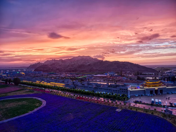
Photo adjustments
Full frame retained; proportionally resized and converted to WebP. No retouching or changes to the photographed subject. Card displays may crop the view.
- Administrative area
- County · 县
- Part of
- Zhangye
- Chinese name
- 临泽县
- Local areas
- County guide
Area & population
- Area in the source
- 2,729.00 km²
- Population · 2018
- 149,523
- Administrative seat
- Shahe
Source: cited geographic source, as of the dates shown.
Getting oriented
The Sunan Yugur Autonomous County (肃南裕固族自治县) lies to the south and the Alxa Right Banner (阿拉善右旗) of Inner Mongolia to the north. The Lanzhou–Xinjiang Railway (兰新铁路) has a station at Linze. The Rainbow Mountains scenic area lies 20 kilometres south of the county town and 40 kilometres west of central Zhangye.
What to see
The Zhangye Rainbow Mountains are a national 5A scenic area and part of the Zhangye Global Geopark, covering 50 square kilometres in all, with a core viewing area of 4. The Zhangye city government describes them as the most typical Danxia landform of China's arid north and the only place in China where Danxia landforms and coloured hills occur together. The banded red, yellow, white and black ridges sit at an average altitude of 1,820 metres. The county government explains the colours by iron compounds in the rock, which turned red about 125 million years ago in a hot, humid inland lake basin; the beds were later folded, lifted and worn by wind and water.
Named viewpoints include Wohu Gorge (卧虎峡), whose striped slopes form a lying tiger and which is billed as the best photo spot, and the Aohe terrace (敖河台) with its long ribbons of colour. Zhang Yimou's "A Simple Noodle Story" (三枪拍案惊奇) made the site known, and later productions filmed here include "The Great Wall" (长城); in 2011 National Geographic listed it among ten geographical wonders of the world.
At the foot of the mountains, Danxiakou (丹霞口) is a 4A-rated tourist town in a mix of Huizhou and north-western building styles, with local food, homestays, craft workshops and displays on Silk Road and farming culture.
History and local products
Under the Han the area formed Zhaowu county (昭武县) in Zhangye commandery; Han bamboo slips from Juyan (居延汉简) unearthed at the Diwancheng site (地湾城遗址) list cavalrymen from Zhaowu. Linze small jujubes (临泽小枣) are a Chinese geographical-indication product.
Highlights
- Zhangye Rainbow Mountains 张掖七彩丹霞: 5A scenic area and core of the Zhangye Global Geopark, 20 km south of the county town.
- Wohu Gorge 卧虎峡: Striped slopes shaped like a lying tiger, billed as the best photo spot in the Rainbow Mountains.
- Danxiakou 丹霞口: 4A tourist town at the foot of the Rainbow Mountains.
- Linze small jujubes 临泽小枣: A Chinese geographical-indication product.
Sources for this guide
临泽县人民政府-【360°游丹霞】丹霞流彩:丝路之上的大地虹霓 · Linze County People's Government (Linze County Media Centre)
【5A】张掖七彩丹霞景区 · Zhangye Municipal People's Government
【4A】张掖市临泽县丹霞口文旅小镇景区 · Zhangye Municipal People's Government
临泽县 - 维基百科,自由的百科全书 · Chinese Wikipedia · CC BY-SA 4.0
Original English written from the listed sources and checked sentence by sentence against quoted extracts by a separate reviewer. Updated 2026-09-25.
Explore Linze County
Core places to explore, with English and Chinese names.
Places to explore around Linze County
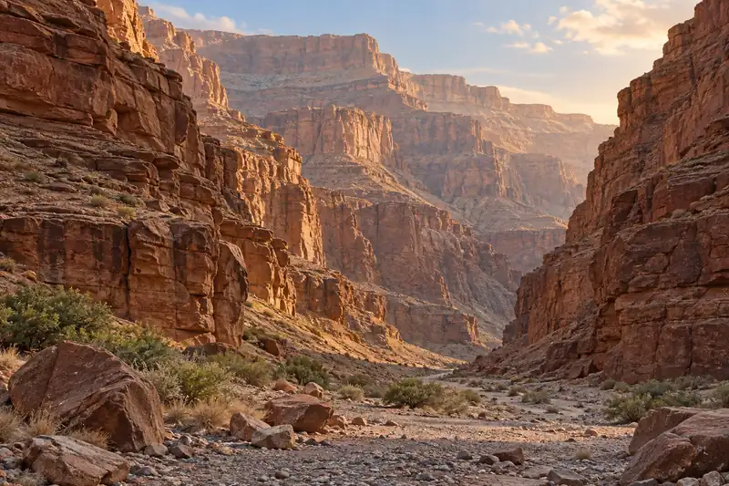 AI illustration · AI
 Local life & food
Linze County local specialties
临泽县特色美食 · 1 specialties to discover
 Siba steamed layered bread 临泽四坝蒸饼AI dish illustration / AI 菜品示意图
The bread is soft and filling, with aroma supplied by its dough and seasonings. It is different from a dry crisp flatbread.
Source ↗Read the dish guide →All dish names · 全部菜名 (1)
More dishes from across Gansu are in the Gansu food guide.
Plan your visit
Getting there
Linze County is about 50 km in a straight line from central Zhangye. Search for 临泽县 in a map app to find stations and your accommodation.
Where to stay →Build your route
Start with Zhangye Rainbow Mountains. The linked place guides have entrance and visit details.
Continue with Zhangye →More in Zhangye
Sources & geographic information
Administrative names and parent areas: Official geographic directory · Reference date 2026-09-06.
Some facts checked against 临泽县 — Wikipedia contributors, CC BY-SA 4.0.
Map data © OpenStreetMap contributors. Pins mark approximate centres, not entrances or boundaries.