


Get to know Guigang
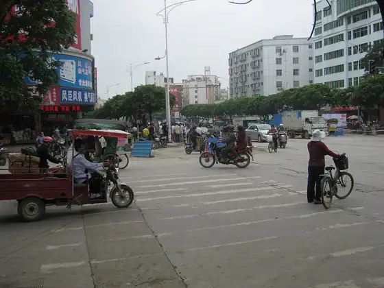
Photo adjustments
Resized and WebP compressed; subject not altered.
- Administrative area
- Prefecture-level city · 地级市
- Part of
- Guangxi
- Chinese name
- 贵港市
- Local areas
- 5 local areas
Area & population
- Area in the source
- 10,601.00 km²
- Population · 2020 census
- 4,316,262
- Administrative seat
- Gangbei District
Source: cited geographic source, as of the dates shown.
Setting and landscape
The Yu (郁江) and Qian (黔江) rivers cross the prefecture and meet inside it to form the Xun (浔江). Much of the land lies on the Xunyu Plain (浔郁平原), which the city government calls Guangxi's largest plain, and the Tropic of Cancer runs through the middle. On the lower Qian, about 8 kilometres from Guiping (桂平), the river passes through Datengxia (大藤峡), a gorge about 45 kilometres long named after a legendary giant rattan that once spanned the water.
History
In 214 BC the Qin seated Guilin Commandery (桂林郡) at Bushan (布山), placed in today's urban area, though some put it near Mengxu (蒙圩) in Guiping; under the Han most of the area belonged to Yulin Commandery (郁林郡), still run from Bushan. The name Gui County (贵县) dates from 1369. Taiping leaders Yang Xiuqing (杨秀清), Wei Changhui (韦昌辉) and Shi Dakai (石达开) came from Guigang. Gui County became the county-level city of Guigang in 1988, and the State Council made it a prefecture-level city in 1995.
What to see
The Jintian Uprising site (太平天国金田起义地址) in Jintian village, Guiping, was among the first national key cultural relics protection units in 1961; it includes the old camp, the drill ground and the Baiqi stone (拜旗石), with a museum on nearby Xiniu Ridge (犀牛岭). Xishan (西山), a Buddhist mountain 500 metres west of Guiping town on the Tropic of Cancer, is a national scenic area and geopark with a history reaching back to the Liang dynasty. Datengxia was the scene of Ming-dynasty Yao uprisings that went on for more than 200 years from 1375, and the rebels' fort and wells survive on Jiucenglou Mountain (九层楼山). Beidi Mountain (北帝山) rises to about 1,300 metres on the southern slopes of the Dayao Mountains (大瑶山) in Pingnan (平南).
Food and local products
Qintang lotus root (覃塘莲藕), grown for more than a thousand years, is a national geographical-indication product, and the Hemei Qintang (荷美覃塘) scenic area is built around its lotus fields. Chinese Wikipedia lists Luoxiu rice noodles (罗秀米粉), Shepo tofu skin (社坡腐竹), Madong lychees (麻垌荔枝) and Guiping Xishan tea (桂平西山茶) among the local specialities.
Getting oriented
The city government sits on Hecheng Road in Gangbei District (港北区). The Nanning–Guangzhou high-speed railway and the Litang–Zhanjiang railway cross the prefecture; passenger stations include Guigang, Guiping and Pingnan South.
Highlights
- Jintian Uprising site 太平天国金田起义地址: Jintian village, Guiping; among the first national key cultural relics protection units (1961).
- Xishan, Guiping 桂平西山: Buddhist mountain 500 m west of Guiping town on the Tropic of Cancer; national scenic area and national geopark.
- Datengxia 大藤峡: Gorge of about 45 km on the lower Qian River near Guiping, scene of long-running Ming Yao uprisings.
- Beidi Mountain 北帝山: Peak of about 1,300 m on the southern slopes of the Dayao Mountains in Dapeng, Pingnan County.
- Qintang lotus root 覃塘莲藕: Grown for more than a thousand years; a national geographical-indication product.
Sources for this guide
贵港概况-贵港概况-广西贵港市人民政府门户网站-www.gxgg.gov.cn · Guigang Municipal People's Government
贵港市历史沿革-人文历史-广西贵港市人民政府门户网站-www.gxgg.gov.cn · Guigang Municipal People's Government (Guigang Local Chronicles Office)
桂平西山风景名胜区(AAAA)-旅游观光-广西贵港市人民政府门户网站-www.gxgg.gov.cn · Guigang Municipal People's Government
太平天国金田起义地址景区(AAAA)-旅游观光-广西贵港市人民政府门户网站-www.gxgg.gov.cn · Guigang Municipal People's Government
大藤峡景区(AAA)-旅游观光-广西贵港市人民政府门户网站-www.gxgg.gov.cn · Guigang Municipal People's Government
北帝山旅游区(AAAA)-旅游观光-广西贵港市人民政府门户网站-www.gxgg.gov.cn · Guigang Municipal People's Government
荷美覃塘景区(AAAA)-旅游观光-广西贵港市人民政府门户网站-www.gxgg.gov.cn · Guigang Municipal People's Government
贵港市 - 维基百科,自由的百科全书 · Chinese Wikipedia · CC BY-SA 4.0
Original English written from the listed sources and checked sentence by sentence against quoted extracts by a separate reviewer. Updated 2026-09-30.
Explore Guigang
Core places to explore, with English and Chinese names.
Places to explore around Guigang
 AI illustration · AI 示意图(仅供参考,非该地点实拍)
Guiping West Mountain桂平西山
Guiping’s West Mountain brings wooded paths, Buddhist buildings and springs close to the city. The new mountain gate carries a long gold-lettered couplet that names features encountered on the slopes. Farther along, Ruquan…
Read the place guide → AI illustration · AI 示意图(仅供参考,非该地点实拍)
Beidi Mountain北帝山
Beidishan is a mountain tourist area at Dapeng town in Pingnan county, Guigang, on the southern flank of the Dayaoshan range in eastern Guangxi. The county gives its Beidi peaks an elevation of about 1,300 metres, and forest covers more than 95 per cent of the area.
Read the place guide →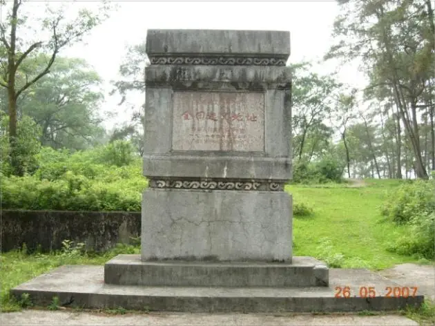 Jintian Uprising Site of the Taiping Heavenly Kingdom · 太平天国金田起义旧址
Jintian Uprising Site of the Taiping Heavenly Kingdom太平天国金田起义旧址
The Jintian uprising site marks the place on Xiniuling, a hill ridge beside Jintian village in Jintian town, Guiping, where the Taiping rising began on 11 January 1851. Its principal relics include an earth-walled camp, and the State Council placed the site in the first national batch of protected monuments in 1961.
Read the place guide → AI illustration · AI 示意图(仅供参考,非该地点实拍)
Guiping Xishan Scenic Area西山
Xishan is the scenic mountain at Xishan town in Guiping, Guigang, eastern Guangxi. Guiping city describes it as a national scenic area, and the buildings standing on it include the Xishi'an nunnery and the Ruquan pavilion.
Read the place guide → Longtan National Forest Park · 龙潭国家森林公园
Longtan National Forest Park龙潭国家森林公园
Longtan National Forest Park occupies hill country in the north-west of Guiping, Guigang, in eastern Guangxi, about 18 kilometres from the city centre. The former Ministry of Forestry approved it as a national forest park in 1993, and the Tropic of Cancer runs across its southern part.
Read the place guide →Local life & food
Guigang local specialties
贵港市特色美食 · 8 specialties to discover
 Guiping Luoxiu Rice Noodles 桂平罗秀米粉Reference photo of a similar dish · 同类菜品参考照片
Guiping Luoxiu Rice Noodles (桂平罗秀米粉) are fine, white rice noodles made in Luoxiu town (罗秀镇) in Guiping (桂平), Guigang (贵港), Guangxi.
Read the dish guide →
Photo adjustments
Full frame retained; EXIF orientation normalized, proportionally resized to at most 800 pixels and converted to WebP. No generated pixels or subject changes. Cards may crop the display.
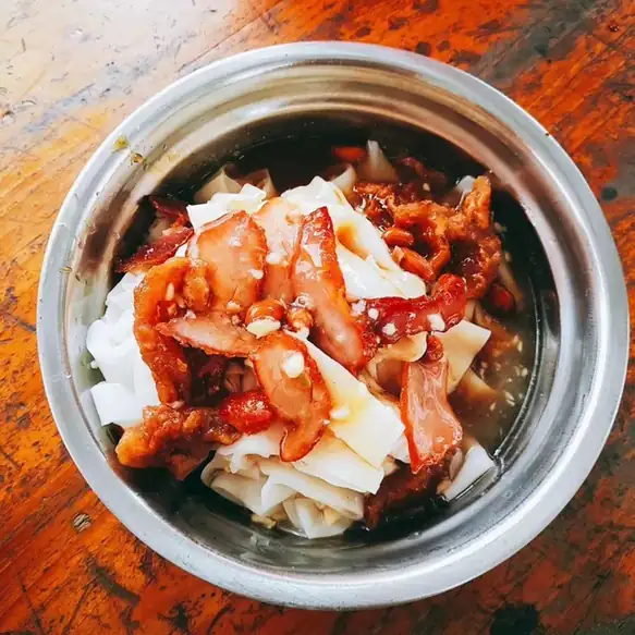 Donglong Sour Rice Noodles 东龙酸粉
Donglong Sour Rice Noodles (东龙酸粉) are steamed rice noodles eaten with a sweet-and-sour sauce and roast and fried meats, from Donglong town (东龙镇) at the northern end of Qintang District (覃塘区) in Guigang (贵港), Guangxi.
Read the dish guide →Photo adjustments
EXIF orientation normalized; resized without changing aspect ratio; converted to WebP. No subject edits.
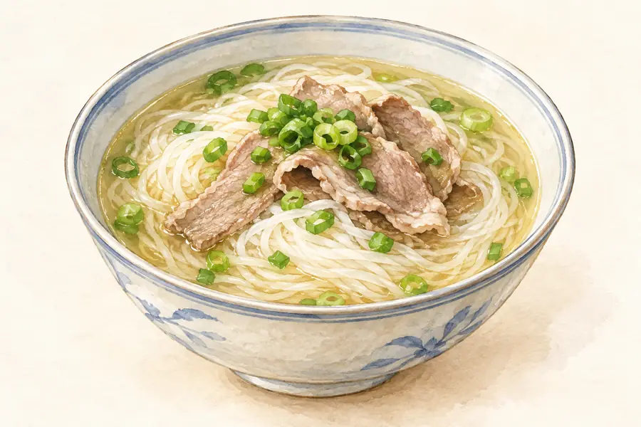 Qiaoxu Duck Rice Noodles 桥圩鸭肉粉AI illustration · AI 示意图(仅供参考,非实拍)
Qiaoxu Duck Rice Noodles (桥圩鸭肉粉) is listed among the local specialties of Guigang, Guangxi. The name includes 鸭 (duck).
Read the dish guide → Shepo Braised Meat with Tofu Skin Sticks 社坡腐竹炖肉AI illustration · AI 示意图(仅供参考,非实拍)
Shepo Braised Meat with Tofu Skin Sticks (社坡腐竹炖肉) cooks meat with Shepo tofu skin (社坡腐竹), the dried soybean-skin sticks made in Shepo town (社坡镇) of Guiping (桂平), a city under Guigang (贵港) in Guangxi.
Read the dish guide →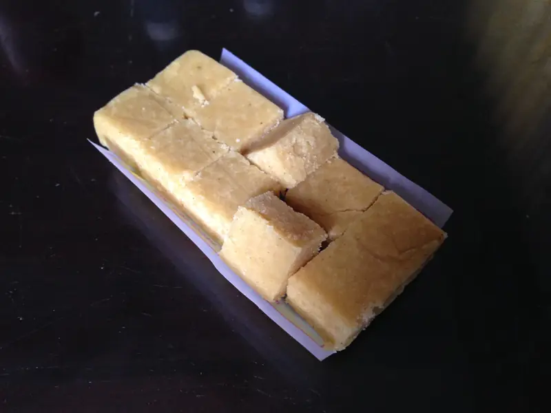 Guiping Mung Bean Cake 桂平绿豆糕
Guiping Mung Bean Cake (桂平绿豆糕) is listed among the local specialties of Guigang, Guangxi. The name includes 绿豆 (mung beans). The term 糕 points to cakes.
Read the dish guide →
Photo adjustments
EXIF orientation normalized; resized without changing aspect ratio; converted to WebP. No subject edits.
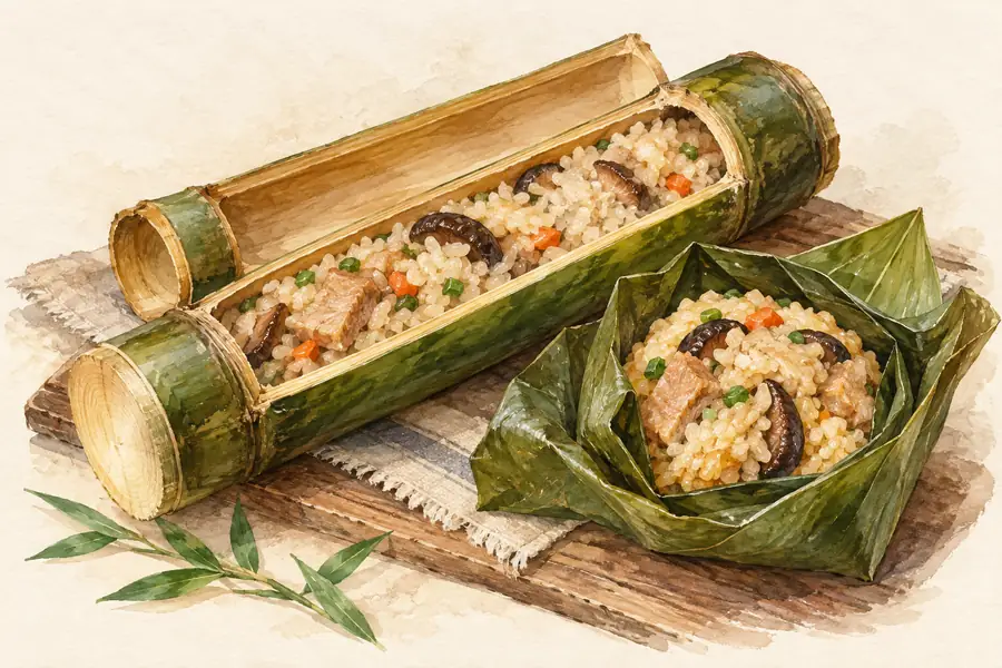 Lotus Leaf Steamed Rice 荷叶蒸饭AI illustration · AI 示意图(仅供参考,非实拍)
Lotus Leaf Steamed Rice (荷叶蒸饭) is listed among the local specialties of Guigang, Guangxi. 蒸 describes steaming.
Read the dish guide →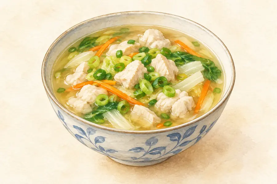 Guigang Lotus Root Soup 贵港莲藕汤AI illustration · AI 示意图(仅供参考,非实拍)
Guigang Lotus Root Soup (贵港莲藕汤) is a slow-simmered soup of lotus root and pork bones from Guigang (贵港), Guangxi, commonly cooked with peanuts as well.
Read the dish guide → Muge White-Cut Duck 木格白切鸭
Muge White-Cut Duck (木格白切鸭) is listed among the local specialties of Guigang, Guangxi. The name includes 鸭 (duck). 白切 describes poaching and cutting.
Read the dish guide →Photo adjustments
EXIF orientation normalized; resized without changing aspect ratio; converted to WebP. No subject edits.
More dishes from across Guangxi are in the Guangxi food guide.
Counties & districts in Guigang
5 areas belong directly to Guigang.
5 areas
Gangbei District 港北区
Gangbei is a district of the city of Guigang, Guangxi, China.
Explore the area →DistrictGangnan District 港南区
Gangnan south') is a district of Guigang, Guangxi, China, covering part of the southern portion of the city.
Explore the area →DistrictQintang District 覃塘区
Qintang District is a district of the city of Guigang, Guangxi, China.
Explore the area →CountyPingnan County 平南县
Pingnan is a county in the east of Guangxi, China. It is both the easternmost and northernmost county-level division of the prefecture-level city of Guigang, with a population (as of 2002) of 520,000 residing…
Explore the area →No areas match this name.
Plan your visit
Getting there
Search for 贵港市 in a map app to find stations and your accommodation.
Where to stay →Build your route
Guiping West Mountain and Beidi Mountain are both listed here. The linked place guides have entrance and visit details.
Continue with Guangxi →More in Guangxi
Sources & geographic information
Administrative names and parent areas: Official geographic directory · Reference date 2026-09-06.
Some facts checked against 贵港市 — Wikipedia contributors, CC BY-SA 4.0.
Photo: Jintian Uprising Site of the Taiping Heavenly Kingdom · Source photographer · License not provided. EXIF orientation normalized; resized without changing aspect ratio; converted to WebP. No subject edits.
Photo: Longtan National Forest Park · Source photographer · License not provided. EXIF orientation normalized; resized without changing aspect ratio; converted to WebP. No subject edits.
Map data © OpenStreetMap contributors. Pins mark approximate centres, not entrances or boundaries.