


Get to know Lingui District
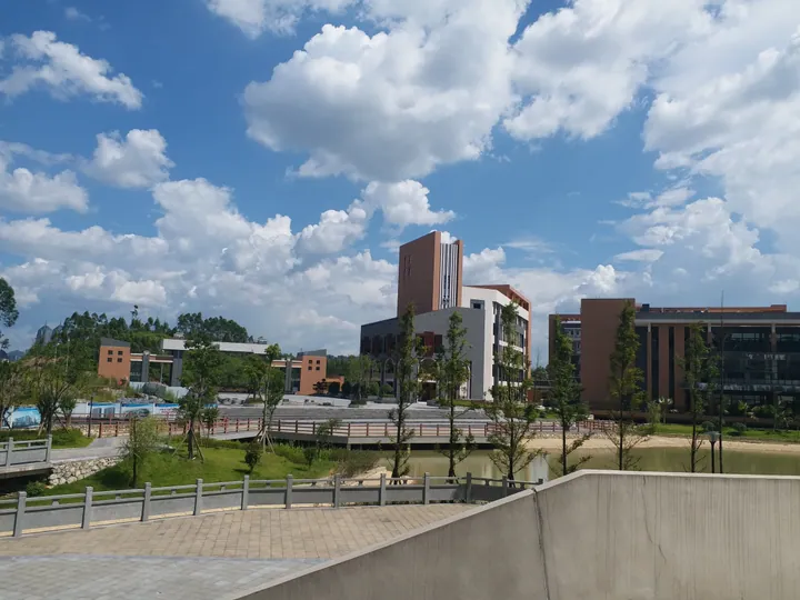
Photo adjustments
Full frame retained; proportionally resized and converted to WebP. No retouching or changes to the photographed subject. Card displays may crop the view.
- Administrative area
- District · 市辖区
- Part of
- Guilin
- Chinese name
- 临桂区
- Local areas
- District guide
Area & population
- Area in the source
- 2,202.00 km²
- Population · 2002
- 450,000
- Administrative seat
- Lingui Town (临桂镇)
Source: cited geographic source, as of the dates shown.
Setting and landscape
The district covers about 2,247 square kilometres, long from north to south and narrow from east to west. Guilin Liangjiang International Airport (桂林两江国际机场) is 15 kilometres from the Lingui urban area. Yangshuo (阳朔县) lies to the south-east and Longsheng (龙胜县) to the north. The north-west belongs to the Tianping Mountains (天平山脉), an offshoot of the Yuecheng Range (越城岭), and Weiqingling (尉青岭), at 1,778 metres, is the district's highest peak. Its rivers drain to the Pearl River; the largest is the Luoqing River (洛清江), known locally as the Yi River (义江), while the Xiangsi River (相思江) flows north into the Li River (漓江).
History
In 111 BC the Han created Shi'an County (始安县), seated in today's urban Guilin; it was renamed Lingui in 757. From 997, when the Guangnan West Circuit (广南西路) was set up with its seat in the Lingui county town, that town served as the capital of Guangxi for a total of 923 years, according to the district's local chronicle office. In 1940 the urban area was split off as Guilin city, and Lingui became a district of Guilin in 2013, with the new district formally inaugurated in 2015.
What to see
Huixian Karst National Wetland Park (会仙喀斯特国家湿地公园), in Huixian town (会仙镇), centres on Mudong Lake (睦洞湖) in a karst peak-forest plain on the watershed between the Li and Liu (柳江) river systems. It became a pilot national wetland park in 2012. Through it runs the ancient Gui-Liu Canal (古桂柳运河), also called Xiangsidai (相思埭), dug in the Tang dynasty and linking the Li and Liu river systems; stone bridges such as Huixian High Bridge (会仙高桥) survive. The district government notes that migratory birds pass through from September, and that the film Liu Sanjie (《刘三姐》) was shot here.
At the old Yangtang airfield (秧塘机场), the Flying Tigers Guilin Heritage Park (美国飞虎队桂林遗址公园) keeps a cave command post, an observation stone used by General Claire Chennault and aircraft shelters; the district calls it the only surviving Flying Tigers command post. Li Zongren's Former Residence (李宗仁故居) in Liangjiang town (两江镇) is a two-storey timber compound of 113 rooms around 13 light wells, listed as a national key cultural relics protection unit in November 1996. In Wantian Yao Township (宛田瑶族乡), Dongzhaijiang village (东宅江村), a Guoshan Yao (过山瑶) settlement of timber stilt houses on a hillside, is the setting of the Zaishui Yifang (在水一汸) national AAAA scenic area.
Food and local products
Lingui is known as a centre for growing luohan guo (罗汉果), the monk fruit Siraitia grosvenorii.
Highlights
- Huixian Karst National Wetland Park 会仙喀斯特国家湿地公园: Karst lake and marsh wetland around Mudong Lake, crossed by the Tang-dynasty Gui-Liu Canal.
- Flying Tigers Guilin Heritage Park 美国飞虎队桂林遗址公园: Cave command post, Chennault's observation stone and aircraft shelters at the Yangtang airfield site.
- Li Zongren's Former Residence 李宗仁故居: Timber compound of 113 rooms in Liangjiang town; national key cultural relics protection unit since 1996.
- Zaishui Yifang scenic area 在水一汸景区: Guoshan Yao village of stilt houses in Wantian Yao Township, a national AAAA scenic area.
Sources for this guide
临桂概况 · Lingui District People's Government, Guilin (district local chronicle office)
会仙喀斯特国家湿地公园 · Lingui District Bureau of Culture, Radio, Sports and Tourism
Lingui District · Wikipedia · CC BY-SA 4.0
Original English written from the listed sources and checked sentence by sentence against quoted extracts by a separate reviewer. Updated 2026-09-24.
Explore Lingui District
Core places to explore, with English and Chinese names.
Places to explore around Lingui District
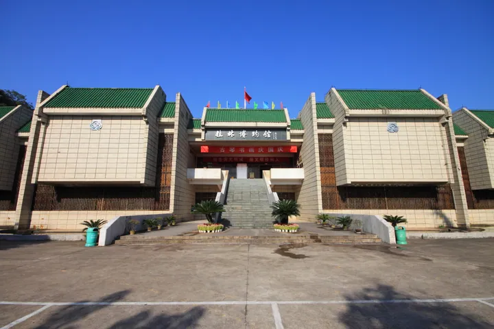 Guilin Museum, a large exhibition building in Lingui District, Guilin · 桂林博物馆展馆建筑,位于桂林市临桂区 Source-recorded photograph date: 2012-09-29 08:54:20.
Guilin Museum桂林博物馆
Guilin Museum’s collections give the surrounding landscape a human history. A particularly distinctive group is the Ming-period meiping, or plum-shaped vases, excavated around Guilin and associated with the Jingjiang princely…
Read the place guide →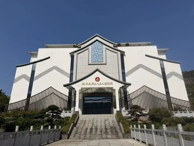 Guilin Wartime Cultural Figures Museum · 桂林抗战文化名人博物馆
Guilin Wartime Cultural Figures Museum桂林抗战文化名人博物馆
This museum follows the writers, dramatists and artists who worked in Guilin during the war against Japan. Its two-storey, Huizhou-inspired building uses objects, photographs and reconstructed settings to explain cultural work…
Read the place guide →Plan your visit
Getting there
Lingui District is about 15 km in a straight line from central Guilin. Search for 临桂区 in a map app to find stations and your accommodation.
Where to stay →Build your route
Guilin Museum and Guilin Wartime Cultural Figures Museum are about 3 km apart in a straight line. The linked place guides have entrance and visit details.
Continue with Guilin →More in Guilin
Sources & geographic information
Administrative names and parent areas: Official geographic directory · Reference date 2026-09-06.
Some facts checked against Lingui District — Wikipedia contributors, CC BY-SA 4.0.
Photo: Guilin Museum · Zhangzhugang · CC BY-SA 3.0. Full frame retained; proportionally resized and converted to WebP. No retouching or changes to the photographed subject. Card displays may crop the view.

Photo: Guilin Wartime Cultural Figures Museum · Source photographer · License not provided. EXIF orientation normalized; resized without changing aspect ratio; converted to WebP. No subject edits.
Map data © OpenStreetMap contributors. Pins mark approximate centres, not entrances or boundaries.