


Get to know Yangshuo County

Photo adjustments
Full frame retained; resized proportionally to a maximum dimension of 960 pixels and converted to WebP quality 88. No crop, retouch, generated elements, or subject alteration. Final website rendition: full frame retained, proportionally resized to at most 720 pixels and converted to WebP. No additional retouching or subject alteration. Card displays may crop the view.
- Administrative area
- County · 县
- Part of
- Guilin
- Chinese name
- 阳朔县
- Local areas
- County guide
Area & population
- Area in the source
- 1,428.00 km²
- Administrative seat
- Yangshuo
Source: cited geographic source, as of the dates shown.
Setting and landscape
The Haiyang Mountains (海洋山) rise in the north-east, where Songpinglong (嵩坪龙) reaches 1,701 metres, the county's highest point, and the Jiaqiao Ridge (驾桥岭) lies in the south-west. Between them the centre of the county is karst hills and basins. Besides the Li, the main rivers are its tributaries the Yulong (遇龙河), Jinbao (金宝河) and Dayuan (大源河). The county government notes limestone deposits across the whole county.
History
Yangshuo became a county in 590 under the Sui, when it was split from Shi'an County (始安县) and named after Yangshuo Mountain. From the Song to the Ming it stayed a county of the prefecture based in Guilin under its successive names, and it has been part of Guilin city since 1 July 1981. The county lists Xianggui Bridge (仙桂桥), the house where Sun Yat-sen stayed, and the former home of the painter Xu Beihong (徐悲鸿) among the relics it is restoring; the old stone city at Yangmeiling village (杨梅岭村古石城) was added to Guangxi's protected-sites list in its eighth batch.
What to see
The county has eight scenic areas rated 3A or above: the Li River, the Yulong River, West Street (西街), Sanqian Lijiang (三千漓), Shiwai Taoyuan (世外桃源), the Butterfly Spring (蝴蝶泉), Julongtan (聚龙潭) and Shanshui Yunong Yuan (山水遇农园). The county government counts more than 70 separate climbing crags with over 1,200 routes, and the International Federation of Sport Climbing has certified them as Asia's most complete natural-rock training base. Sightseeing flights run over the Ten-Mile Gallery (十里画廊), the Yulong and the Li.
Food and local products
The county government names Yangshuo beer fish (阳朔啤酒鱼), braised pork belly (扣肉) and stuffed vegetables (酿菜) as its local dishes, together with the newer kumquat banquet (金桔宴) and Yangshuo pot dishes (阳朔扒锅菜), whose method is on the county's intangible-heritage list. Yangshuo kumquats (阳朔金桔) received national geographical-indication protection in 2006; other local products include honey from the Jiulongteng plant (九龙藤蜂蜜), shatian pomelos, navel oranges, black-skinned sugarcane, osmanthus and water chestnuts.
Highlights
- Li River 漓江: Runs north to south through the county; its scenic area is rated 3A or above.
- Yulong River 遇龙河: Li tributary with its own rated scenic area and sightseeing flights.
- West Street 西街: One of the county's eight scenic areas rated 3A or above.
- Yangshuo kumquat 阳朔金桔: Protected as a national geographical-indication product since 2006.
- Yangshuo beer fish 阳朔啤酒鱼: Named by the county government as a local speciality dish.
Sources for this guide
阳朔概况(2026年) · Yangshuo County People's Government (compiled by the county Party History and Gazetteer Research Office)
阳朔县 · Wikipedia (Chinese) · CC BY-SA 4.0
Original English written from the listed sources and checked sentence by sentence against quoted extracts by a separate reviewer. Updated 2026-09-25.
Explore Yangshuo County
Core places to explore, with English and Chinese names.
Places to explore around Yangshuo County
 Li River · 漓江
Li River漓江
The Li River is the setting for the limestone landscape between Guilin and Yangshuo. Some hills form connected clusters, while others rise as steep individual towers above relatively flat ground. Seeing these forms from the…
Read the place guide →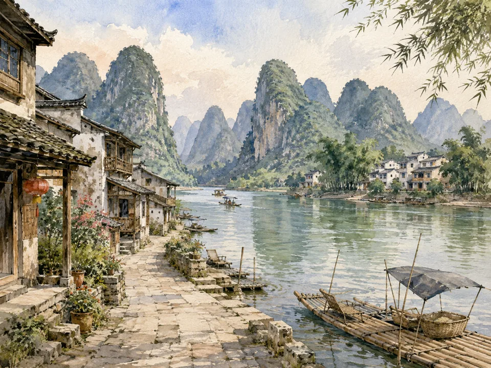 AI illustration; an interpretive view, not a photograph. AI 示意图,非景点实拍。
Xingping兴坪
Xingping brings an old trading-town street pattern close to one of the Li River’s best-known limestone settings. Stone paving and an old theatre stage give the lanes a different scale from the river views beyond. At the older…
Read the place guide → Yulong River · 遇龙河
Yulong River遇龙河
The Yulong valley offers a more intimate river landscape than the larger Li, with farming villages, cultivated fields and stone bridges along its course. Yulong Bridge and Fuli Bridge are useful landmarks for reading the…
Read the place guide →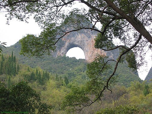 Moon Hill · 月亮山
Moon Hill月亮山
Moon Hill is the natural rock arch south of Yangshuo. Current visitor listings report the attraction temporarily closed; reopening is unconfirmed. Use only permitted exterior viewpoints, without entering closed trails.
Read the place guide → Yangshuo town, river bend and karst hills, photographed in 2017 · 阳朔 Photograph date recorded by the source: Taken on 27 December 2016, 13:27:45.
Yangshuo阳朔
Yangshuo town sits between steep limestone peaks and the Li River, with West Street at the centre of its visitor activity. The surrounding county offers a different pace: the Yulong valley has cultivated fields, stone bridges…
Read the place guide → West Street · 阳朔西街
West Street西街
West Street combines Yangshuo’s visitor economy with a recognisable northern Guangxi streetscape. Small roof tiles, sloping roofs, white walls and stone paving sit beneath the surrounding limestone peaks. Shops selling sweets…
Read the place guide →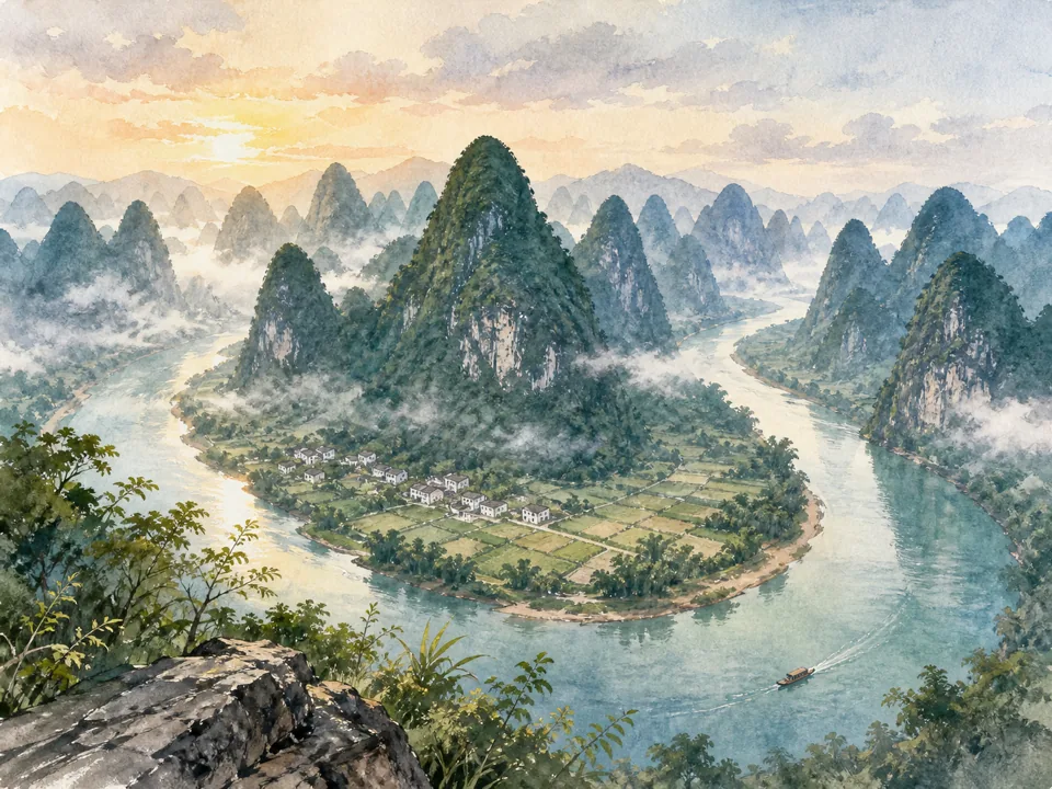 AI illustration; an interpretive view, not a photograph. AI 示意图,非景点实拍。
Xianggong Mountain相公山
Xianggong Mountain is a hilltop viewpoint over a bend of the Li River. From above, the water forms a strong line between densely grouped limestone peaks, making the structure of the landscape easier to read than from river…
Read the place guide →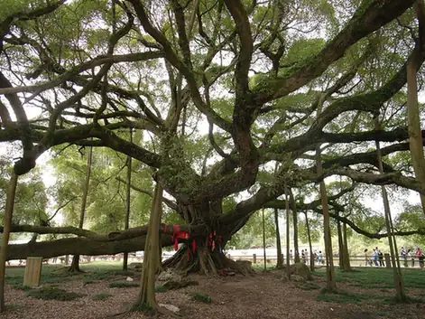 Yangshuo Big Banyan Tree · 阳朔大榕树
Yangshuo Big Banyan Tree阳朔大榕树
Yangshuo’s Big Banyan spreads a broad canopy beside the Jinbao River. Its hanging aerial roots and branches growing close to the ground make one tree resemble a small grove. The setting also carries a cinematic association: the…
Read the place guide →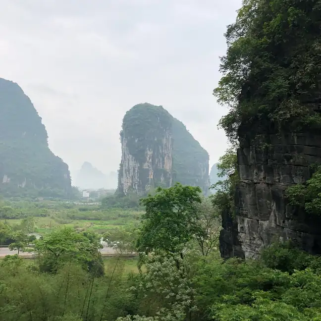 Yangshuo Butterfly Spring Cave · 阳朔蝴蝶泉岩洞
Yangshuo Butterfly Spring Cave阳朔蝴蝶泉岩洞
Tianlai Butterfly Spring combines a small cave and hill viewpoint with staged Miao and Dong cultural performances. A large butterfly sculpture on the rock face marks the entrance, while a butterfly-like cave formation explains…
Read the place guide →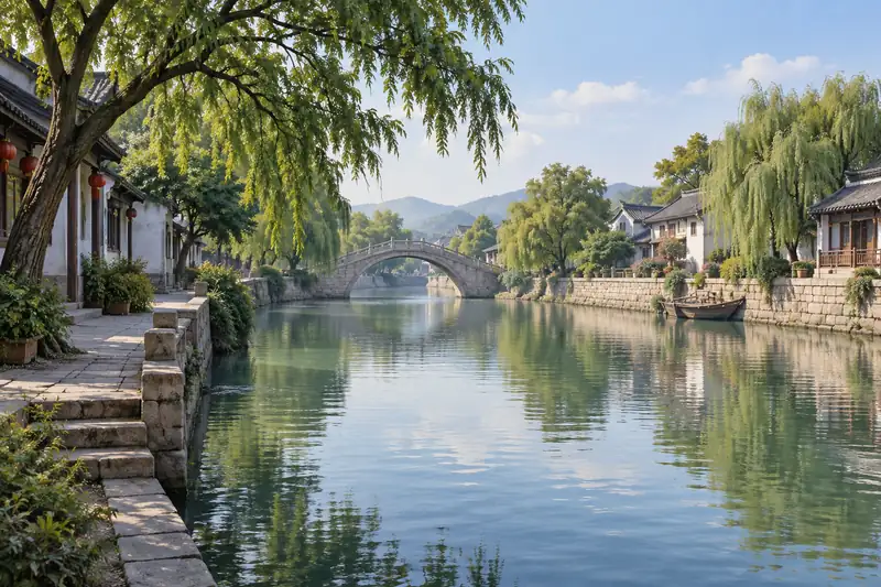 AI illustration · AI 示意图(仅供参考,非该地点实拍)
Fuli Bridge富里桥
Fuli Bridge crosses the upper Yulong valley with a single rounded stone arch. Its curved deck and reflection create the familiar near-circular outline when the water is still, while trees and rural fields keep the setting…
Read the place guide → Ruyi Peak Scenic Area · 阳朔如意峰
Ruyi Peak Scenic Area阳朔如意峰
Ruyi Peak is a developed hilltop attraction that uses a cableway and elevated paths to reveal Yangshuo’s limestone landscape. Yuanbao, Ruyi and Xianglian peaks frame the visit, with a viewing platform, suspension bridge and…
Read the place guide →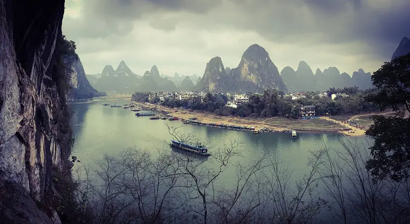 Xingping Ancient Town (兴坪古镇), Yangshuo County. Photograph: "Yangshuo, Guilin, Guangxi, China - panoramio (51)".
Xingping Ancient Town兴坪古镇
Xingping Ancient Town lies beside the Li River northeast of central Yangshuo.
Read the place guide →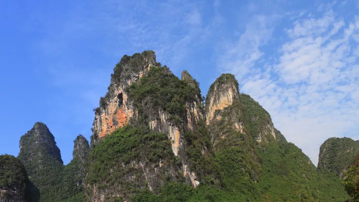 Karst limestone peaks along the Ten-Mile Gallery scenic road, Yangshuo County · 阳朔十里画廊喀斯特山峰,阳朔县 Source-recorded photograph date: 2012-09-30 09:00:00.
Ten-Mile Gallery十里画廊
Shilihualang (十里画廊) is a scenic area in Yangshuo County, Guilin, that takes in Fenglou village in Gaotian town, which the town government places north of Gaotian and south of the county seat, and whose residents' tourism trade depends on named landmarks including the Big Banyan Tree, Moon Hill, the Yulong River and Julong Pond.
Read the place guide →Local life & food
Yangshuo County local specialties
阳朔县特色美食 · 2 specialties to discover
 Yangshuo beer fish 阳朔啤酒鱼
The flesh is tender beneath a rich, aromatic sauce; beer forms part of the cooking liquid rather than making the dish taste like a cold drink. Tomato or peppers may add freshness.
Source ↗Read the dish guide →_(253141965).jpg)
Photo adjustments
EXIF orientation applied where present; resized proportionally to at most 640 px on the long edge and encoded as WebP. No crop, retouching, recoloring or subject changes.
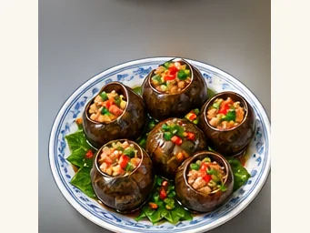 Yangshuo stuffed river snails 阳朔酿田螺AI illustration · AI 示意图
The filling is tender and savory with a more resilient snail bite, while the sauce adds richness. The shell is a serving vessel and must be navigated with a pick.
Source ↗Read the dish guide →All dish names · 全部菜名 (2)
More dishes from across Guangxi are in the Guangxi food guide.
Plan your visit
Getting there
Yangshuo County is about 60 km in a straight line from central Guilin. Search for 阳朔县 in a map app to find stations and your accommodation.
Where to stay →Build your route
Li River and Xingping are about 35 km apart in a straight line. The linked place guides have entrance and visit details.
Continue with Guilin →More in Guilin
Sources & geographic information
Administrative names and parent areas: Official geographic directory · Reference date 2026-09-06.
Some facts checked against 阳朔县 — Wikipedia contributors, CC BY-SA 4.0.
Photo: Li River · xiquinhosilva · CC BY 2.0. Wikimedia thumbnail; fitted to the ranking-card frame.

Photo: Yulong River · Qeqertaq · CC BY 3.0. Wikimedia thumbnail; fitted to the ranking-card frame.

Photo: Moon Hill · Kelisi · Public domain. Wikimedia thumbnail; fitted to the ranking-card frame.

Photo: Yangshuo · Chensiyuan · CC BY-SA 4.0. Full frame retained; proportionally resized and converted to WebP. No retouching or changes to the photographed subject. Card displays may crop the view.

Photo: West Street · Gisling · CC BY 2.5. Wikimedia thumbnail; fitted to the ranking-card frame.

Photo: Yangshuo Big Banyan Tree · y-yoshiike · CC BY 3.0. EXIF orientation normalized; resized without changing aspect ratio; converted to WebP. No subject edits.

Photo: Yangshuo Butterfly Spring Cave · Source photographer · License not provided. EXIF orientation normalized; resized without changing aspect ratio; converted to WebP. No subject edits.
Photo: Ruyi Peak Scenic Area · Source photographer · License not provided. EXIF orientation normalized; resized without changing aspect ratio; converted to WebP. No subject edits.
Photo: Xingping Ancient Town · Ethan Lee · CC BY-SA 3.0. Full frame retained; EXIF orientation normalized, proportionally resized to at most 800 pixels and converted to WebP. No generated pixels or subject changes. Cards may crop the display.

Photo: Ten-Mile Gallery · Zhangzhugang · CC BY-SA 3.0. Full frame retained; proportionally resized and converted to WebP. No retouching or changes to the photographed subject. Card displays may crop the view.

Map data © OpenStreetMap contributors. Pins mark approximate centres, not entrances or boundaries.