


Get to know Qixing District
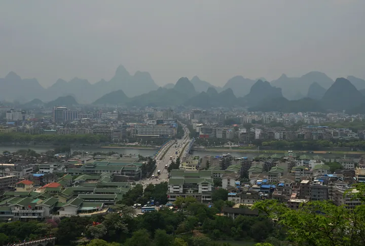
Photo adjustments
Full frame retained; proportionally resized and converted to WebP. No retouching or changes to the photographed subject. Card displays may crop the view.
- Administrative area
- District · 市辖区
- Part of
- Guilin
- Chinese name
- 七星区
- Local areas
- District guide
Area & population
- Area in the source
- 74.00 km²
- Administrative seat
- Lidong Subdistrict
Source: cited geographic source, as of the dates shown.
History
From 111 BC the area belonged to Shi'an County (始安县). Qixing District was formed in February 1979, when the local communes were abolished and merged. The Guilin National High-Tech Industrial Development Zone was set up in 1988 and joined the first group of national-level high-tech zones in 1991; in June 1997 the district and the zone were merged. The Guilin Overseas Chinese tourism new town (华侨旅游新城), in the south of the district on the west bank of the Li River, also belongs to the district.
What to see
Seven Star Park (七星公园), about 134.7 hectares and a national 4A scenic area, contains the Flower Bridge (花桥), Yuanfeng Cave (元风洞) and the Guihai Stele Forest (桂海碑林), whose cliff inscriptions the Guilin city government counts among the city's cultural heritage. Seven Star Cave (七星岩) and Chuanshan Cave (穿山岩) are among the caves developed earliest, from the Tang and Song onwards, the city government notes. Chuanshan Park (穿山公园), 53.8 hectares and also 4A, faces Pagoda Hill (塔山) across the Little East River (小东江). Yao Mountain (尧山) in the east of the district rises to 909.3 metres, the highest point in urban Guilin, and the Jingjiang princes' tombs (靖江王陵) lie at its western foot.
Getting oriented
Most of Guilin's universities are concentrated here, including Guangxi Normal University (广西师范大学) on its Yucai campus and the east campus of Guilin University of Electronic Technology (桂林电子科技大学); the Institute of Karst Geology (桂林岩溶所) is among its research bodies. Bridges such as Jiefang Bridge (解放桥) cross the Li River to the other city districts, and the Guilin ring expressway runs through the east of the district.
Highlights
- Seven Star Park 七星公园: About 134.7 ha, national 4A; contains the Flower Bridge, Yuanfeng Cave and Guihai Stele Forest.
- Guihai Stele Forest Museum 桂海碑林博物馆: Stele forest and cliff inscriptions inside Seven Star Park.
- Chuanshan Scenic Park 穿山公园: 53.8 ha, national 4A; Chuanshan Cave faces Pagoda Hill across the Little East River.
- Yao Mountain 尧山: 909.3 m, the highest peak in urban Guilin, with the Jingjiang princes' tombs at its foot.
Sources for this guide
七星区 - 维基百科,自由的百科全书 · Wikipedia (Chinese) · CC BY-SA 4.0
地文景观 - 桂林市人民政府 · Guilin Municipal People's Government
文化遗产 - 桂林市人民政府 · Guilin Municipal People's Government
Original English written from the listed sources and checked sentence by sentence against quoted extracts by a separate reviewer. Updated 2026-09-25.
Explore Qixing District
Core places to explore, with English and Chinese names.
Places to explore around Qixing District
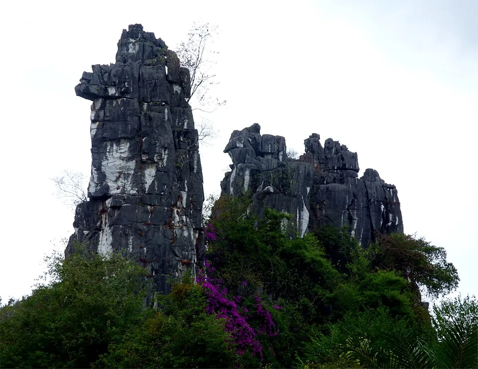 Camel Hill in Seven Star Park, Guilin. Photo: 2016-11-01 09:21:04.
Seven Star Park七星公园
Seven Star Park gathers several of Guilin’s characteristic landscapes within one large city park. Flower Bridge uses a row of stone arches to cross the water, while Camel Hill creates a very different silhouette farther inside…
Read the place guide → Chuanshan Scenic Park · 穿山公园
Chuanshan Scenic Park穿山公园
Chuanshan Park brings limestone hills and small caves into Guilin’s urban landscape. The natural opening at Moon Rock contrasts with the enclosed, illuminated formations of Chuanshan Cave, while the Xiaodong River gives a…
Read the place guide → The carved stone 'winding stream' (曲水流觞) relic on display at Guihai Stele Forest Museum, Guilin · 桂林桂海碑林博物馆展出的曲水流觞石刻 Source-recorded photograph date: 2012-09-28 15:39:38.
Guihai Stele Forest Museum桂海碑林博物馆
Guihai’s inscriptions are part of the limestone landscape around Longyin Rock and Longyin Cave, on the southwestern side of Seven Star Park. The carved texts include poems, names and political writing, turning the rock face into…
Read the place guide →Plan your visit
Getting there
Qixing District is about 3 km in a straight line from central Guilin. Search for 七星区 in a map app to find stations and your accommodation.
Where to stay →Build your route
Seven Star Park and Chuanshan Scenic Park are about 2 km apart in a straight line. The linked place guides have entrance and visit details.
Continue with Guilin →More in Guilin
Sources & geographic information
Administrative names and parent areas: Official geographic directory · Reference date 2026-09-06.
Some facts checked against 七星区 — Wikipedia contributors, CC BY-SA 4.0.
Photo: Seven Star Park · Rcdewiki · CC BY-SA 4.0. Converted to WebP and resized without changing the subject or cropping the source frame.

Photo: Chuanshan Scenic Park · Source photographer · License not provided. EXIF orientation normalized; resized without changing aspect ratio; converted to WebP. No subject edits.
Photo: Guihai Stele Forest Museum · Zhangzhugang · CC BY-SA 3.0. Full frame retained; proportionally resized and converted to WebP. No retouching or changes to the photographed subject. Card displays may crop the view.

Map data © OpenStreetMap contributors. Pins mark approximate centres, not entrances or boundaries.