


Get to know Xining

Photo adjustments
Full frame retained; proportionally resized and converted to WebP. No retouching or changes to the photographed subject. Card displays may crop the view.
- Administrative area
- Prefecture-level city · 地级市
- Part of
- Qinghai
- Chinese name
- 西宁市
- Local areas
- 7 local areas
Area & population
- Area in the source
- 7,596.00 km²
- Population · 2020 census
- 2,467,965
- Administrative seat
- Chengzhong
Source: cited geographic source, as of the dates shown.
Xining was a commercial hub along the Northern Silk Road's Hexi Corridor for over 2000 years, and was a stronghold of the Han, Sui, Tang, and Song dynasties' resistance against nomadic attacks from the west. Although long a part of Gansu province, Xining was added to Qinghai in 1928. Xining holds sites of religious significance to Muslims and Buddhists, including the Dongguan Mosque and Kumbum Monastery. It is connected by the Qinghai–Tibet railway to Lhasa, Tibet and connected by a high-speed railway to Lanzhou, Gansu and Ürümqi, Xinjiang.
Transportation
Xining is situated in a fertile mountain basin in the valley of the Huangshui (river), a tributary of the Yellow River, that acts as a river port. The city lies about 200 km west of Lanzhou, the capital of Gansu province, on what was traditionally the main trade route from northern China into Tibet and the Qaidam Basin. These routes are now followed by modern highways.
Explore Xining
Core places to explore, with English and Chinese names.
Kumbum / Ta'er Monastery 塔尔寺
Dongguan Mosque 东关清真大寺
Qinghai Provincial Museum 青海省博物馆
Qinghai Tibetan Culture Museum 青海藏文化博物院
Sun and Moon Mountain 日月山
Xining 西宁
Xining Nanchan Temple 西宁南禅寺
Xining People’s Park 西宁人民公园
Xining Nanshan Park 西宁南山公园
Pearl of Puning Tower 浦宁之珠
Xining Wildlife Park 西宁野生动物园
Shuijingxiang Market Street 水井巷
Danggar Ancient Town 丹噶尔古城
Beishan Tulou Taoist Temple 北山土楼观
Chahanhe Forest Scenic Area 察汗河开放游览区
Laoye Mountain 老爷山
Chengdong District 城东区
Chengzhong District 城中区
Chengxi District 城西区
Chengbei District 城北区
Huangzhong District 湟中区
Datong Hui and Tu Autonomous County 大通回族土族自治县
Huangyuan County 湟源县
Places to explore around Xining
 Ta'er Monastery · 塔尔寺
Kumbum / Ta'er Monastery塔尔寺
Kumbum, known in Chinese as Ta’er Temple, grew around a memorial to Tsongkhapa, founder of the Gelug school of Tibetan Buddhism. Its buildings follow the folds of the valley rather than a single straight axis. The Great Golden…
Read the place guide → Xining Dongguan Mosque · 西宁东关清真大寺
Dongguan Mosque东关清真大寺
Dongguan Mosque is a major centre of Muslim religious life in Xining’s eastern old-city area. Its courtyard and prayer hall are the useful architectural focus, set within a neighbourhood where worship and everyday commerce…
Read the place guide →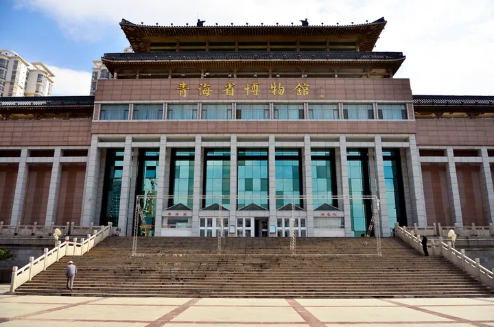 Front facade of the Qinghai Provincial Museum in Chengxi District, Xining · 青海西宁市城西区青海省博物馆正面 Source-recorded photograph date: 2012-09-25 13:15:28.
Qinghai Provincial Museum青海省博物馆
Qinghai Provincial Museum places the region’s archaeology within the routes and communities that connected the plateau with surrounding areas. Its historical collection is complemented by displays of archaeological discoveries…
Read the place guide → Exterior of the Qinghai Tibetan Culture Museum.
Qinghai Tibetan Culture Museum青海藏文化博物院
Qinghai Tibetan Culture Museum covers both Tibetan medicine and a wider artistic and cultural tradition. The northern and southern buildings have different emphases, so choose your galleries before buying a ticket. The large…
Read the place guide → The Sun and Moon Mountain visitor approach in Qinghai, October 2015.
Sun and Moon Mountain日月山
Riyue Mountain marks a transition between the farming valleys around Xining and the pastoral landscapes towards Qinghai Lake. The pass is associated with the historical Tang–Tibet route and with legends of Princess Wencheng’s…
Read the place guide →A view across Xining (西宁) from the north, showing urban neighbourhoods below the hills. Photograph date recorded by the source: 2014-07-13 00:01:45.Xining西宁
Xining lies in the Huangshui valley and makes a useful introduction to Qinghai before travelling farther onto the plateau. Dongguan Mosque and the surrounding streets show one part of the city’s religious and commercial life…
Read the place guide → Xining Nanchan Temple · 西宁南禅寺
Xining Nanchan Temple西宁南禅寺
Nanchan Temple stands at the northern foot of Phoenix Mountain in Xining. Its Chinese-style halls and courtyards offer a different architectural experience from Qinghai’s large Tibetan monasteries. The Guandi shrine is part of…
Read the place guide → Xining People’s Park · 西宁人民公园
Xining People’s Park西宁人民公园
People’s Park is a central Xining green space beside the Huangshui River, near its meeting with the Beichuan River. The artificial lake is the focal point, with waterside paths, planted areas and places to sit. It suits an…
Read the place guide → The Phoenix Terrace pavilion at Nanshan Park, Xining · 西宁南山公园凤凰台 Source-recorded photograph date: Taken on 24 July 2012.
Xining Nanshan Park西宁南山公园
Nanshan Park covers the slopes of Phoenix Mountain south of central Xining. The Phoenix Terrace area provides city views, while wooded paths, flower gardens and the Puning Friendship Garden make it a local place for a hillside…
Read the place guide → AI illustration · AI 示意图(仅供参考,非该地点实拍)
Pearl of Puning Tower浦宁之珠
The Pearl of Puning is Xining’s observation and television tower on Xishan. Its spherical upper structure is visible across the city and reflects the city’s connection with Shanghai’s Pudong district. From the hill, the urban…
Read the place guide → Xining Wildlife Park · 西宁野生动物园
Xining Wildlife Park西宁野生动物园
Xining Wildlife Park, also called Qinghai–Tibet Plateau Wildlife Park, combines animal displays with rescue, breeding and conservation work. Its hillside setting on the western part of Dananshan distinguishes it from a compact…
Read the place guide →AI illustration · AI 示意图(仅供参考,非该地点实拍)Shuijingxiang Market Street水井巷
Market lane in Xining's Chengzhong District with Xiangzhongjing, a 2024 retro hall selling Qinghai products and snacks under old Xining shop signs.
Read the place guide → A gate at Danggar Ancient Town · 丹噶尔古城 Photograph date recorded by the source: 9 October 2015.
Danggar Ancient Town丹噶尔古城
Danggar in Huangyuan grew as a town on the routes between the farming valleys and the plateau. Its east and west gates, Yingchun and Gonghai, provide a clear way to understand the old street axis. Temples dedicated to the City…
Read the place guide → Beishan Tulou Taoist Temple · 北山土楼观
Beishan Tulou Taoist Temple北山土楼观
Beishan Tulou Guan (北山土楼观) is a Taoist temple at the eastern end of Chengbei district in Xining, Qinghai, on the hill that the Qinghai provincial government's page records under the original name Tulou Shan and the further name Beichan Temple (北禅寺), backed by Dadunling with the Huangshui river on its western side.
Read the place guide →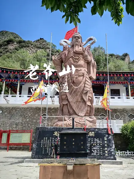 Chahanhe Forest Scenic Area · 察汗河开放游览区
Chahanhe Forest Scenic Area察汗河开放游览区
Chahan He (察汗河), catalogued as an open visiting area, is a forest scenic area in Baoku township, Datong county, Xining, Qinghai, one of the two well-known scenic areas of Datong National Forest Park and, as the provincial news network records it, a national AAA-grade tourist attraction.
Read the place guide → Entrance gate and stone stairway ascending Laoye Mountain, Datong County, Xining · 西宁市大通回族土族自治县老爷山山门与登山步道 Source-recorded photograph date: Taken on 23 October 2005.
Laoye Mountain老爷山
Laoye Shan (老爷山), also called Yuanshuo Shan, is a mountain on the bank of the Beichuan river on the east side of Qiaotou township in Datong county, Xining, Qinghai, one of Qinghai's nine scenic areas and, as the provincial information office records, a national AAAA-grade tourist attraction.
Read the place guide →Local life & food
Xining local specialties
西宁市特色美食 · 17 specialties to discover
 Beef-offal soup 牛杂碎AI illustration · AI 示意图
The broth is savory, while each cut brings a distinct tender, springy or chewy texture. Herbs, pepper and chili can alter the flavor at serving.
Source ↗Read the dish guide → Sweet fermented barley 甜醅AI illustration · AI 示意图
Soft, moist grains retain a little chew and a gently fermented aroma. The flavor is distinct from both yogurt and plain sweet porridge.
Source ↗Read the dish guide →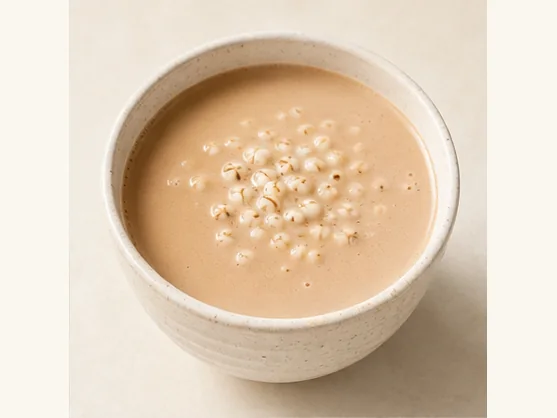 Fermented-grain milk tea 甜醅奶茶AI dish illustration / AI 菜品示意图
Expect milky tea, sweetness and a mild fermented note, with grains collecting at the bottom. Stirring changes the balance between a plain sip and a mouthful containing the grain.
Source ↗Read the dish guide → Qinghai sour-spicy pork soup 青海酸辣里脊AI dish illustration / AI 菜品示意图
Expect tender or lightly coated pork, crisp vegetable pieces and a sharp, warming broth. Peppery heat and vinegar sourness are distinct, so asking for less chilli may not change the soup's acidity.
Source ↗Read the dish guide → Qinghai hand-served lamb 手抓羊肉
Lean portions are firm and juicy, while fatty and connective sections are softer, with a clear lamb aroma throughout.
Source ↗Read the dish guide →
Photo adjustments
EXIF orientation applied where present; resized proportionally to at most 640 px on the long edge and encoded as WebP. No crop, retouching, recoloring or subject changes.
 Lamb Sausage Noodles 羊肠面AI illustration · AI 示意图(仅供参考,非实拍)
Lamb Sausage Noodles (羊肠面) are a Xining noodle dish also called zhuamian (抓面), 'grabbed noodles'. Golden noodles are scalded in hot beef broth and served with lamb sausage, beef and seasoning.
Read the dish guide → Qinghai yogurt 青海老酸奶
The yogurt is creamy and distinctly sour, sometimes with a firmer surface layer. Sweetening changes the balance quickly.
Source ↗Read the dish guide →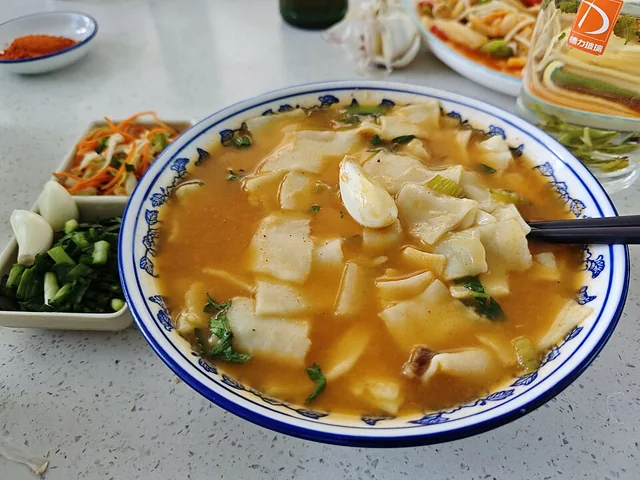 Hand-torn noodle soup 尕面片
The irregular pieces have tender edges and slightly thicker, chewy centers. They carry the broth well and make a satisfying spoon-and-chopstick meal.
Source ↗Read the dish guide →
Photo adjustments
EXIF orientation applied where present; resized proportionally to at most 640 px on the long edge and encoded as WebP. No crop, retouching, recoloring or subject changes.
All dish names · 全部菜名 (17)
- Beef-offal soup · 牛杂碎
- Sweet fermented barley · 甜醅
- Fermented-grain milk tea · 甜醅奶茶
- Qinghai sour-spicy pork soup · 青海酸辣里脊
- Qinghai hand-served lamb · 手抓羊肉
- Lamb Sausage Noodles · 羊肠面
- Qinghai yogurt · 青海老酸奶
- Hand-torn noodle soup · 尕面片
- Niangpi noodle sheets · 酿皮
- Mixed Offal Soup · 杂碎汤
- Pan-Roasted Lamb Ribs · 炕锅羊排
- Oil-Drizzled Flatbread · 狗浇尿油饼
- Hehuang mixed stew · 熬饭
- Qinghai Charcoal Hot Pot · 青海土火锅
- Kunkuo oven-pot bread · 焜锅馍馍
- Mutton Covered with Dough · 羊肉盖被
- Yak Jerky · 牦牛肉干
More dishes from across Qinghai are in the Qinghai food guide.
Counties & districts in Xining
7 areas belong directly to Xining.
7 areas
Chengdong District城东区
Chengdong District is one of four districts of the prefecture-level city of Xining, the capital of Qinghai Province, Northwest China.
Explore the area →DistrictChengzhong District城中区
Chengzhong is one of four districts and the municipal seat of the prefecture-level city of Xining, the capital of Qinghai Province, Northwest China.
Explore the area →DistrictChengxi District城西区
Chengxi District is one of four districts of the prefecture-level city of Xining, the capital of Qinghai Province, Northwest China.
Explore the area →DistrictChengbei District城北区
Chengbei is one of four districts of the prefecture-level city of Xining, the capital of Qinghai Province, Northwest China, covering part of the northern portion of the city as its name suggests.
Explore the area →Show fewer areas
Huangzhong District湟中区
Huangzhong District is a district of Xining, Qinghai Province, China. It is located about 80 km (50 mi) east of Qinghai Lake and about 10 km (6.2 mi) southwest of downtown Xining.
Explore the area →Autonomous countyDatong Hui and Tu Autonomous County大通回族土族自治县
Datong Hui and Tu Autonomous County, Datong County, or Serkhog County (simplified Chinese: 大通回族土族自治县; traditional Chinese: 大通回族土族自治縣; pinyin: Dàtōng Huízú Tǔzú Zìzhìxiàn; Tibetan…
Explore the area →CountyHuangyuan County湟源县
Huangyuan County is a county of Qinghai Province, China, under the administration of the prefecture-level city of Xining, the capital of Qinghai.
Explore the area →No areas match this name.
Plan your visit
Getting there
Search for 西宁市 in a map app to find stations and your accommodation.
Where to stay →Build your route
Kumbum / Ta'er Monastery and Dongguan Mosque are about 25 km apart in a straight line. The linked place guides have entrance and visit details.
Continue with Qinghai →More in Qinghai
Sources & geographic information
Administrative names and parent areas: Official geographic directory · Reference date 2026-09-06.
Background text adapted from Xining — Wikipedia contributors, under CC BY-SA 4.0. Text has been shortened and reorganized; source revision 1368507292.
Photo: Kumbum / Ta'er Monastery · Andreas Gruschke · CC BY 3.0. Wikimedia thumbnail; fitted to the ranking-card frame.

Photo: Dongguan Mosque · Michał Beim · CC BY 4.0. Wikimedia thumbnail; fitted to the ranking-card frame.
.jpg)
Photo: Qinghai Provincial Museum · Byrnzie500 · CC BY-SA 2.0. Full frame retained; proportionally resized and converted to WebP. No retouching or changes to the photographed subject. Card displays may crop the view.

Photo: Qinghai Tibetan Culture Museum · N509FZ · CC BY-SA 4.0. Wikimedia thumbnail; fitted to the ranking-card frame.
.jpg)
Photo: Sun and Moon Mountain · 慕尼黑啤酒 · CC BY-SA 3.0. Proportionally resized and converted to WebP without cropping, retouching or changing the photographed subject.

Photo: Xining · NoGhost · CC BY-SA 4.0. Full frame retained; proportionally resized and converted to WebP. No retouching or changes to the photographed subject. Card displays may crop the view.

Photo: Xining Nanchan Temple · Source photographer · License not provided. EXIF orientation normalized; resized without changing aspect ratio; converted to WebP. No subject edits.
Photo: Xining People’s Park · Mintchocicecream at English Wikipedia · CC BY 2.5. EXIF orientation normalized; resized without changing aspect ratio; converted to WebP. No subject edits.

Photo: Xining Nanshan Park · fish4fish · CC BY-SA 3.0. Full frame retained; proportionally resized and converted to WebP. No retouching or changes to the photographed subject. Card displays may crop the view.

Photo: Xining Wildlife Park · Source photographer · License not provided. EXIF orientation normalized; resized without changing aspect ratio; converted to WebP. No subject edits.
Photo: Danggar Ancient Town · 慕尼黑啤酒 · CC BY-SA 4.0. Full frame retained; proportionally resized and converted to WebP. No retouching or changes to the photographed subject. Card displays may crop the view.

Photo: Beishan Tulou Taoist Temple · Source photographer · License not provided. EXIF orientation normalized; resized without changing aspect ratio; converted to WebP. No subject edits.
Photo: Chahanhe Forest Scenic Area · Source photographer · License not provided. EXIF orientation normalized; resized without changing aspect ratio; converted to WebP. No subject edits.
Photo: Laoye Mountain · crongbin · CC BY-SA 3.0. Full frame retained; proportionally resized and converted to WebP. No retouching or changes to the photographed subject. Card displays may crop the view.

Map data © OpenStreetMap contributors. Pins mark approximate centres, not entrances or boundaries.