


Get to know Yushu Tibetan Autonomous Prefecture
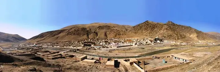
Photo adjustments
Full frame retained; resized proportionally to a maximum dimension of 960 pixels and converted to WebP quality 88. No crop, retouch, generated elements, or subject alteration. Final website rendition: full frame retained, proportionally resized to at most 720 pixels and converted to WebP. No additional retouching or subject alteration. Card displays may crop the view.
- Administrative area
- Autonomous prefecture · 自治州
- Part of
- Qinghai
- Chinese name
- 玉树藏族自治州
- Local areas
- 6 local areas
On 14 April 2010, an earthquake struck the prefecture, registering a magnitude of 6.9 (USGS, EMSC) or 7.1 (Xinhua). It originated in the Yushu Tibetan Autonomous Prefecture, at 07:49 local time.
Transportation
The eastern part of the prefecture, where most of its population lives, is served by the China National Highway 214 and the recently constructed (opened 2009) Yushu Batang Airport. In 2017 the G0613 Xining–Lijiang Expressway was completed, connecting the region to Hainan Tibetan Autonomous Prefecture and Xining.
The far western part of the prefecture, which is hundreds of kilometers away from the prefecture's eastern "core", and has very little population, is crossed by China National Highway 109 and the Qinghai-Tibet Railway.
Explore Yushu Tibetan Autonomous Prefecture
Core places to explore, with English and Chinese names.
Places to explore around Yushu Tibetan Autonomous Prefecture
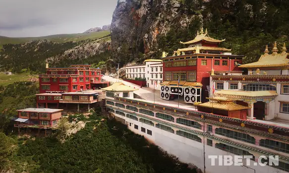 Ga'er Monastery · 尕尔寺
Ga'er Monastery尕尔寺
Ga'er Monastery (尕尔寺) is a Tibetan Buddhist temple built into a cliff at 前麦村 in 白扎乡, Nangqên County, Yushu Tibetan Autonomous Prefecture, Qinghai, roughly 76 km from the county seat at 香达镇.
Read the place guide → AI illustration · AI 示意图(仅供参考,非该地点实拍)
Princess Wencheng Temple and Leba Valley文成公主庙与勒巴沟
Princess Wencheng Temple and Leba Valley (文成公主庙与勒巴沟) covers two linked sites in Yushu City, Yushu Tibetan Autonomous Prefecture, Qinghai: the Princess Wencheng Temple (文成公主庙), a Buddhist hall built against a cliff and also known as 加萨公主庙, and 勒巴沟, the valley whose rock walls carry Tibetan religious carvings.
Read the place guide →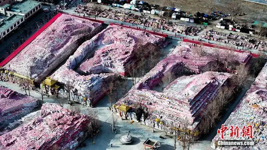 Xinzhai Gyanak Mani Stone City · 新寨嘉那玛尼石经城
Xinzhai Gyanak Mani Stone City新寨嘉那玛尼石经城
Xinzhai Gyanak Mani Stone City (新寨嘉那玛尼石经城), also written 新寨嘉那嘛呢石经城, is a mani-stone complex at 新寨村 in Yushu City, Yushu Tibetan Autonomous Prefecture, Qinghai. The first Jiana Rinpoche of 结古寺 began carving and piling stones here in 1715 and the mound has been growing ever since; in 2006 it was listed in the sixth batch of national key cultural relic protection units.
Read the place guide → Döndrub Ling Monastery (Jyekundo Monastery) on its hillside site, Yushu · 青海玉树结古寺(顿珠林寺)山坡全景 Source-recorded photograph date: 2013-06-16.
Jyekundo Monastery结古寺
Jyekundo Monastery, known locally as Jiegu Temple, rises on the hill above the eastern part of Yushu. It belongs to the Sakya school of Tibetan Buddhism. Assembly halls and monastic residences occupy the hillside, giving the…
Read the place guide → Gaduo Juewu Mountain Viewing Area · 尕朵觉悟山外围合法观景区
Gaduo Juewu Mountain Viewing Area尕朵觉悟山外围合法观景区
Gaduo Juewu Mountain Viewing Area (尕朵觉悟山外围合法观景区) is a catalogue label rather than a name any cited page uses: it joins 尕朵觉悟山 with 外围合法观景区, “peripheral legally open viewing area”, and points to 尕朵觉悟, a sacred mountain in Yushu Tibetan Autonomous Prefecture, Qinghai. Qinghai Daily pairs it with Mount Kailash, Meili Snow Mountain and Animaqing as the “four great sacred mountains” and gives its main peak as 5,470 m.
Read the place guide →Local life & food
Yushu Tibetan Autonomous Prefecture local specialties
玉树藏族自治州特色美食 · 10 specialties to discover
 Yushu Yak Meat 玉树牦牛肉AI illustration · AI 示意图(仅供参考,非实拍)
Yushu Yak Meat (玉树牦牛肉) includes the fresh meat and prepared products brought by Nangqen (囊谦) producers to a Beijing (北京) exhibition in December 2019.
Read the dish guide →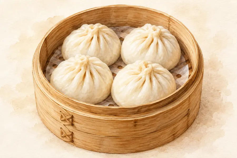 Tibetan Steamed Buns 藏包AI illustration · AI 示意图(仅供参考,非实拍)
Tibetan Steamed Buns (藏包) is listed among the local specialties of Yushu Tibetan Autonomous Prefecture, Qinghai. It is grouped here with regional dishes & banquets; retain the complete Chinese name when comparing local menus.
Read the dish guide → Tibetan Butter Tea 酥油茶AI dish illustration · AI 菜品示意图
Tibetan Butter Tea (酥油茶) appears in the local food directory for Qinghai. The Chinese introduction below explains the named food and its preparation in the linked culinary reference.
Source ↗Read the dish guide →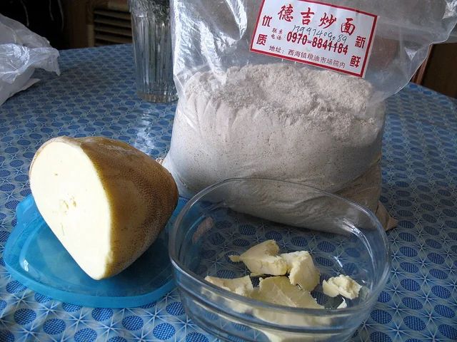 Tsampa Roasted Barley Flour 糌粑Dish photograph · see caption for context
Tsampa Roasted Barley Flour (糌粑) appears in the local food directory for Qinghai. The Chinese introduction below explains the named food and its preparation in the linked culinary reference.
Source ↗Read the dish guide →
Photo adjustments
EXIF orientation applied where present; resized proportionally to at most 640 px on the long edge and encoded as WebP. No crop, retouching, recoloring or subject changes.
 Qumarleb Yak Jerky 曲麻莱牦牛肉干AI illustration · AI 示意图(仅供参考,非实拍)
Qumarleb Yak Jerky (曲麻莱牦牛肉干) is listed among the local specialties of Yushu Tibetan Autonomous Prefecture, Qinghai. The name includes 牛肉 (beef).
Read the dish guide →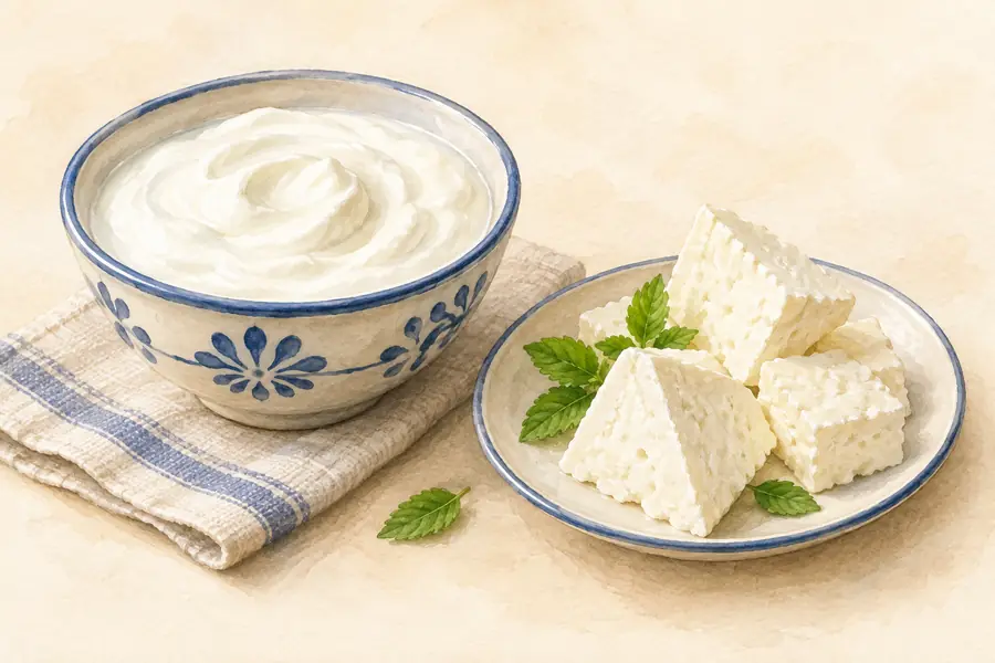 Chindu Yogurt 称多酸奶AI illustration · AI 示意图(仅供参考,非实拍)
Chindu Yogurt (称多酸奶) is listed among the local specialties of Yushu Tibetan Autonomous Prefecture, Qinghai. The name includes 酸奶 (cultured milk).
Read the dish guide → Nangqen Black Highland Barley Cake 囊谦黑青稞饼AI illustration · AI 示意图(仅供参考,非实拍)
Nangqen Black Highland Barley Cake (囊谦黑青稞饼) is listed among the local specialties of Yushu Tibetan Autonomous Prefecture, Qinghai. The term 饼 points to cakes or flatbreads.
Read the dish guide →Dried Cheese Curds 奶渣AI illustration · AI 示意图(仅供参考,非实拍)
Dried Cheese Curds (奶渣) is listed among the local specialties of Yushu Tibetan Autonomous Prefecture, Qinghai. It is grouped here with sweets & desserts; retain the complete Chinese name when comparing local menus.
Read the dish guide →More dishes from across Qinghai are in the Qinghai food guide.
Counties & districts in Yushu Tibetan Autonomous Prefecture
6 areas belong directly to Yushu Tibetan Autonomous Prefecture.
6 areas
Yushu City 玉树市
Yushu (Tibetan: ཡུལ་ཤུལ་གྲོང་ཁྱེར།, Chinese: 玉树市), also Romanized as Yüxü, is a county-level city of Yushu Tibetan Autonomous Prefecture in Southern Qinghai Province, China.
Explore the area →CountyZadoi County 杂多县
Zadoi County (Tibetan: རྫ་སྟོད་རྫོང་།; Chinese: 杂多县) is a county in the southwest of Qinghai Province, China, bordering the Tibet Autonomous Region to the south.
Explore the area →CountyChindu County 称多县
Chindu County (Tibetan: ཁྲི་འདུ་རྫོང་།) or Chenduo County is a county of Qinghai Province, China, bordering Sichuan to the east. It is under the administration of Yushu Tibetan Autonomous Prefecture.
Explore the area →CountyZhidoi County 治多县
Zhidoi County (Tibetan: འབྲི་སྟོད་རྫོང།, Chinese: 治多县) is a county in the west and southwest of Qinghai Province, China, bordering the autonomous regions of Tibet to the west and Xinjiang to the northwest.
Explore the area →Show fewer areas
Nangqên County 囊谦县
Nangqên County, or Nangchen (Tibetan: ནང་ཆེན་རྫོང་།, Chinese: 囊谦县), is currently a county of the Yushu Tibetan Autonomous Prefecture and is the southernmost county-level division of Qinghai province, China…
Explore the area →CountyQumarlêb County 曲麻莱县
Qumarlêb County (Tibetan: ཆུ་དམར་ལེབ་རྫོང་།; Chinese: 曲麻莱县) is a county in the northeast of the Yushu Tibetan Autonomous Prefecture, south-central Qinghai province, China.
Explore the area →No areas match this name.
Plan your visit
Getting there
Search for 玉树藏族自治州 in a map app to find stations and your accommodation.
Where to stay →Build your route
Ga'er Monastery and Princess Wencheng Temple and Leba Valley are both listed here. The linked place guides have entrance and visit details.
Continue with Qinghai →More in Qinghai
Sources & geographic information
Administrative names and parent areas: Official geographic directory · Reference date 2026-09-06.
Background text adapted from Yushu Tibetan Autonomous Prefecture — Wikipedia contributors, under CC BY-SA 4.0. Text has been shortened and reorganized; source revision 1366283308.
Photo: Ga'er Monastery · Source photographer · License not provided. EXIF orientation normalized; resized without changing aspect ratio; converted to WebP. No subject edits.
Photo: Xinzhai Gyanak Mani Stone City · Source photographer · License not provided. EXIF orientation normalized; resized without changing aspect ratio; converted to WebP. No subject edits.
Photo: Jyekundo Monastery · Gruschke · CC BY-SA 3.0. Full frame retained; proportionally resized and converted to WebP. No retouching or changes to the photographed subject. Card displays may crop the view.

Photo: Gaduo Juewu Mountain Viewing Area · Source photographer · License not provided. EXIF orientation normalized; resized without changing aspect ratio; converted to WebP. No subject edits.
Map data © OpenStreetMap contributors. Pins mark approximate centres, not entrances or boundaries.