


Get to know Dabancheng District
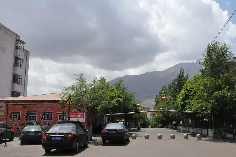
Photo adjustments
Full frame retained; EXIF orientation normalized, proportionally resized to at most 800 pixels and converted to WebP. No generated pixels or subject changes. Cards may crop the display.
- Administrative area
- District · 市辖区
- Part of
- Ürümqi
- Chinese name
- 达坂城区
- Local areas
- District guide
Area & population
- Area in the source
- 4,764.00 km²
- Population · 2020
- 35,540
- Administrative seat
- Dabancheng Town
Source: cited geographic source, as of the dates shown.
A basin enclosed on three sides
The narrow Chaiwopu–Dabancheng Basin (柴窝堡—达坂城盆地) is enclosed by mountains on three sides and opens westward. Its terrain includes icy peaks, canyons, hills and alluvial fans. Desert shrubs dominate the plains, including saxaul and ephedra, while surrounding mountains have forest and meadow belts. The district’s water systems include Chaiwopu Lake (柴窝堡湖), the Baiyang River (白杨河), Alagou (阿拉沟) and Daheyan (大河沿).
An airflow corridor through the mountains
The Dabancheng wind corridor runs between the central and eastern Tianshan Mountains (天山), extending about eighty kilometres. It channels air between northern and southern Xinjiang. A wind farm was established here in 1989. The district name derives from a Uyghur word for a mountain ridge or pass, reflecting its historic role as a transport gateway.
Sources for this guide
达坂城区自然资源_自然资源_乌鲁木齐市达坂城区人民政府 · Dabancheng District Government
达坂城区概况_达坂城概况_乌鲁木齐市达坂城区人民政府 · Dabancheng District Government Office
Original English written from the listed sources and checked sentence by sentence against quoted extracts by a separate reviewer. Updated 2026-09-27.
Explore Dabancheng District
Core places to explore, with English and Chinese names.
Places to explore around Dabancheng District
 AI illustration · AI 示意图(仅供参考,非该地点实拍)
Chaiwopu Lake柴窝堡湖
Freshwater lake 45 km south-east of Urumqi between Bogda and Tiangeer peaks, nearly dry in 2014 and restored as a national wetland park.
Read the place guide → AI illustration · AI 示意图(仅供参考,非该地点实拍)
Dabancheng Ancient Town达坂城古镇
Dabancheng ancient town (达坂城古镇) is the place the sources call Baishuijian ancient town (白水涧古镇), at the southern end of the Dabancheng basin in Dabancheng District (达坂城区), Urumqi (乌鲁木齐市), Xinjiang, at the foot of the Tianshan on the ancient Silk Road.
Read the place guide →Plan your visit
Getting there
Dabancheng District is about 3 km in a straight line from central Ürümqi. Search for 达坂城区 in a map app to find stations and your accommodation.
Where to stay →Build your route
Chaiwopu Lake and Dabancheng Ancient Town are both listed here. The linked place guides have entrance and visit details.
Continue with Ürümqi →More in Ürümqi
Sources & geographic information
Administrative names and parent areas: Official geographic directory · Reference date 2026-09-06.
Map data © OpenStreetMap contributors. Pins mark approximate centres, not entrances or boundaries.