


Get to know Fu'an
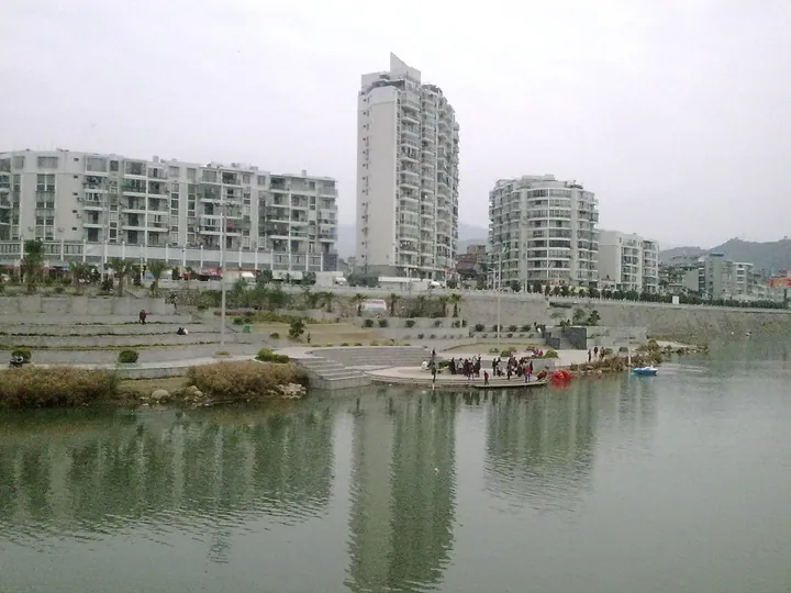
Photo adjustments
Full frame retained; proportionally resized and converted to WebP. No retouching or changes to the photographed subject. Card displays may crop the view.
- Administrative area
- County-level city · 县级市
- Part of
- Ningde
- Chinese name
- 福安市
- Local areas
- County-level city guide
Area & population
- Area in the source
- 67.44 km²
- Population · 2020
- 609,779
Source: cited geographic source, as of the dates shown.
Setting and landscape
The west lies on the south-east slopes of the Donggong and Jiufeng ranges (洞宫—鹫峰山脉), the east on the south-west slopes of the Taimu Mountains (太姥山脉). The Changxi (长溪) and Baishi (白石溪) streams meet at Tantou (潭头镇) to form the Jiaoxi, which is called the Fuchun Stream (富春溪) as it passes the city and the Saijiang (赛江) below Saiqi (赛岐); its mouth opens onto Sansha Bay (三沙湾). The city grew out of the old Hanyang flat (韩阳坂), hence its other name, Hancheng (韩城).
The local speech, Fu'an dialect (福安话), is the representative dialect of the northern Funing group of Eastern Min. The city has 47 Catholic churches.
History
The county was created in 1245, under the Song, after the official Zheng Cai (郑采) petitioned for part of Changxi County to be split off; its name was taken from the phrase 'pacify Fujian' (福建安抚). In 1934 the Eastern Fujian Soviet Government (闽东苏维埃政府) was founded at Baizhuyang (柏柱洋).
What to see
Baiyunshan (白云山), in Muyun She Ethnic Township (穆云畲族乡) and Xiaoyang (晓阳镇) in the north-west, became a national scenic area in 2009 and joined Taimushan (太姥山) and Baishuiyang (白水洋) in the Ningde global geopark in 2010. It is known for clusters of river potholes, deeply incised meanders in granite gorges and volcanic rock forms. In the Jiulong Cave (九龙洞) section the largest pothole, 'Feitian Well' (飞天井), is about 60 m high and 30 m across; the city calls it the largest single pothole found in China.
Liancun (廉村) in the south-west was the home of Xue Lingzhi (薛令之), called the first jinshi of Fujian; Emperor Suzong of the Tang (唐肃宗) named the village 'Lian' (integrity) for his honesty. Its old walls, official road, wharf, ancestral halls and houses survive, and it is a national historic and cultural village. At Baizhuyang in Xibing (溪柄镇), the former offices of the Eastern Fujian Special Committee (闽东特委) and the Soviet government are preserved, and Louxia Village (楼下村), also part of Baizhuyang, has 30 Ming and Qing houses and the Shifeng Temple (狮峰寺), a national protected site.
Food and local products
Tanyang Village (坦洋村) in Shekou (社口镇) is the birthplace of Tanyang Gongfu (坦洋工夫) black tea, first produced successfully there in the Xianfeng and Tongzhi reigns of the Qing; the village keeps old tea houses, a watchtower, a covered bridge and a Mazu temple (天后宫). Tanyang Gongfu is a national geographical-indication product. The shallow sea off Fu'an yields large yellow croaker and hairtail.
Highlights
- Baiyunshan 白云山: National scenic area in the Ningde global geopark, known for giant river potholes and granite gorges.
- Liancun 廉村: Village named by a Tang emperor for the integrity of Xue Lingzhi; national historic and cultural village.
- Tanyang Village 坦洋村: Birthplace of Tanyang Gongfu black tea, with Qing tea houses.
- Baizhuyang 柏柱洋: Site of the Eastern Fujian Soviet Government founded in 1934.
Sources for this guide
白云山景区 - 旅游风景 - 福安市人民政府 · Fu'an Municipal People's Government (Culture, Sports and Tourism Bureau)
溪潭镇廉村 - 旅游风景 - 福安市人民政府 · Fu'an Municipal People's Government (Culture, Sports and Tourism Bureau)
社口镇坦洋村 - 旅游风景 - 福安市人民政府 · Fu'an Municipal People's Government (Culture, Sports and Tourism Bureau)
柏柱洋红色经典旅游景区 - 旅游风景 - 福安市人民政府 · Fu'an Municipal People's Government (Culture, Sports and Tourism Bureau)
福安市 - 维基百科,自由的百科全书 · Wikipedia (Chinese) · CC BY-SA 4.0
Original English written from the listed sources and checked sentence by sentence against quoted extracts by a separate reviewer. Updated 2026-09-23.
Explore Fu'an
Core places to explore, with English and Chinese names.
Places to explore around Fu'an
 AI illustration · AI
 Plan your visit
Getting there
Fu'an is about 50 km in a straight line from central Ningde. Search for 福安市 in a map app to find stations and your accommodation.
Where to stay →Build your route
Start with Baiyun Mountain. The linked place guides have entrance and visit details.
Continue with Ningde →More in Ningde
Sources & geographic information
Administrative names and parent areas: Official geographic directory · Reference date 2026-09-06.
Some facts checked against 福安市 — Wikipedia contributors, CC BY-SA 4.0.
Map data © OpenStreetMap contributors. Pins mark approximate centres, not entrances or boundaries.