


Get to know Siming District
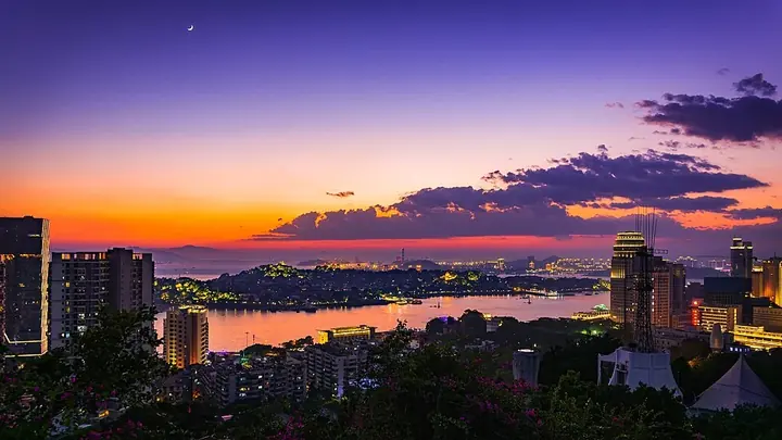
Photo adjustments
Full frame retained; proportionally resized and converted to WebP. No retouching or changes to the photographed subject. Card displays may crop the view.
- Administrative area
- District · 市辖区
- Part of
- Xiamen
- Chinese name
- 思明区
- Local areas
- District guide
Area & population
- Area in the source
- 76.00 km²
- Population · 2020 census
- 1,073,315
Source: cited geographic source, as of the dates shown.
History
The name goes back to 1650, when Koxinga (郑成功) garrisoned Xiamen and renamed it Siming prefecture (思明州), meaning "longing for the Ming". The Qing abolished it in 1680; a Siming County was created in 1912. The present district was formed in 2003 by merging the old Kaiyuan (开元区), Siming and Gulangyu districts.
What to see
Gulangyu, an island of 1.88 square kilometres in the south-west, became a World Heritage site in 2017; the district government describes it as a window on China's contact with the outside world from the 1840s that grew quickly into an international community. Hulishan Fort (胡里山炮台), built in 1894 and a national protected site, keeps a 28-centimetre Krupp gun that the National Cultural Heritage Administration confirmed as the largest 19th-century breech-loading coastal gun still complete on its original site.
The Xiamen Botanical Garden (厦门市园林植物园), founded in 1960 on Wanshi Mountain (万石山), covers 4.93 square kilometres and grows more than 9,000 kinds of plants; old temples such as Tianjie (天界寺) and Taiping Rock (太平岩寺) stand within it. Shapowei (沙坡尾), next to South Putuo Temple (南普陀寺) and Xiamen University (厦门大学), was the origin of Xiamen harbour and has served as a typhoon shelter since the Qing. Other sites the district lists include the Overseas Chinese Museum (华侨博物院), the Lu Xun Memorial Hall (鲁迅纪念馆) and the site of Koxinga's drill ground (郑成功演武场遗址).
Food and local traditions
South Putuo vegetarian cooking (南普陀素菜) began as temple food for monks and worshippers and keeps to vegetarian ingredients and vegetarian dish names. The temple's vegetarian pastries (南普陀素饼) date from the Ming, when they were made as offerings, and Gulangyu has its own filled pastry (鼓浪屿馅饼) made to a recipe more than a century old. Local customs include thin pancake rolls (薄饼) at Qingming and a dice game for mooncakes (搏会饼) at Mid-Autumn. Xiamen glove puppetry is mainly found in Siming's Hecuo (何厝), Zengcuo'an (曾厝垵) and Gulangyu, and storytelling in the southern Fujian dialect (讲古) is on the national intangible-heritage list.
Highlights
- Gulangyu 鼓浪屿: Island of 1.88 square kilometres, a World Heritage site since 2017.
- Hulishan Fort 胡里山炮台: Built in 1894; national protected site with a 28-centimetre Krupp coastal gun on its original site.
- Xiamen Botanical Garden 厦门市园林植物园: Founded in 1960 on Wanshi Mountain; more than 9,000 kinds of plants.
- Shapowei 沙坡尾: Origin of Xiamen harbour and a typhoon shelter since the Qing.
- South Putuo vegetarian pastries 南普陀素饼: Ming-era temple offering pastries, still made by hand.
Sources for this guide
思明区概况-厦门市思明区人民政府 · Siming District People's Government, Xiamen
思明区 - 维基百科,自由的百科全书 · Wikipedia (Chinese) · CC BY-SA 4.0
Original English written from the listed sources and checked sentence by sentence against quoted extracts by a separate reviewer. Updated 2026-09-25.
Explore Siming District
Core places to explore, with English and Chinese names.
Places to explore around Siming District
 AI illustration; an interpretive view, not a photograph. AI 示意图,非景点实拍。
Xiamen Botanical Garden厦门园林植物园
Xiamen Botanical Garden uses a rocky hillside setting for a series of specialised plant collections. Rainforest World contrasts dense tropical planting with the open shapes of the succulent collection, while the palm area…
Read the place guide → AI illustration · AI 示意图(仅供参考,非该地点实拍)
Xiamen Huandao Road Coastline环岛路海岸
The Siming stretch of Xiamen's Huandao Road follows a coast of beaches, seaside green spaces and public squares facing the sea.
Read the place guide →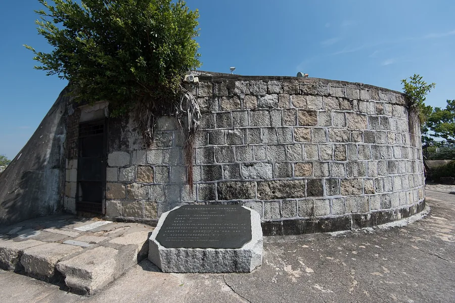 Stone defensive masonry at Hulishan Fortress in Xiamen, September 2019.
Hulishan Fortress胡里山炮台
Hulishan Fortress occupies a coastal position at the southeastern end of Xiamen Island. The battery was built in 1894 during the late Qing period.
Read the place guide → Gulangyu Island · 鼓浪屿
Gulangyu Island鼓浪屿
Gulangyu’s steep lanes pass former consulates, churches and villas built during its international-settlement period. The variety is especially clear around the Catholic church, Union Church and Eight Diagrams Mansion, now…
Read the place guide → A corner of Xiamen's Zhongshan Road: a four-storey cream-coloured building with the sign 天仙旅社 on its parapet and facade, balconies with iron railings, and arcaded shopfronts at street level (长海食品, 闽台缘食品商行, 名香茶庄) with pedestrians on the pavement under a blue sky.
Xiamen Zhongshan Road中山路
Zhongshan Road is Xiamen's historic commercial street, where arcaded buildings record the city's links with overseas Chinese communities and maritime trade.
Read the place guide →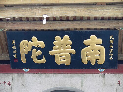 Name plaque at South Putuo Temple.
South Putuo Temple南普陀寺
South Putuo’s halls rise towards the wooded Wulao Peaks beside Xiamen University. The temple’s dedication to Guanyin is expressed most clearly in the Great Compassion Hall, while the Heavenly Kings Hall introduces the sequence…
Read the place guide →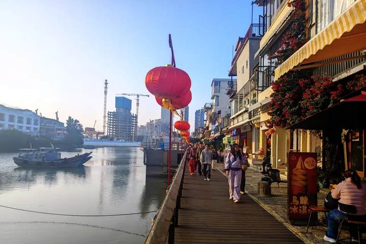 The renovated waterfront boardwalk at Shapowei, Xiamen, strung with red lanterns at dusk · 厦门沙坡尾改造后的滨海步道,傍晚挂着红灯笼 Source-recorded photograph date: 2026-02-03 17:04:57.
Shapowei Old Harbour沙坡尾
Shapowei is a former fishing-harbour neighbourhood in Xiamen's Siming District, where a sheltered basin and old waterfront buildings sit alongside creative businesses.
Read the place guide → Lawn, palm trees and historic buildings on the campus of Xiamen University, Siming District · 厦门市思明区厦门大学校园草坪与历史建筑 Source-recorded photograph date: Taken on 28 December 2006.
Xiamen University Campus厦门大学校园
Xiamen University's Siming campus combines a coastal university setting with the distinctive Jiageng architecture associated with its founder, Tan Kah Kee.
Read the place guide →Plan your visit
Getting there
Siming District is about 4 km in a straight line from central Xiamen. Search for 思明区 in a map app to find stations and your accommodation.
Where to stay →Build your route
Xiamen Botanical Garden and Xiamen Huandao Road Coastline are both listed here. The linked place guides have entrance and visit details.
Continue with Xiamen →More in Xiamen
Sources & geographic information
Administrative names and parent areas: Official geographic directory · Reference date 2026-09-06.
Some facts checked against 思明区 — Wikipedia contributors, CC BY-SA 4.0.
Photo: Hulishan Fortress · Siyuwj · CC BY-SA 4.0. Proportionally resized and converted to WebP without cropping, retouching or changing the photographed subject.

Photo: Gulangyu Island · -森屿- · CC BY 2.5. Wikimedia thumbnail; fitted to the ranking-card frame.

Photo: Xiamen Zhongshan Road · 衔禾之鹭 · CC BY-SA 4.0. Full frame retained; proportionally resized and converted to WebP. No retouching or changes to the photographed subject. Card displays may crop the view.

Photo: South Putuo Temple · Gisling · CC BY 3.0. Wikimedia thumbnail; fitted to the ranking-card frame.

Photo: Shapowei Old Harbour · 向史公哲曰 · CC BY-SA 4.0. Full frame retained; proportionally resized and converted to WebP. No retouching or changes to the photographed subject. Card displays may crop the view.

Photo: Xiamen University Campus · 江上清风1961 · CC BY 3.0. Full frame retained; proportionally resized and converted to WebP. No retouching or changes to the photographed subject. Card displays may crop the view.

Map data © OpenStreetMap contributors. Pins mark approximate centres, not entrances or boundaries.