


Get to know Yumen
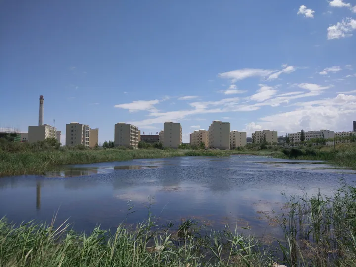
Photo adjustments
Full frame retained; proportionally resized and converted to WebP. No retouching or changes to the photographed subject. Card displays may crop the view.
- Administrative area
- County-level city · 县级市
- Part of
- Jiuquan
- Chinese name
- 玉门市
- Local areas
- County-level city guide
Area & population
- Area in the source
- 13,500.00 km²
- Population · 2020
- 137,736
- Administrative seat
- Yumen Town
Source: cited geographic source, as of the dates shown.
History
Under the Tang the county seat stood at Chijin (赤金镇), east of the present city. Oil came much later: the first well at Laojunmiao (老君庙) was drilled in 1939. In the ten years before 1949 the field produced 520,000 tonnes of crude, which the city government puts at 95 per cent of China's output at the time. From the 1960s the oilfield sent more than 100,000 core workers to other oilfields around the country and became known as the "cradle" of China's oil industry. Wang Jinxi (王进喜), the oil worker known as the "Iron Man", left the banks of the Shiyou River (石油河) here for Daqing (大庆).
In 2003 the city government moved from the old oil town, now Laojunmiao town, to the farming town of Yumen (玉门镇). The name means Jade Gate, but it is not the ancient Yumen Pass (玉门关), which stood west of Dunhuang (敦煌).
What to see
Laojunmiao and Well No. 1 (老一井) are at the southern end of the old urban area. The Laojun temple was first built in 1863 and rebuilt in 1980 by the Yumen Petroleum Administration to mark the field's discovery; a pumpjack and a stone inscribed "老一井" (Old Well No. 1) mark the spot where the first well was drilled.
The Changma Grottoes (昌马石窟) are cut about 25 metres up a cliff beside Shuixia village (水峡村) in Changma township, some 70 kilometres south of Yumen town and National Highway 312. The caves are counted as part of the Dunhuang group, with the Mogao and Yulin caves. They were first carved in the Five Dynasties and early Song and extended under the Yuan and Ming. Of 24 original caves, only four survived the magnitude 7.7 earthquake of 25 December 1932. The grottoes became a national key protected site in 2019.
Getting oriented
Yumen has a cold desert climate with about 67 millimetres of precipitation a year. The railway through the city links Lanzhou with Ürümqi.
Highlights
- Laojunmiao and Well No. 1 老君庙和老一井: Temple rebuilt in 1980 beside the site of the oilfield's first well, drilled in 1939.
- Changma Grottoes 昌马石窟: Four surviving caves of the Dunhuang group; national key protected site since 2019.
- Yumen Oilfield 玉门油田: Developed from 1939; called the cradle of China's oil industry.
Sources for this guide
Yumen City - Wikipedia · Wikipedia (English) · CC BY-SA 4.0
玉门油田 · Yumen City People's Government
昌马石窟 · Yumen City People's Government
老君庙 · Yumen City People's Government
Original English written from the listed sources and checked sentence by sentence against quoted extracts by a separate reviewer. Updated 2026-09-23.
Explore Yumen
Core places to explore, with English and Chinese names.
Places to explore around Yumen
 Yumen Oilfield Industrial Heritage ·
 Plan your visit
Getting there
Yumen is about 80 km in a straight line from central Jiuquan. Search for 玉门市 in a map app to find stations and your accommodation.
Where to stay →Build your route
Start with Yumen Oilfield Industrial Heritage. The linked place guides have entrance and visit details.
Continue with Jiuquan →More in Jiuquan
Sources & geographic information
Administrative names and parent areas: Official geographic directory · Reference date 2026-09-06.
Some facts checked against Yumen City — Wikipedia contributors, CC BY-SA 4.0.
Photo: Yumen Oilfield Industrial Heritage · Source photographer · License not provided. EXIF orientation normalized; resized without changing aspect ratio; converted to WebP. No subject edits.
Map data © OpenStreetMap contributors. Pins mark approximate centres, not entrances or boundaries.