


Get to know Dunhuang
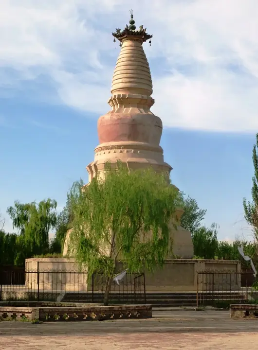
Photo adjustments
Full frame retained; resized proportionally to a maximum dimension of 960 pixels and converted to WebP quality 88. No crop, retouch, generated elements, or subject alteration. Final website rendition: full frame retained, proportionally resized to at most 720 pixels and converted to WebP. No additional retouching or subject alteration. Card displays may crop the view.
- Administrative area
- County-level city · 县级市
- Part of
- Jiuquan
- Chinese name
- 敦煌市
- Local areas
- County-level city guide
Area & population
- Area in the source
- 31,200.00 km²
- Population · 2020
- 185,231
- Administrative seat
- Shazhou Town
Source: cited geographic source, as of the dates shown.
Setting and landscape
Oasis land makes up only about 7 per cent of the city's area. Sanwei Mountain (三危山) rises to the east and the Mingsha dunes (鸣沙山) to the south; desert running on to the Taklamakan lies west, and gobi reaching the last spurs of the Tian Shan lies north. The oasis is fed by the Dang River (党河), which rises in the Qilian Mountains and runs 390 kilometres. The city government records 42.2 millimetres of rain a year against evaporation of 2,505 millimetres, a typical warm-temperate arid climate.
History
The name first appears in Sima Qian's Records of the Grand Historian; the Eastern Han scholar Ying Shao read it as "great and glorious". Emperor Wu of Han set up Dunhuang Commandery in 111 BC, after campaigns pushed the Xiongnu out of the Hexi region. In AD 366 the monk Yuezun (乐僔) began work on the Mogao Caves, and in 400 Li Gao (李暠) founded the Western Liang state with Dunhuang as its first capital. The area fell to Tibet around 781; in 848 Zhang Yichao (张议潮) led a rising that returned it to the Tang, and the Guiyi Army period lasted until the Western Xia took it in 1036. After the Ming closed the Jiayu Pass in 1528, the area had no administration for two centuries. It became Dunhuang County in 1760 and a city in 1987.
What to see
The city government counts three World Heritage sites: the Mogao Caves, inscribed by UNESCO in 1987, the Yumen Pass site and the Xuanquanzhi (悬泉置) post-station site. The Great Wall within Dunhuang is also a national key protected site. Mingsha Mountain and Crescent Spring (鸣沙山月牙泉), south of the city, is a 5A scenic area and a world geopark; the sand is said to rumble when crowds slide down it. The Western Thousand Buddha Caves (西千佛洞) lie south-west of Mogao, and the Dunhuang Yardang National Geopark (敦煌雅丹国家地质公园) is on the national geopark list.
Food and local products
A local saying, the "Eight oddities of Dunhuang" (敦煌八大怪), names among them donkey meat with yellow noodles (驴肉黄面), jiangshui noodles (浆水面) eaten to beat the heat, fragrant pears (香水梨) sold only once they have turned black, pao'er yougao (泡儿油糕) pastries, suoyang (锁阳, cynomorium) and Luobuma tea (罗布麻茶). Nationally listed intangible heritage is Dunhuang quzi opera (敦煌曲子戏); Dunhuang folk song, painted clay sculpture and paper-cutting are on the provincial list.
Highlights
- Mogao Caves 莫高窟: Begun by the monk Yuezun in 366; inscribed by UNESCO in 1987.
- Mingsha Mountain and Crescent Spring 鸣沙山月牙泉: 5A scenic area and world geopark south of the city.
- Yumen Pass 玉门关遗址: Han pass site counted by the city among its three World Heritage sites.
- Xuanquanzhi 悬泉置遗址: Post-station site of the Han and Jin periods; World Heritage.
- Dunhuang quzi opera 敦煌曲子戏: The city's national-level intangible heritage item.
- Donkey meat with yellow noodles 驴肉黄面: Named in the local Eight oddities saying.
Sources for this guide
敦煌概况 地理位置 · Dunhuang City People's Government
敦煌概况 自然环境 · Dunhuang City People's Government
敦煌概况 文化旅游 · Dunhuang City People's Government
历史文化 · Dunhuang City People's Government
敦煌市 · Wikipedia (Chinese) · CC BY-SA 4.0
Original English written from the listed sources and checked sentence by sentence against quoted extracts by a separate reviewer. Updated 2026-09-25.
Explore Dunhuang
Core places to explore, with English and Chinese names.
Places to explore around Dunhuang
 A painted mural of Buddhist figures and pavilions on display at Dunhuang Museum · 敦煌博物馆内展出的佛教人物楼阁壁画 Source-recorded photograph date: 8 November 2015 (original upload date).
Dunhuang Museum敦煌博物馆
Dunhuang Museum follows the oasis’s history through objects ranging from pottery and bronze to silk, written slips and painted bricks. Its permanent exhibition treats the city as a meeting place, tracing Han development, later…
Read the place guide → Wind-eroded yardang rock formations at Dun Huang Ya Dan Guo Jia Di Zhi Gong Yuan (Dunhuang Yardang National Geopark) · 敦煌雅丹国家地质公园的雅丹地貌 Source-recorded photograph date: 2011-09.
Dunhuang Yardang National Geopark敦煌雅丹国家地质公园
Wind-carved yardang field about 180 km northwest of Dunhuang, Gansu, the core of the Dunhuang UNESCO Global Geopark, known as Devil City.
Read the place guide →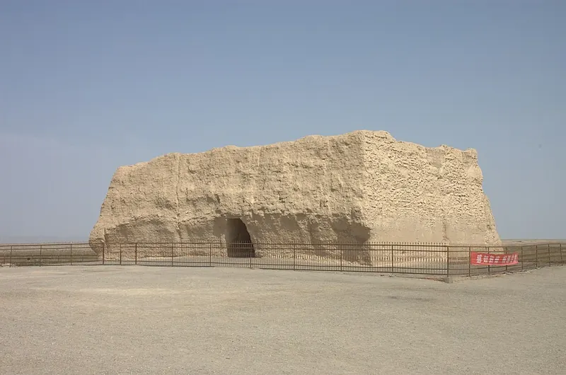 The ruined rammed-earth fort of Yumenguan (Small Square City), Dunhuang · 敦煌玉门关小方盘城遗址 Source-recorded photograph date: 2011-09.
Yumen Pass Ruins玉门关遗址
Square Han fort of the Jade Gate northwest of Dunhuang by the Shule River, gateway of the Silk Road's northern route and a World Heritage site.
Read the place guide →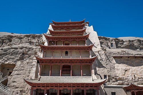 Mogao Caves · 莫高窟
Mogao Caves莫高窟
Mogao’s cliff contains a long sequence of Buddhist caves in which murals, painted sculpture and architecture work together. Narrative paintings share walls with donors and repeated Buddha figures, while changing styles reflect…
Read the place guide →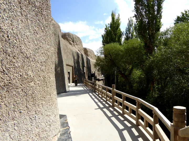 A cliffside walkway past rock-cut cave entrances at the Western Thousand Buddha Caves, Dunhuang City. · 酒泉市敦煌市西千佛洞崖壁栈道及石窟洞口。 Source-recorded photograph date: 7 November 2015 (original upload date).
Western Thousand Buddha Caves西千佛洞
Buddhist cave temples on a Dang River cliff 35 km southwest of Dunhuang, with 22 decorated caves from the Northern Wei to the Yuan.
Read the place guide → The entrance gate of the Yang Guan (Sunny Pass) scenic area near Dunhuang, Gansu · 甘肃敦煌阳关遗址景区大门 Source-recorded photograph date: 7 November 2015 (original upload date).
Yangguan Pass Ruins阳关遗址
Ruins of the Han pass on the Silk Road's southern route, 70 km southwest of Dunhuang: a lone beacon tower and a sand flat of foundations and potsherds.
Read the place guide →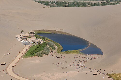 Crescent Lake and the surrounding dunes of Mingsha Shan, Dunhuang · 敦煌鸣沙山月牙泉 Source-recorded photograph date: 2023-09-18 10:12:14.
Mingsha Mountain and Crescent Moon Spring鸣沙山月牙泉
A ring of singing sand dunes enclosing a small crescent-shaped spring 5 km southwest of Dunhuang, rated a 5A scenic area in 2015.
Read the place guide →Plan your visit
Getting there
Dunhuang is about 330 km in a straight line from central Jiuquan. Search for 敦煌市 in a map app to find stations and your accommodation.
Where to stay →Build your route
Dunhuang Museum and Dunhuang Yardang National Geopark are both listed here. The linked place guides have entrance and visit details.
Continue with Jiuquan →More in Jiuquan
Sources & geographic information
Administrative names and parent areas: Official geographic directory · Reference date 2026-09-06.
Some facts checked against 敦煌市 — Wikipedia contributors, CC BY-SA 4.0.
Photo: Dunhuang Museum · Hiroki Ogawa · CC BY 3.0. Full frame retained; proportionally resized and converted to WebP. No retouching or changes to the photographed subject. Card displays may crop the view.

Photo: Dunhuang Yardang National Geopark · 张骐 · CC BY-SA 3.0. Full frame retained; proportionally resized and converted to WebP. No retouching or changes to the photographed subject. Card displays may crop the view.

Photo: Yumen Pass Ruins · 张骐 · CC BY-SA 3.0. Full frame retained; proportionally resized and converted to WebP. No retouching or changes to the photographed subject. Card displays may crop the view.

Photo: Mogao Caves · xiquinhosilva · CC BY 2.0. Wikimedia thumbnail; fitted to the ranking-card frame.
.jpg)
Photo: Western Thousand Buddha Caves · Hiroki Ogawa · CC BY 3.0. Full frame retained; proportionally resized and converted to WebP. No retouching or changes to the photographed subject. Card displays may crop the view.

Photo: Yangguan Pass Ruins · Hiroki Ogawa · CC BY 3.0. Full frame retained; proportionally resized and converted to WebP. No retouching or changes to the photographed subject. Card displays may crop the view.
.jpg)
Photo: Mingsha Mountain and Crescent Moon Spring · N509FZ · CC BY-SA 4.0. Wikimedia thumbnail; fitted to the ranking-card frame.
.jpg)
Map data © OpenStreetMap contributors. Pins mark approximate centres, not entrances or boundaries.