


Get to know Subei Mongol Autonomous County
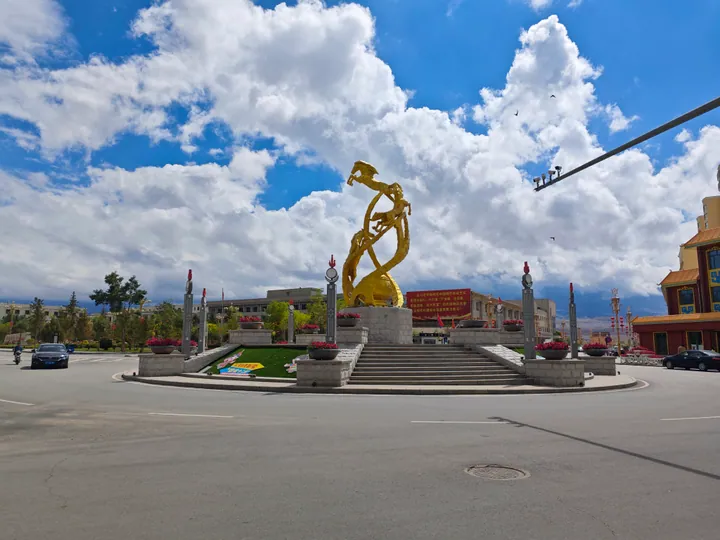
Photo adjustments
Full frame retained; proportionally resized and converted to WebP. No retouching or changes to the photographed subject. Card displays may crop the view.
- Administrative area
- Autonomous county · 自治县
- Part of
- Jiuquan
- Chinese name
- 肃北蒙古族自治县
- Local areas
- Autonomous county guide
Area & population
- Area in the source
- 66,748.00 km²
- Population · 2020
- 15,093
- Administrative seat
- Dangchengwan
Source: cited geographic source, as of the dates shown.
Setting and landscape
The county government describes Subei as the largest county in Gansu by area. Its land takes in glaciers, snow mountains, gorges, rivers, wetlands, grassland and gobi. The Mazongshan area is 470 kilometres from the county seat, and its hills are shaped like a horse's mane. Four inland rivers rise within the county: the Shule (疏勒河), the Danghe (党河), the Shiyou (石油河) and the Yulin (榆林河). The climate is dry, with little rain, long sunshine and low temperatures.
The southern part is a key area of the Yanchiwan National Nature Reserve (盐池湾国家级保护区) within the Qilian Mountain National Park (祁连山国家公园). The reserve covers 1.36 million hectares, including 78,000 hectares of glacier, and shelters white-lipped deer, snow leopards and wild yak. In the north, the Mazongshan Siberian Ibex Provincial Nature Reserve (马鬃山北山羊省级自然保护区) was set up in 2001 to protect Siberian ibex and desert-steppe ecosystems.
History
People lived here as early as the Spring and Autumn period, and a county already existed under the Western Jin (西晋). A Subei administrative bureau (设治局) was set up in 1937. The Communist Party and the People's Liberation Army entered the area on 22 July 1950, and the autonomous county was formally established a week later, on 29 July 1950.
What to see
The Toumeng Ke Glacier (透明梦柯冰川), also called Laohugou Glacier No. 12 (老虎沟12号冰川), is a valley glacier in the Daxue Mountains (大雪山) of the north-western Qilian range, in Shibaocheng township (石包城乡). Chinese Wikipedia gives it as the largest known valley glacier in the Qilian Mountains, about 10.1 kilometres long, first found by researchers of the Chinese Academy of Sciences in 1959.
Food and local products
Livestock raised here are mainly cashmere goats, fine-wool sheep, yak and camels. Camel down and goat cashmere are the best-known products, and Subei snow-mountain mutton (肃北雪山羊肉) is a national geographical-indication farm product.
Getting oriented
The county borders Mongolia's Govi-Altai Province (戈壁阿尔泰省) as well as Xinjiang, Qinghai and Inner Mongolia. Subei station on the Dunhuang–Golmud railway (敦格铁路) opened to passengers on 1 October 2018.
Highlights
- Toumeng Ke Glacier 透明梦柯冰川: Valley glacier in Shibaocheng township, about 10.1 km long, found by Chinese Academy of Sciences researchers in 1959.
- Yanchiwan National Nature Reserve 盐池湾国家级保护区: Part of the Qilian Mountain National Park; home to snow leopards, white-lipped deer and wild yak.
- Subei snow-mountain mutton 肃北雪山羊肉: A national geographical-indication farm product.
Sources for this guide
肃北蒙古族自治县 - 维基百科,自由的百科全书 · Wikipedia (Chinese) · CC BY-SA 4.0
区域概况 · Subei Mongol Autonomous County People's Government
自然资源 · Subei Mongol Autonomous County People's Government
透明梦柯冰川 - 维基百科,自由的百科全书 · Wikipedia (Chinese) · CC BY-SA 4.0
Original English written from the listed sources and checked sentence by sentence against quoted extracts by a separate reviewer. Updated 2026-09-23.
Explore Subei Mongol Autonomous County
Core places to explore, with English and Chinese names.
Places to explore around Subei Mongol Autonomous County
 Touming Mengke Glacier Viewing Route ·
 Plan your visit
Getting there
Subei Mongol Autonomous County is about 310 km in a straight line from central Jiuquan. Search for 肃北蒙古族自治县 in a map app to find stations and your accommodation.
Where to stay →Build your route
Start with Touming Mengke Glacier Viewing Route. The linked place guides have entrance and visit details.
Continue with Jiuquan →More in Jiuquan
Sources & geographic information
Administrative names and parent areas: Official geographic directory · Reference date 2026-09-06.
Some facts checked against 肃北蒙古族自治县 — Wikipedia contributors, CC BY-SA 4.0.
Some facts checked against 透明梦柯冰川 — Wikipedia contributors, CC BY-SA 4.0.
Photo: Touming Mengke Glacier Viewing Route · Source photographer · License not provided. EXIF orientation normalized; resized without changing aspect ratio; converted to WebP. No subject edits.
Map data © OpenStreetMap contributors. Pins mark approximate centres, not entrances or boundaries.