


Get to know Fogang County
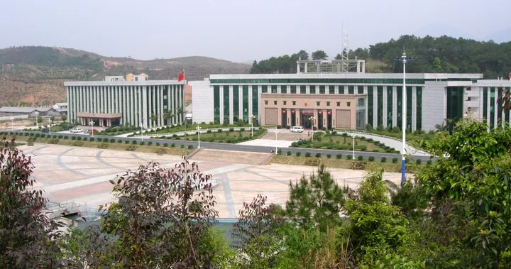
Photo adjustments
Full frame retained; proportionally resized and converted to WebP. No retouching or changes to the photographed subject. Card displays may crop the view.
- Administrative area
- County · 县
- Part of
- Qingyuan
- Chinese name
- 佛冈县
- Local areas
- County guide
Area & population
- Area in the source
- 1,302.00 km²
- Population · 2020
- 315,502
Source: cited geographic source, as of the dates shown.
Setting and landscape
The land falls from north-east to south-west, with mountain ranges in the south-east and north-west. The highest point is Yapoji (亚婆髻, 1,218.8 m) on Guanyin Mountain (观音山) along the north-western border. The Pa River (潖江) rises in Shuitou town (水头镇) and flows south to the Bei River (北江), while the Yanling River (烟岭河) runs north into Yingde. The county government calls Fogang one of Guangdong's heavy-rain centres, with 2,206.8 mm a year, and lists a drinkable natural carbonated spring at Huanghua Lake (黄花湖) and hot groundwater of 73–81 °C.
History
Fogang became an administrative unit in 1813, when the Qing formed a sub-prefecture from land taken from Qingyuan and Yingde counties; it became a county in 1914. It was merged into Conghua in 1958 and restored in 1961. The name comes from Fogang village near the old office: in the Song dynasty, monks from a Buddhist temple are said to have guided settlers to a low hillside, hence "Buddha hill".
About a third of the people are Hakka, living mainly in the north; the other two thirds speak a local Cantonese and live in the centre and the south along the Pa River. Hakka villages keep enclosed Hakka houses, Cantonese villages Guangfu-style ones.
What to see
Three villages are listed as Guangdong ancient villages: Xinlian (新联村) in Gaogang town (高岗镇), Tangtang (汤塘村) in Tangtang town (汤塘镇), and Shangyue (上岳村) in Longshan town (龙山镇). The county tourism bureau describes Tangtang as a Ming–Qing Lingnan village of grey-brick houses with "wok-ear" gables, with the Lianxi Academy (濂溪书院) and an old hot-spring source. Guanyin Mountain is a provincial nature reserve entered through Longtan Villa (龙潭山庄), and Chinese Wikipedia also lists the Wangshan Temple (王山寺) resort area. Folk customs include a tofu festival at Shegangxia village (社岗下村), Gaogang, on the 13th day of the first lunar month, and the women of Weizhen village (围镇村), Tangtang, perform a "quilt lion" (被狮) dance on the 15th and 16th.
Food and local products
Choupi vinegar (臭屁醋, literally "smelly-fart vinegar") is a vinegar made from fried rice, glutinous or ordinary, in Tangtang, Sijiu (四九) and Longshan; it is named for its smell on the table but tastes mellow, and is on the county's fifth intangible-heritage list. It is cooked with pork trotters and ginger, and new mothers drink it after giving birth. Shuitou town grows about 10,000 mu of konjac, which the county calls the largest konjac base in the province.
Highlights
- Guanyin Mountain 观音山: Provincial nature reserve; its peak Yapoji (1,218.8 m) is the county's highest point.
- Tangtang ancient village 汤塘村: Ming–Qing Lingnan village with wok-ear gables, the Lianxi Academy and an old hot-spring source.
- Shangyue ancient village 上岳村: Longshan town village listed as a Guangdong ancient village.
- Choupi vinegar 臭屁醋: Fried-rice vinegar from Tangtang on the county heritage list, cooked with pork trotters and ginger.
Sources for this guide
自然地理 - 佛冈县政府门户网站 · Fogang County People's Government
历史沿革 - 佛冈县政府门户网站 · Fogang County People's Government
“臭”名远扬的佛冈味道 - 佛冈县政府门户网站 · Fogang County Culture, Radio, TV, Tourism and Sports Bureau
佛冈水头魔芋特色美食“七十二变” - 佛冈县政府门户网站 · Fogang County Culture, Radio, TV, Tourism and Sports Bureau
双节畅游佛冈|3天2晚!泡温泉探古村,非遗、嬉水、漂流一站式玩够! - 佛冈县政府门户网站 · Fogang County Culture, Radio, TV, Tourism and Sports Bureau
佛冈县 - 维基百科,自由的百科全书 · Chinese Wikipedia · CC BY-SA 4.0
Original English written from the listed sources and checked sentence by sentence against quoted extracts by a separate reviewer. Updated 2026-09-23.
Explore Fogang County
Core places to explore, with English and Chinese names.
Places to explore around Fogang County
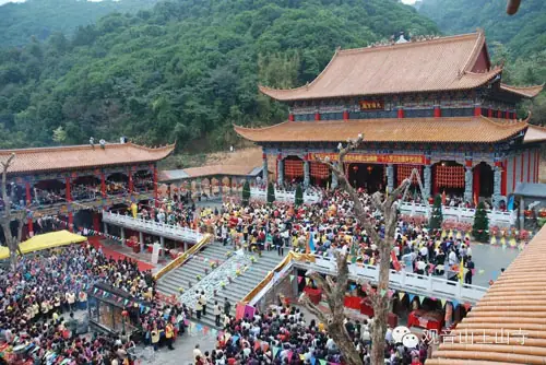 Guanyin Mountain Wangshan Temple ·
 Plan your visit
Getting there
Fogang County is about 55 km in a straight line from central Qingyuan. Search for 佛冈县 in a map app to find stations and your accommodation.
Where to stay →Build your route
Start with Guanyin Mountain Wangshan Temple. The linked place guides have entrance and visit details.
Continue with Qingyuan →More in Qingyuan
Sources & geographic information
Administrative names and parent areas: Official geographic directory · Reference date 2026-09-06.
Some facts checked against 佛冈县 — Wikipedia contributors, CC BY-SA 4.0.
Photo: Guanyin Mountain Wangshan Temple · Source photographer · License not provided. EXIF orientation normalized; resized without changing aspect ratio; converted to WebP. No subject edits.
Map data © OpenStreetMap contributors. Pins mark approximate centres, not entrances or boundaries.