


Get to know Yangshan County
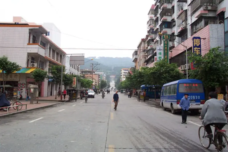
Photo adjustments
EXIF orientation normalized; resized without changing aspect ratio; converted to WebP. No subject edits.
- Administrative area
- County · 县
- Part of
- Qingyuan
- Chinese name
- 阳山县
- Local areas
- County guide
Area & population
- Area in the source
- 3,372.00 km²
Source: cited geographic source, as of the dates shown.
Setting and landscape
The county is olive-shaped, about 67 kilometres across at its widest and 104 kilometres from north to south, with basins and plains making up only a tenth of its area. Its northernmost point is Shikengkong (石坑崆) in the Taipingdong (太平洞) area of Chengjia Yao Township (秤架瑶族乡), where Yangshan meets Ruyuan (乳源) and Yizhang. At 1,902 metres Shikengkong is the highest peak in Guangdong, nicknamed 'the roof of Guangdong', and its slopes hold what Chinese Wikipedia describes as the province's largest and best-preserved primeval forest. The county government gives forest cover as 72.53%.
History
In the Warring States period a state called Yangyu (阳禺国) had its seat east of the present county, around the head of the Qinglian Gorge (青莲峡). Yangshan County was first set up under the Western Han, and Chinese Wikipedia traces its name to the Yangshan Pass (阳山关) established here at the end of the Qin. In 803 the Tang writer Han Yu (韩愈) was sent here as county magistrate after a demotion, and the county government counts Yangshan among the main places to learn about his legacy. The county was merged into Lianyang Autonomous County (连阳各族自治县) in 1958, restored in 1960 and placed under Qingyuan in February 1988.
What to see
The county government names its main scenic areas as Xianling Mountain Forest Park (贤令山森林公园), Shenfeng Pass (神峰关), the Guangdong First Peak (广东第一峰) scenic area, rated 4A, and Guangdong Xiatianxia (广东峡天下). The First Peak area takes in Shikengkong, with old-growth forest, high gorges and clear karst landforms. Chinese Wikipedia also lists Shenbi Cave (神笔洞), the Xuefa ancestral hall at Qigong (七拱学发公祠), the Shiluo forest hot springs (石螺森林温泉), and Han Yu relics and cliff inscriptions.
Food and local products
Yangshan Chinese yam (阳山淮山), Yangshan watercress (阳山西洋菜) and Yangshan chicken (阳山鸡) hold national geographical-indication certification. Chinese Wikipedia adds Tongguan pears (同冠梨), chestnuts and shatian pomelos (沙田柚) among local farm products, and notes that big differences in altitude let the county grow crops of different climate zones and off-season vegetables.
Getting oriented
The county town, Yangcheng (阳城镇), is 110 kilometres from urban Qingyuan and 81 kilometres southeast of urban Lianzhou (连州), according to the county government. National Highway G107 runs through the county from north to south, and the Qingyuan–Lianzhou Expressway (清连高速) opened across it in 2004.
Highlights
- Shikengkong 石坑崆: Guangdong's highest peak at 1,902 m, on the county's northern border.
- Guangdong First Peak scenic area 广东第一峰: 4A scenic area around Shikengkong with old-growth forest and gorges.
- Xianling Mountain Forest Park 贤令山森林公园: One of the main scenic areas named by the county government.
- Yangshan Chinese yam 阳山淮山: National geographical-indication product.
Sources for this guide
阳山县概况-阳山县政府门户网站 · Yangshan County People's Government
自然地理(位置、范围、面积)-阳山县政府门户网站 · Yangshan County People's Government
阳山历史-阳山县政府门户网站 · Yangshan County People's Government
阳山县 - 维基百科,自由的百科全书 · Wikipedia · CC BY-SA 4.0
石坑崆 - 维基百科,自由的百科全书 · Wikipedia · CC BY-SA 4.0
Original English written from the listed sources and checked sentence by sentence against quoted extracts by a separate reviewer. Updated 2026-09-23.
Explore Yangshan County
Core places to explore, with English and Chinese names.
Places to explore around Yangshan County
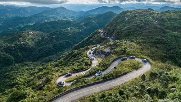 Guangdong First Peak Scenic Area ·
 Plan your visit
Getting there
Yangshan County is about 100 km in a straight line from central Qingyuan. Search for 阳山县 in a map app to find stations and your accommodation.
Where to stay →Build your route
Start with Guangdong First Peak Scenic Area. The linked place guides have entrance and visit details.
Continue with Qingyuan →More in Qingyuan
Sources & geographic information
Administrative names and parent areas: Official geographic directory · Reference date 2026-09-06.
Some facts checked against 阳山县 — Wikipedia contributors, CC BY-SA 4.0.
Some facts checked against 石坑崆 — Wikipedia contributors, CC BY-SA 4.0.
Photo: Guangdong First Peak Scenic Area · Source photographer · License not provided. EXIF orientation normalized; resized without changing aspect ratio; converted to WebP. No subject edits.
Map data © OpenStreetMap contributors. Pins mark approximate centres, not entrances or boundaries.