


Get to know Yingde
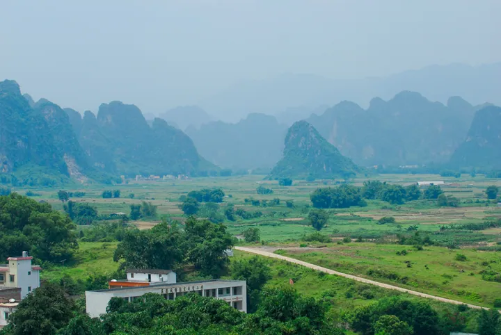
Photo adjustments
Full frame retained; proportionally resized and converted to WebP. No retouching or changes to the photographed subject. Card displays may crop the view.
- Administrative area
- County-level city · 县级市
- Part of
- Qingyuan
- Chinese name
- 英德市
- Local areas
- County-level city guide
Area & population
- Area in the source
- 5,627.00 km²
Source: cited geographic source, as of the dates shown.
Setting and landscape
The Huangsinao range (黄思脑山脉) runs across the north and carries Chuandiding (船底顶, 1,586 metres), the highest point in Yingde; the Huashuishan range (滑水山山脉) forms the eastern rim. Karst landforms, including isolated peaks, peak clusters and peak forests, cover about a fifth of the city, with underground rivers and caves inside them. The main rivers leave only through narrow gorges in the south, among them Zhenyang Gorge (浈阳峡) and Damiao Gorge (大庙峡), so the valleys upstream flood easily. Hot springs rise at Wangbu (望埠), Hengshitang (横石塘), Baisha (白沙) and Shuibian (水边).
History
Chipped stone tools from the old riverbed deposits at Baojing Palace (宝晶宫) show people here more than 100,000 years ago, and late Palaeolithic people lived in Niulan Cave (牛栏洞) in today's Yinghong town (英红镇). The Han founded the counties of Zhenyang (浈阳) and Hanhuang (含洭) in the area. The Southern Han created Yingzhou (英州) in 920, and in 1195 the Southern Song raised it to Yingde Prefecture (英德府), the first use of the name. Yingde moved from Shaoguan (韶关) to Qingyuan in January 1988 and became a county-level city in January 1994.
What to see
Baojing Palace (宝晶宫), on the southern edge of the city, is a 4A resort built around lakes and karst caves. The Yingxi peak forest (英西峰林) corridor in the west holds two more 4A areas: Dongtian Xianjing (洞天仙境), 2 kilometres west of Jiulong town (九龙镇) and billed as South China's first tiankeng, and Jiulong Fenglin Xiaozhen (九龙峰林晓镇), a farm-park resort in the core of the peak forest. At Xianqiao village in Hengshitang, the Xianqiao Underground River (仙桥地下河) runs 13 kilometres and is toured entirely by boat. Pengjia Ancestral Hall (彭家祠) at Huanghua town (黄花镇), locally nicknamed the 'little Potala', is a mid-Qing clan hall built as a fortress against bandits on a 33-metre hill; it became a provincial protected site in 2019.
Food and local products
The city government singles out Yingde stone (英石) and tea culture. The craft of making rockeries and penjing from Yingde stone (英石假山盆景技艺) entered the national intangible heritage list in 2008. The Hongqi Tea Factory (红旗茶厂) in Yinghong town opened in 1958; its black tea was one of China's three main export black teas, and it is now listed as national industrial heritage. Local food festivals include one for Bei River dried fish at Zhenyang Gorge and one for Jiulong tofu (九龙豆腐).
Highlights
- Yingxi peak forest 英西峰林: Karst peak-forest corridor in western Yingde with two 4A scenic areas at Jiulong town.
- Baojing Palace 宝晶宫: 4A lake-and-cave resort on the southern edge of the city, where Palaeolithic stone tools were found.
- Xianqiao Underground River 仙桥地下河: 13-kilometre cave river at Hengshitang, toured by boat.
- Yingde stone rockery craft 英石假山盆景技艺: National intangible heritage since 2008.
- Hongqi Tea Factory 红旗茶厂: Black-tea factory founded in 1958, now national industrial heritage.
Sources for this guide
地理位置_地理位置_英德市人民政府网 · Yingde Municipal People's Government
自然环境_英德市人民政府网 · Yingde Municipal People's Government
历史沿革_英德市人民政府网 · Yingde Municipal People's Government
旅游文化_英德市人民政府网 · Yingde Municipal People's Government
市情概况_英德概况_英德市人民政府网 · Yingde Municipal People's Government
盆景技艺(英石假山盆景技艺) - 中国非物质文化遗产网 · China Intangible Cultural Heritage Network (ihchina.cn)
Original English written from the listed sources and checked sentence by sentence against quoted extracts by a separate reviewer. Updated 2026-09-23.
Explore Yingde
Core places to explore, with English and Chinese names.
Places to explore around Yingde
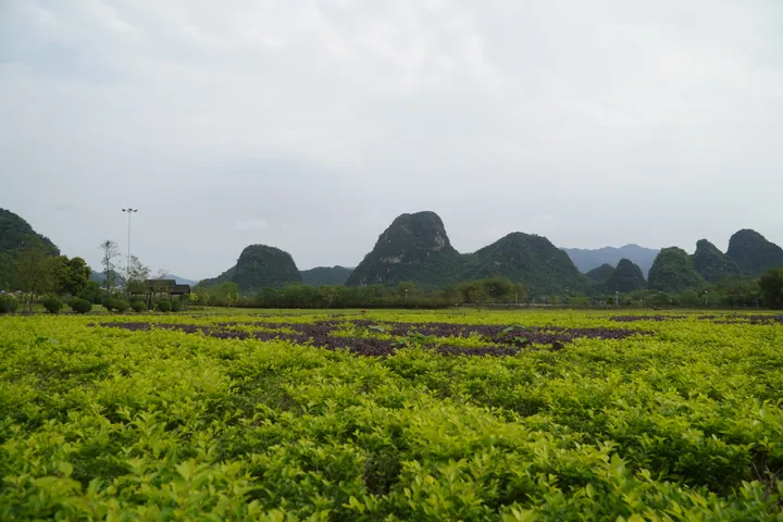 Karst peaks of Yingxi Stone Forest rising above farmland in Yingde, Qingyuan · 清远市英德市英西峰林,田野上耸立的喀斯特山峰 Source-recorded photograph date: 2026-04-04 09:48:19.
Yingxi Peak Forest英西峰林
Yingxi Fenglin is a karst peak-forest corridor between Huanghua and Jiulong towns, Yingde, Qingyuan, Guangdong, holding more than 1,000 linearly arranged limestone peaks with rivers and streams winding among them. The corridor stretches more than 20 li, and the city government describes it as the longest peak-forest touring corridor with the most scenic spots yet found in the province.
Read the place guide →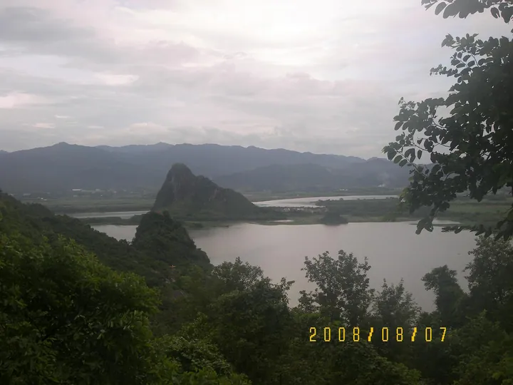 The karst hill and lake around Baojing Palace cave, Yingde · 英德宝晶宫外景,石灰岩山峰与湖泊 Source-recorded photograph date: Taken on 7 August 2008.
Baojing Palace Cave宝晶宫
Four-level limestone cave 7.2 km southwest of Yingde, found in 1981, with dripstone formations and stone tools provisionally dated to 100,000 years ago.
Read the place guide →Plan your visit
Getting there
Yingde is about 70 km in a straight line from central Qingyuan. Search for 英德市 in a map app to find stations and your accommodation.
Where to stay →Build your route
Yingxi Peak Forest and Baojing Palace Cave are both listed here. The linked place guides have entrance and visit details.
Continue with Qingyuan →More in Qingyuan
Sources & geographic information
Administrative names and parent areas: Official geographic directory · Reference date 2026-09-06.
Photo: Yingxi Peak Forest · Jayden Chao · Jayden Chao / jaydenchao.com / CC-BY-SA 4.0 · CC BY-SA 4.0. Full frame retained; proportionally resized and converted to WebP. No retouching or changes to the photographed subject. Card displays may crop the view.

Photo: Baojing Palace Cave · WXL520430 · CC BY-SA 3.0. Full frame retained; proportionally resized and converted to WebP. No retouching or changes to the photographed subject. Card displays may crop the view.

Map data © OpenStreetMap contributors. Pins mark approximate centres, not entrances or boundaries.